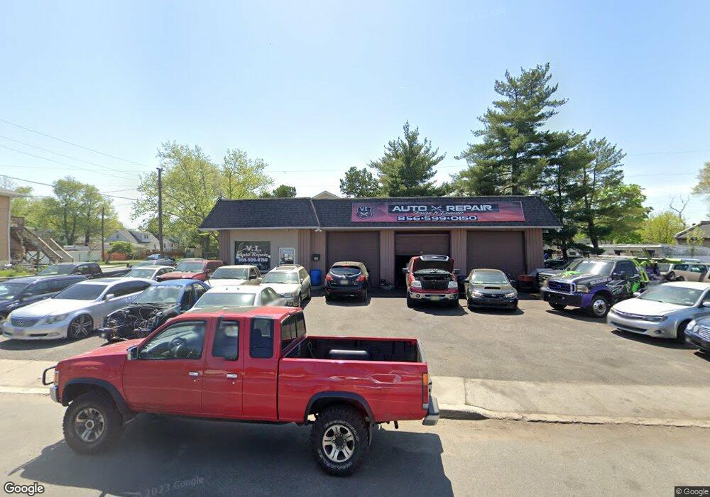
400-404 W Broad St Paulsboro, NJ 08066
--
Bed
--
Bath
--
Sq Ft
7,405
Sq Ft Lot
About This Home
This home is located at 400-404 W Broad St, Paulsboro, NJ 08066. 400-404 W Broad St is a home located in Gloucester County with nearby schools including Billingsport Elementary School, Loudenslager Elementary School, and Paulsboro High School.
Ownership History
Date
Name
Owned For
Owner Type
Purchase Details
Closed on
Jan 31, 2019
Sold by
A Aaron Inc
Bought by
Brusco Francesco and Brusco Diana
Purchase Details
Closed on
Jan 15, 2013
Sold by
G-Max Realty Llc
Bought by
A Aaron Inc
Purchase Details
Closed on
Mar 8, 2010
Sold by
Licciardello Enrico
Bought by
G Max Realty Llc
Home Financials for this Owner
Home Financials are based on the most recent Mortgage that was taken out on this home.
Original Mortgage
$67,513
Interest Rate
5.02%
Mortgage Type
Seller Take Back
Create a Home Valuation Report for This Property
The Home Valuation Report is an in-depth analysis detailing your home's value as well as a comparison with similar homes in the area
Home Values in the Area
Average Home Value in this Area
Purchase History
| Date | Buyer | Sale Price | Title Company |
|---|---|---|---|
| Brusco Francesco | $225,000 | Surety Title Co Llc | |
| A Aaron Inc | $49,165 | Freedom Title And Abst Co Of | |
| G Max Realty Llc | $90,000 | Old Republic National Title |
Source: Public Records
Mortgage History
| Date | Status | Borrower | Loan Amount |
|---|---|---|---|
| Previous Owner | G Max Realty Llc | $67,513 |
Source: Public Records
Tax History Compared to Growth
Tax History
| Year | Tax Paid | Tax Assessment Tax Assessment Total Assessment is a certain percentage of the fair market value that is determined by local assessors to be the total taxable value of land and additions on the property. | Land | Improvement |
|---|---|---|---|---|
| 2025 | $4,114 | $93,500 | $74,000 | $19,500 |
| 2024 | $4,110 | $93,500 | $74,000 | $19,500 |
| 2023 | $4,110 | $93,500 | $74,000 | $19,500 |
| 2022 | $4,035 | $93,500 | $74,000 | $19,500 |
| 2021 | $3,957 | $93,500 | $74,000 | $19,500 |
| 2020 | $3,933 | $93,500 | $74,000 | $19,500 |
| 2019 | $3,809 | $93,500 | $74,000 | $19,500 |
| 2018 | $3,591 | $93,500 | $74,000 | $19,500 |
| 2017 | $3,576 | $93,500 | $74,000 | $19,500 |
| 2016 | $3,407 | $93,500 | $74,000 | $19,500 |
| 2015 | $3,388 | $93,500 | $74,000 | $19,500 |
| 2014 | $3,149 | $93,500 | $74,000 | $19,500 |
Source: Public Records
Map
Nearby Homes
- L18 20 W Broad St
- 335 W Buck St
- 344 W Washington St
- 269 W Broad St
- 219 Vanneman Blvd
- 255 Elizabeth Ave
- 227 W Buck St
- 1043 Penn Line Rd
- 1534 Pine St
- 122 W Washington St
- 129 W Washington St
- 1214 Walter Ave
- 836 E Broad St
- 140 142 W Jefferson St
- 1224 Heddon Ave
- 20 W Adams St
- 28 W Jefferson St
- 21 W Adams St
- 11 W Washington St
- 330 Croce Ave
- 400 W Broad St
- 404 W Broad St
- 338 W Broad St
- 336 W Broad St
- 334 W Broad St
- 0 W Broad St Unit 1004778829
- 421 W Broad St
- 417 W Broad St
- 425 W Broad St
- 413 W Broad St
- 424 W Broad St
- 429 W Broad St
- 330 W Broad St
- 409 Thomson Ave
- 405 W Broad St
- 409 W Broad St
- 433 W Broad St
- 333 Thomson Ave
- 335 Thomson Ave
- 403 W Broad St