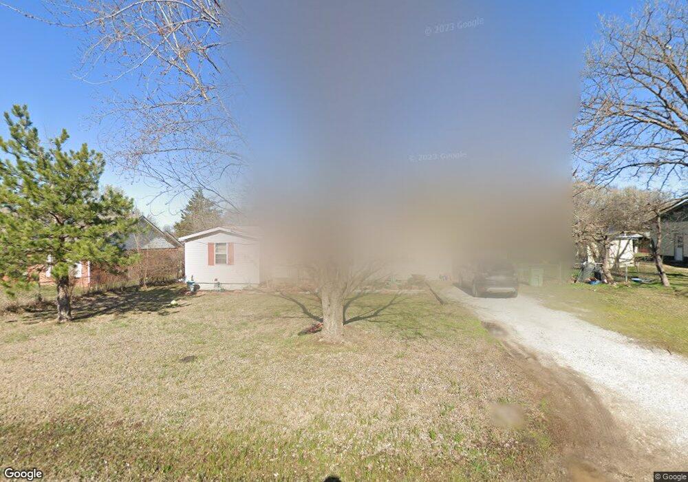
400 Anderson Dr Prague, OK 74864
Estimated Value: $106,468 - $122,000
4
Beds
1
Bath
1,072
Sq Ft
$105/Sq Ft
Est. Value
About This Home
This home is located at 400 Anderson Dr, Prague, OK 74864 and is currently estimated at $112,867, approximately $105 per square foot. 400 Anderson Dr is a home located in Lincoln County with nearby schools including Prague Elementary School, Prague Middle School, and Prague High School.
Ownership History
Date
Name
Owned For
Owner Type
Purchase Details
Closed on
Mar 9, 2020
Sold by
Reagan Judy L and Reagan Richard D
Bought by
Petta Robin L
Current Estimated Value
Purchase Details
Closed on
Jun 18, 2010
Sold by
Page Dallen
Bought by
Page Dallen and Page Sherry L
Home Financials for this Owner
Home Financials are based on the most recent Mortgage that was taken out on this home.
Original Mortgage
$27,744
Interest Rate
4.87%
Mortgage Type
Purchase Money Mortgage
Purchase Details
Closed on
Feb 15, 1980
Sold by
Lashbrook
Bought by
Florville Karen K
Create a Home Valuation Report for This Property
The Home Valuation Report is an in-depth analysis detailing your home's value as well as a comparison with similar homes in the area
Home Values in the Area
Average Home Value in this Area
Purchase History
| Date | Buyer | Sale Price | Title Company |
|---|---|---|---|
| Petta Robin L | -- | None Available | |
| Page Dallen | -- | None Available | |
| Florville Karen K | -- | -- |
Source: Public Records
Mortgage History
| Date | Status | Borrower | Loan Amount |
|---|---|---|---|
| Previous Owner | Page Dallen | $27,744 |
Source: Public Records
Tax History Compared to Growth
Tax History
| Year | Tax Paid | Tax Assessment Tax Assessment Total Assessment is a certain percentage of the fair market value that is determined by local assessors to be the total taxable value of land and additions on the property. | Land | Improvement |
|---|---|---|---|---|
| 2024 | $603 | $5,448 | $214 | $5,234 |
| 2023 | $603 | $5,698 | $214 | $5,484 |
| 2022 | $497 | $5,189 | $186 | $5,003 |
| 2021 | $475 | $4,942 | $204 | $4,738 |
| 2020 | $452 | $4,707 | $204 | $4,503 |
| 2019 | $379 | $4,483 | $204 | $4,279 |
| 2018 | $431 | $4,270 | $204 | $4,066 |
| 2017 | $440 | $4,396 | $204 | $4,192 |
| 2016 | $458 | $4,490 | $204 | $4,286 |
| 2015 | $411 | $4,432 | $204 | $4,228 |
| 2014 | $442 | $4,533 | $198 | $4,335 |
Source: Public Records
Map
Nearby Homes
- 416 Donna Ln
- 0 U S Highway 62
- 1116 Klabzuba Ave
- 1206 Mitacek Ave
- 821 Brunson
- 1411 Brunson Ave
- 1503 Mitacek Ave
- 606 16th St
- 1310 W 15th St
- 1600 16th St
- 2222 W 7th St
- 2217 7th St
- 11445 Ns 3540 Rd
- 1930 Haynie Ln
- 1809 Tyler Terrace
- 356818 E 1070 Rd
- 9027 Ns 3500 Rd
- 0 Highway 99
- 55928 Moccasin Trail Rd
- 106263 S 3520 Rd