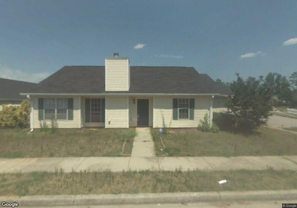
400 Ashton Cir McDonough, GA 30253
Estimated Value: $222,000 - $236,544
3
Beds
2
Baths
1,310
Sq Ft
$176/Sq Ft
Est. Value
About This Home
This home is located at 400 Ashton Cir, McDonough, GA 30253 and is currently estimated at $230,136, approximately $175 per square foot. 400 Ashton Cir is a home located in Henry County with nearby schools including Oakland Elementary School, Eagle's Landing Middle School, and Eagle's Landing High School.
Ownership History
Date
Name
Owned For
Owner Type
Purchase Details
Closed on
Aug 30, 2017
Sold by
Ashton Family Homes Trust
Bought by
Pennington Jesstine
Current Estimated Value
Purchase Details
Closed on
Dec 1, 2011
Sold by
Gorlovsky Mira
Bought by
Iliyev S and Ashton Family Homes Trust
Purchase Details
Closed on
Jun 15, 2011
Sold by
Bank Of New York Me 2005-13
Bought by
Gorlovsky Mira
Purchase Details
Closed on
Mar 1, 2011
Sold by
Manga-Foster Marie J
Bought by
Bank Of New York Mellon 2005-1
Purchase Details
Closed on
Oct 22, 1998
Sold by
Koppar Corp
Bought by
Wuerth Thomas James and Wuerth Azzari
Home Financials for this Owner
Home Financials are based on the most recent Mortgage that was taken out on this home.
Original Mortgage
$82,600
Interest Rate
6.61%
Mortgage Type
New Conventional
Create a Home Valuation Report for This Property
The Home Valuation Report is an in-depth analysis detailing your home's value as well as a comparison with similar homes in the area
Home Values in the Area
Average Home Value in this Area
Purchase History
| Date | Buyer | Sale Price | Title Company |
|---|---|---|---|
| Pennington Jesstine | $81,820 | -- | |
| Iliyev S | -- | -- | |
| Gorlovsky Mira | $42,000 | -- | |
| Bank Of New York Mellon 2005-1 | $45,350 | -- | |
| Wuerth Thomas James | $81,500 | -- |
Source: Public Records
Mortgage History
| Date | Status | Borrower | Loan Amount |
|---|---|---|---|
| Previous Owner | Wuerth Thomas James | $82,600 |
Source: Public Records
Tax History Compared to Growth
Tax History
| Year | Tax Paid | Tax Assessment Tax Assessment Total Assessment is a certain percentage of the fair market value that is determined by local assessors to be the total taxable value of land and additions on the property. | Land | Improvement |
|---|---|---|---|---|
| 2025 | $3,682 | $91,440 | $12,000 | $79,440 |
| 2024 | $3,682 | $87,480 | $12,000 | $75,480 |
| 2023 | $3,215 | $82,040 | $10,000 | $72,040 |
| 2022 | $2,546 | $64,600 | $10,000 | $54,600 |
| 2021 | $2,147 | $54,200 | $10,000 | $44,200 |
| 2020 | $1,858 | $46,680 | $6,000 | $40,680 |
| 2019 | $1,600 | $39,960 | $6,000 | $33,960 |
| 2018 | $1,324 | $32,760 | $5,733 | $27,027 |
| 2016 | $1,300 | $32,120 | $6,000 | $26,120 |
| 2015 | $1,164 | $27,720 | $6,000 | $21,720 |
| 2014 | $916 | $21,200 | $6,000 | $15,200 |
Source: Public Records
Map
Nearby Homes
- 401 Bainbridge Dr
- 300 Ashton Place
- Aster Plan at Kendall Grove - Single Family Homes
- Splendor Plan at Kendall Grove - Single Family Homes
- Radiance Plan at Kendall Grove - Single Family Homes
- Echo Plan at Kendall Grove - Townhomes
- Beacon Plan at Kendall Grove - Single Family Homes
- Triton Plan at Kendall Grove - Townhomes
- Spectra Plan at Kendall Grove - Single Family Homes
- 50 Silver Tip Ct
- 608 Pelican Place
- 409 Corricella Ct
- 317 Torcello Blvd
- 1248 Fagiolo St
- 1232 Fagiolo St
- 405 Corricella Ct
- 1204 Fagiolo St
- 1216 Fagiolo St
- 1256 Fagiolo St
- 1205 Fagiolo St
- 410 Ashton Cir
- 324 Ashton Place
- 420 Ashton Cir
- 322 Ashton Place
- 327 Ashton Place
- 405 Ashton Cir
- 329 Ashton Place
- 325 Ashton Place
- 420 Bainbridge Dr
- 331 Ashton Place
- 422 Bainbridge Dr
- 323 Ashton Place
- 320 Ashton Place
- 430 Ashton Cir
- 0 Ashton Place Unit 8161784
- 0 Ashton Place Unit 8653277
- 0 Ashton Place Unit 8458928
- 0 Ashton Place Unit 8099407
- 0 Ashton Place Unit 7114849
- 0 Ashton Place Unit 7055019