Estimated Value: $181,134 - $235,000
3
Beds
2
Baths
1,525
Sq Ft
$144/Sq Ft
Est. Value
About This Home
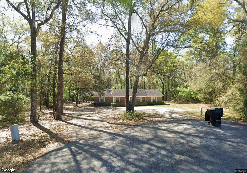
This home is located at 400 Bay Tree Rd NE, Cairo, GA 39828 and is currently estimated at $219,034, approximately $143 per square foot. 400 Bay Tree Rd NE is a home located in Grady County with nearby schools including Cairo High School.
Ownership History
Date
Name
Owned For
Owner Type
Purchase Details
Closed on
Aug 23, 2024
Sold by
Thornton Constance
Bought by
Mct Sky Acquisitions & Development Llc and Widener Timothy
Current Estimated Value
Home Financials for this Owner
Home Financials are based on the most recent Mortgage that was taken out on this home.
Original Mortgage
$176,702
Outstanding Balance
$116,985
Interest Rate
6.78%
Mortgage Type
New Conventional
Estimated Equity
$102,049
Purchase Details
Closed on
Jul 8, 1997
Bought by
Brimm Michael C
Purchase Details
Closed on
Oct 29, 1996
Sold by
Sasser Sara G
Bought by
Tandem Dev Inc
Purchase Details
Closed on
Dec 11, 1991
Bought by
Sasser Sara G
Create a Home Valuation Report for This Property
The Home Valuation Report is an in-depth analysis detailing your home's value as well as a comparison with similar homes in the area
Home Values in the Area
Average Home Value in this Area
Purchase History
| Date | Buyer | Sale Price | Title Company |
|---|---|---|---|
| Mct Sky Acquisitions & Development Llc | $135,500 | -- | |
| Brimm Michael C | $70,500 | -- | |
| Tandem Dev Inc | $5,500 | -- | |
| Sasser Sara G | $6,600 | -- |
Source: Public Records
Mortgage History
| Date | Status | Borrower | Loan Amount |
|---|---|---|---|
| Open | Mct Sky Acquisitions & Development Llc | $176,702 |
Source: Public Records
Tax History Compared to Growth
Tax History
| Year | Tax Paid | Tax Assessment Tax Assessment Total Assessment is a certain percentage of the fair market value that is determined by local assessors to be the total taxable value of land and additions on the property. | Land | Improvement |
|---|---|---|---|---|
| 2024 | $2,328 | $59,000 | $9,480 | $49,520 |
| 2023 | $1,554 | $43,656 | $6,000 | $37,656 |
| 2022 | $1,619 | $43,656 | $6,000 | $37,656 |
| 2021 | $1,624 | $43,656 | $6,000 | $37,656 |
| 2020 | $1,628 | $43,656 | $6,000 | $37,656 |
| 2019 | $1,628 | $43,656 | $6,000 | $37,656 |
| 2018 | $1,548 | $43,656 | $6,000 | $37,656 |
| 2017 | $1,489 | $43,656 | $6,000 | $37,656 |
| 2016 | $1,283 | $36,996 | $6,000 | $30,996 |
| 2015 | $1,270 | $36,996 | $6,000 | $30,996 |
| 2014 | $1,270 | $36,996 | $6,000 | $30,996 |
| 2013 | -- | $33,270 | $6,000 | $27,270 |
Source: Public Records
Map
Nearby Homes
- 0 20th St NE
- 00 20th St NE
- 00 NW 9th Ave
- 711 2nd Ave NE
- 66 22nd St NE
- Lot #15, 3 64 Acres Oakbend Cir
- 2600 U S 84
- 21 24th St NE
- 00 State Route 188
- 0 State Route 188
- 78.6 Ac Strickland Rd
- 2975 U S 84
- 4761 Hadley Ferry Rd
- 0 NE Airport Rd Unit 145784
- 471 4th St SE
- 309 3rd St SE
- 481 4th St SE
- 530 6th Ave SE
- X 1st St
- 00 Hwy 111 South Tract 1
- 403 Bay Tree Rd
- 1962 Hickory Cir
- 405 Bay Tree Rd
- 405 Bay Tree Rd
- 408 Bay Tree Rd
- 409 Bay Tree Rd
- 409 Bay Tree Rd
- 00 NE Hickory Cir
- 407 Hickory Cir
- 413 Bay Tree Rd
- 406 Hickory Cir
- 410 Hickory Cir
- 412 Bay Tree Rd
- 411 Hickory Cir
- 417 Bay Tree Rd
- 1370 10th Ave NE
- 1397 9th Ave NE
- 416 Hickory Cir
- 00 #10 Oak Dr
- 421 Bay Tree Rd