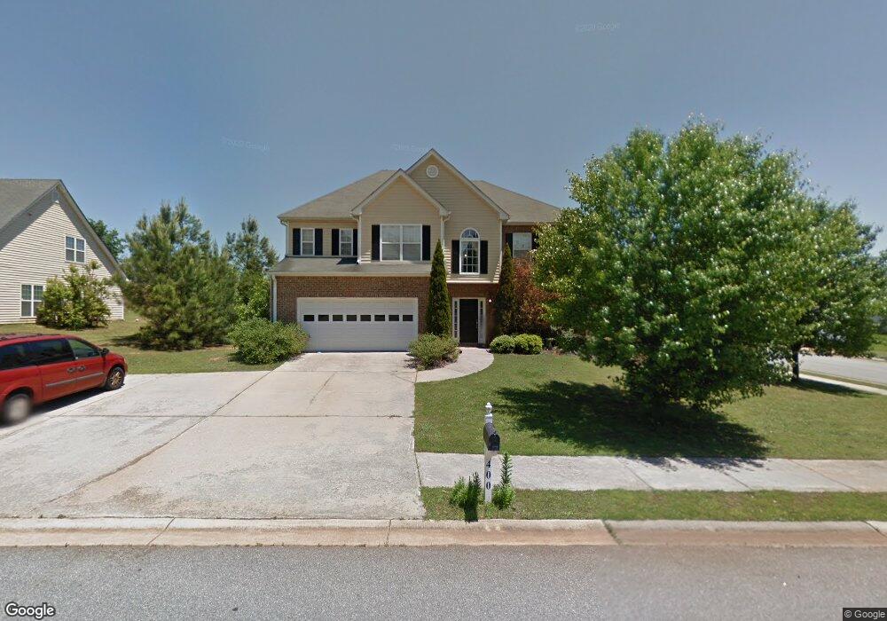
400 Carrie Ct Athens, GA 30606
Estimated Value: $359,000 - $403,349
3
Beds
3
Baths
2,555
Sq Ft
$150/Sq Ft
Est. Value
About This Home
This home is located at 400 Carrie Ct, Athens, GA 30606 and is currently estimated at $383,337, approximately $150 per square foot. 400 Carrie Ct is a home located in Clarke County with nearby schools including Whitehead Road Elementary School, Burney-Harris-Lyons Middle School, and Clarke Central High School.
Ownership History
Date
Name
Owned For
Owner Type
Purchase Details
Closed on
Apr 5, 2005
Sold by
Greenwood Homes Inc
Bought by
Wettstead James R and Wettstead Judith L
Current Estimated Value
Home Financials for this Owner
Home Financials are based on the most recent Mortgage that was taken out on this home.
Original Mortgage
$164,700
Outstanding Balance
$80,111
Interest Rate
5.1%
Mortgage Type
New Conventional
Estimated Equity
$303,226
Purchase Details
Closed on
Oct 11, 2002
Sold by
Metropoliation Land Deve & Inv
Bought by
Greenwood Homes Inc
Create a Home Valuation Report for This Property
The Home Valuation Report is an in-depth analysis detailing your home's value as well as a comparison with similar homes in the area
Home Values in the Area
Average Home Value in this Area
Purchase History
| Date | Buyer | Sale Price | Title Company |
|---|---|---|---|
| Wettstead James R | $183,000 | -- | |
| Greenwood Homes Inc | $35,000 | -- | |
| Metropoliation Land Deve & Invest Corp | $29,500 | -- |
Source: Public Records
Mortgage History
| Date | Status | Borrower | Loan Amount |
|---|---|---|---|
| Open | Wettstead James R | $164,700 |
Source: Public Records
Tax History Compared to Growth
Tax History
| Year | Tax Paid | Tax Assessment Tax Assessment Total Assessment is a certain percentage of the fair market value that is determined by local assessors to be the total taxable value of land and additions on the property. | Land | Improvement |
|---|---|---|---|---|
| 2025 | $3,997 | $146,436 | $12,000 | $134,436 |
| 2024 | $3,997 | $141,885 | $12,000 | $129,885 |
| 2023 | $3,935 | $136,067 | $12,000 | $124,067 |
| 2022 | $3,192 | $110,058 | $10,400 | $99,658 |
| 2021 | $2,832 | $94,050 | $10,400 | $83,650 |
| 2020 | $2,753 | $91,698 | $10,400 | $81,298 |
| 2019 | $2,576 | $85,868 | $8,800 | $77,068 |
| 2018 | $1,992 | $68,664 | $8,800 | $59,864 |
| 2017 | $1,835 | $64,055 | $8,800 | $55,255 |
| 2016 | $1,479 | $53,577 | $8,800 | $44,777 |
| 2015 | $1,400 | $51,162 | $8,800 | $42,362 |
| 2014 | $1,357 | $49,835 | $8,800 | $41,035 |
Source: Public Records
Map
Nearby Homes
- 240 Bowden Ln
- 560 Bethany Ct
- 114 Kara Dr
- 369 Westchester Dr
- 121 Chadds Ct
- 584 Edgewood Dr
- 533 Edgewood Dr
- 155 Hunters Pointe Dr
- 104 Westchester Cir Unit 4
- 275 Westchester Cir
- 105 Westchester Dr Unit A8
- 105 Westchester Dr Unit A8
- 105 Westchester Dr Unit E5
- 160 Magnolia Blossom Way
- 110 S Homewood Dr
- 140 Breckenridge Ln