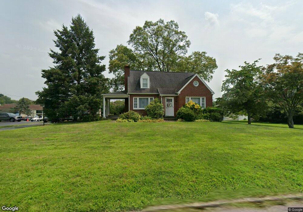
400 Heston Ave Norristown, PA 19403
West Norriton Township NeighborhoodEstimated Value: $394,000 - $432,000
2
Beds
2
Baths
1,607
Sq Ft
$252/Sq Ft
Est. Value
About This Home
This home is located at 400 Heston Ave, Norristown, PA 19403 and is currently estimated at $405,421, approximately $252 per square foot. 400 Heston Ave is a home located in Montgomery County with nearby schools including Charles Blockson Middle School, Paul V Fly Elementary School, and East Norriton Middle School.
Ownership History
Date
Name
Owned For
Owner Type
Purchase Details
Closed on
Aug 25, 2025
Sold by
Picardi Kathleen
Bought by
Picardi Kathleen and Picardi Salvatore C
Current Estimated Value
Home Financials for this Owner
Home Financials are based on the most recent Mortgage that was taken out on this home.
Original Mortgage
$52,000
Outstanding Balance
$51,933
Interest Rate
6.74%
Mortgage Type
Credit Line Revolving
Estimated Equity
$353,488
Purchase Details
Closed on
Jul 18, 2014
Sold by
Monaco Joanne W
Bought by
Picardi Kathleen
Home Financials for this Owner
Home Financials are based on the most recent Mortgage that was taken out on this home.
Original Mortgage
$21,510
Interest Rate
4.18%
Mortgage Type
Seller Take Back
Create a Home Valuation Report for This Property
The Home Valuation Report is an in-depth analysis detailing your home's value as well as a comparison with similar homes in the area
Home Values in the Area
Average Home Value in this Area
Purchase History
| Date | Buyer | Sale Price | Title Company |
|---|---|---|---|
| Picardi Kathleen | -- | First Source Title | |
| Picardi Kathleen | -- | None Available |
Source: Public Records
Mortgage History
| Date | Status | Borrower | Loan Amount |
|---|---|---|---|
| Open | Picardi Kathleen | $52,000 | |
| Previous Owner | Picardi Kathleen | $21,510 |
Source: Public Records
Tax History Compared to Growth
Tax History
| Year | Tax Paid | Tax Assessment Tax Assessment Total Assessment is a certain percentage of the fair market value that is determined by local assessors to be the total taxable value of land and additions on the property. | Land | Improvement |
|---|---|---|---|---|
| 2025 | $5,887 | $120,500 | $45,740 | $74,760 |
| 2024 | $5,887 | $120,500 | $45,740 | $74,760 |
| 2023 | $5,821 | $120,500 | $45,740 | $74,760 |
| 2022 | $5,783 | $120,500 | $45,740 | $74,760 |
| 2021 | $5,748 | $120,500 | $45,740 | $74,760 |
| 2020 | $5,576 | $120,500 | $45,740 | $74,760 |
| 2019 | $5,452 | $120,500 | $45,740 | $74,760 |
| 2018 | $4,449 | $120,500 | $45,740 | $74,760 |
| 2017 | $5,147 | $120,500 | $45,740 | $74,760 |
| 2016 | $5,100 | $120,500 | $45,740 | $74,760 |
| 2015 | $4,725 | $120,500 | $45,740 | $74,760 |
| 2014 | $4,725 | $120,500 | $45,740 | $74,760 |
Source: Public Records
Map
Nearby Homes
- 2044 Mill Rd
- 0 Roosevelt Blvd
- 123 Glenwood Ave
- 365 Norris Hall Ln
- 2017 Yorktown S
- 1503 Reagan Ct
- 2012 Yorktown S
- 526 Bassett Ln
- 2504 Grant Ct
- 37 Burnside Ave
- 1914 Yorktown S
- 1905 Yorktown N
- 1924 Juniata Rd
- 143 Riversedge Dr Unit CONDO 143
- 307 Brandon Rd
- 176 Riversedge Dr
- 167 Woodstream Dr Unit CONDO 167
- 402 Brandon Rd
- 533 Brandon Rd
- 121 Woodstream Dr Unit CONDO 121
- 364 Heston Ave
- 404 Heston Ave
- 332 Heston Ave
- 401 Heston Ave
- 412 Heston Ave
- 403 Heston Ave
- 337 Heston Ave
- 328 Heston Ave
- 335 Heston Ave
- 407 Heston Ave
- 416 Heston Ave
- 329 Heston Ave
- 413 Heston Ave
- 324 Heston Ave
- 420 Heston Ave
- 417 Heston Ave
- 321 Heston Ave
- 344 S Trooper Rd Unit 12
- 348 S Trooper Rd
- 340 S Trooper Rd