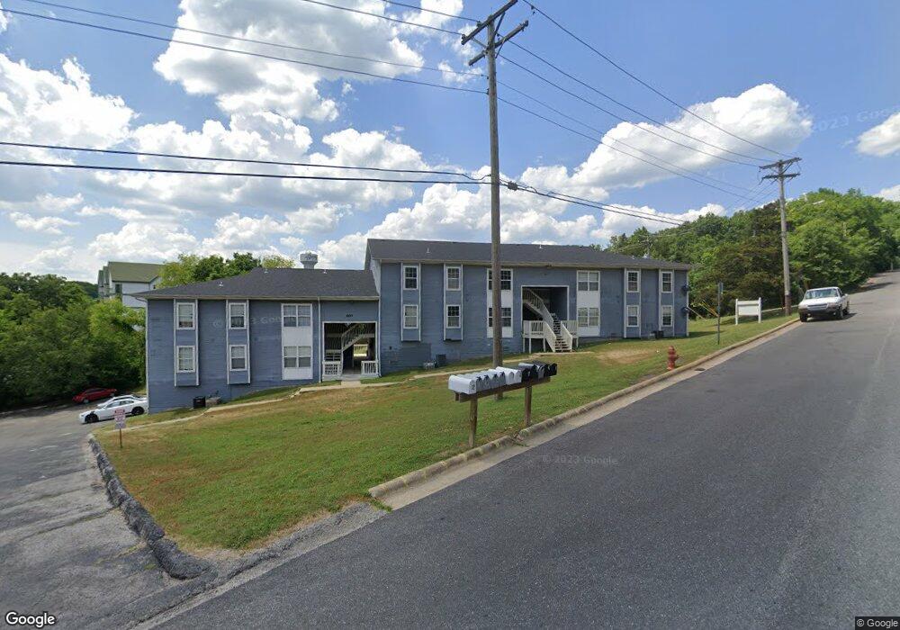
400 Judy St Branson, MO 65616
West Branson NeighborhoodEstimated Value: $364,000
2
Beds
1
Bath
900
Sq Ft
$404/Sq Ft
Est. Value
About This Home
This home is located at 400 Judy St, Branson, MO 65616 and is currently priced at $364,000, approximately $404 per square foot. 400 Judy St is a home located in Taney County with nearby schools including Cedar Ridge Primary, Cedar Ridge Intermediate School, and Cedar Ridge Elementary School.
Ownership History
Date
Name
Owned For
Owner Type
Purchase Details
Closed on
Jun 30, 2022
Sold by
Clancy Properties Xvi Llc
Bought by
Cure Capital Llc
Current Estimated Value
Purchase Details
Closed on
Sep 30, 2016
Sold by
Douglas Apartments Lp
Bought by
Clancy Properties Xvi Llc
Home Financials for this Owner
Home Financials are based on the most recent Mortgage that was taken out on this home.
Original Mortgage
$957,000
Interest Rate
3.43%
Mortgage Type
Future Advance Clause Open End Mortgage
Create a Home Valuation Report for This Property
The Home Valuation Report is an in-depth analysis detailing your home's value as well as a comparison with similar homes in the area
Home Values in the Area
Average Home Value in this Area
Purchase History
| Date | Buyer | Sale Price | Title Company |
|---|---|---|---|
| Cure Capital Llc | -- | None Listed On Document | |
| Clancy Properties Xvi Llc | -- | None Available |
Source: Public Records
Mortgage History
| Date | Status | Borrower | Loan Amount |
|---|---|---|---|
| Previous Owner | Clancy Properties Xvi Llc | $957,000 |
Source: Public Records
Tax History
| Year | Tax Paid | Tax Assessment Tax Assessment Total Assessment is a certain percentage of the fair market value that is determined by local assessors to be the total taxable value of land and additions on the property. | Land | Improvement |
|---|---|---|---|---|
| 2025 | $4,783 | $84,000 | -- | -- |
| 2023 | $4,783 | $89,460 | $0 | $0 |
| 2022 | $4,652 | $89,460 | $0 | $0 |
| 2021 | $4,621 | $89,460 | $0 | $0 |
| 2019 | $4,283 | $79,460 | $0 | $0 |
| 2018 | $4,286 | $79,460 | $0 | $0 |
| 2017 | $4,245 | $79,460 | $0 | $0 |
| 2016 | $4,740 | $88,940 | $0 | $0 |
| 2015 | $4,695 | $88,940 | $0 | $0 |
| 2014 | $4,293 | $85,250 | $0 | $0 |
Source: Public Records
Map
Nearby Homes
- 220 Harmony Ln
- 237 Dakota Rd
- 301 Dakota Rd
- 667 Henderson St
- 2820 Green Mountain Dr Unit 309
- 2820 Green Mountain Dr Unit 310
- 2820 Green Mountain Dr Unit 109
- 2820 Green Mountain Dr Unit 208
- 2820 Green Mountain Dr Unit 108
- 2800 Green Mountain Dr Unit 111 B & C
- 2800 Green Mountain Dr Unit 112 B & C
- 2800 Green Mountain Dr Unit 110 B & C
- 745 Aaron Way
- 123 Oak Dr Unit 1-9
- 105 Oxford Dr Unit 10
- 119 Residence Ln Unit 2
- 108 Residence Ln
- 106 Oxford Dr Unit 8
- 106 Oxford Dr Unit 6-6
- 106 Oxford Dr Unit 6-4
- 407 Judy St Unit B18
- 407 Judy St
- 404 Judy St
- 404 Judy St
- 406 Judy St
- 430 State Highway 165 Unit 15JAN
- 430 State Highway 165 Unit 25JAN
- 430 State Highway 165 Unit 16JAN
- 430 State Highway 165 Unit 1
- 430 State Highway 165 Unit 1
- 430 State Highway 165 Unit 1
- 430 State Highway 165 Unit 2
- 430 State Highway 165 Unit 1
- 430 State Highway 165
- 303 Judy St
- 308 Judy St
- 261 Pine St
- 306 Judy St
- 281 Pine St
- 301 Judy St
Your Personal Tour Guide
Ask me questions while you tour the home.