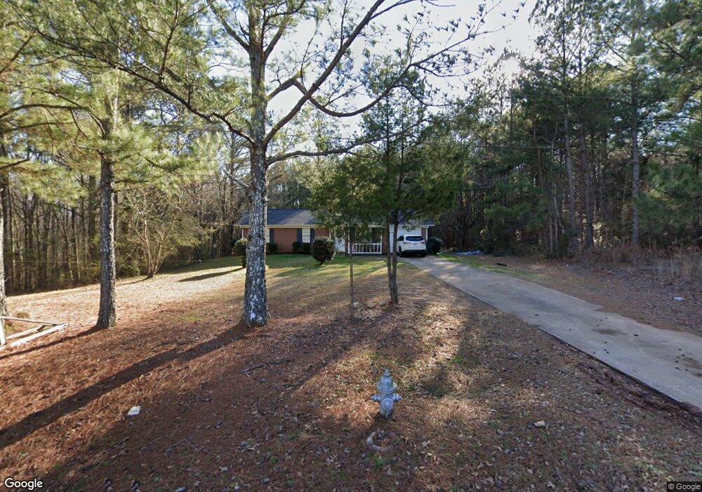
400 Laney Rd McDonough, GA 30252
Estimated Value: $201,000 - $249,000
3
Beds
2
Baths
1,092
Sq Ft
$204/Sq Ft
Est. Value
About This Home
This home is located at 400 Laney Rd, McDonough, GA 30252 and is currently estimated at $223,293, approximately $204 per square foot. 400 Laney Rd is a home located in Henry County with nearby schools including New Hope Elementary School, Locust Grove Middle School, and Locust Grove High School.
Ownership History
Date
Name
Owned For
Owner Type
Purchase Details
Closed on
Apr 16, 2021
Sold by
Capes Ronald E
Bought by
Galbreath Brandon
Current Estimated Value
Home Financials for this Owner
Home Financials are based on the most recent Mortgage that was taken out on this home.
Original Mortgage
$162,626
Outstanding Balance
$146,832
Interest Rate
3%
Mortgage Type
New Conventional
Estimated Equity
$76,461
Purchase Details
Closed on
Oct 18, 2019
Sold by
Najarian Armen Z
Bought by
Capes Ronald E
Home Financials for this Owner
Home Financials are based on the most recent Mortgage that was taken out on this home.
Original Mortgage
$133,536
Interest Rate
3.87%
Mortgage Type
FHA
Purchase Details
Closed on
Sep 7, 2018
Sold by
Nadzharyan Armen A
Bought by
Najarian Armen Z and Najarian Anahit K
Create a Home Valuation Report for This Property
The Home Valuation Report is an in-depth analysis detailing your home's value as well as a comparison with similar homes in the area
Home Values in the Area
Average Home Value in this Area
Purchase History
| Date | Buyer | Sale Price | Title Company |
|---|---|---|---|
| Galbreath Brandon | $161,000 | -- | |
| Capes Ronald E | $136,000 | -- | |
| Najarian Armen Z | -- | -- |
Source: Public Records
Mortgage History
| Date | Status | Borrower | Loan Amount |
|---|---|---|---|
| Open | Galbreath Brandon | $162,626 | |
| Previous Owner | Capes Ronald E | $133,536 |
Source: Public Records
Tax History
| Year | Tax Paid | Tax Assessment Tax Assessment Total Assessment is a certain percentage of the fair market value that is determined by local assessors to be the total taxable value of land and additions on the property. | Land | Improvement |
|---|---|---|---|---|
| 2025 | $3,715 | $92,960 | $16,000 | $76,960 |
| 2024 | $3,715 | $90,880 | $14,400 | $76,480 |
| 2023 | $3,416 | $88,000 | $13,880 | $74,120 |
| 2022 | $2,510 | $64,400 | $12,429 | $51,971 |
| 2021 | $440 | $54,400 | $11,000 | $43,400 |
| 2020 | $439 | $48,480 | $10,360 | $38,120 |
| 2019 | $1,183 | $41,600 | $9,800 | $31,800 |
| 2018 | $0 | $36,880 | $9,080 | $27,800 |
| 2016 | $1,183 | $29,800 | $6,920 | $22,880 |
| 2015 | -- | $28,000 | $6,880 | $21,120 |
| 2014 | -- | $22,520 | $6,880 | $15,640 |
Source: Public Records
Map
Nearby Homes
- 383 Laney Rd
- 373 Laney Rd
- 363 Laney Rd
- 125 Karen Dr
- 175 Laney Ct Unit 1
- 285 Creekside Way
- 690 Laney Rd
- 356 Cattlemans Cir
- 105 Tiffany Ct
- 173 Michael Ln
- 310 Cattlemans Cir
- 976 S Laney Rd
- 992 S Laney Rd
- 290 Laney Ct
- 328 Cattlemans Cir
- 281 Laney Dr
- 145 Creekside Way
- 121, 125, 129 Case Dr
- 136 Ducati Dr
- 725 Old Jackson Rd
- 424 Laney Rd
- 450 Laney Rd
- 460 Laney Rd
- 425 Laney Rd
- 455 Laney Rd
- 405 Laney Rd
- 570 Plantation Rd
- 20 Plantation Ln
- 415 Laney Rd
- 100 Karen Dr
- 560 Plantation Rd
- 475 Laney Rd
- 586 Plantation Rd
- 30 Plantation Ln
- 480 Laney Rd
- 480 Laney Rd Unit 20
- 25 Plantation Ln
- 575 Plantation Rd
- 594 Plantation Rd
- 35 Plantation Ln
Your Personal Tour Guide
Ask me questions while you tour the home.