Estimated Value: $295,000 - $372,758
3
Beds
2
Baths
2,872
Sq Ft
$117/Sq Ft
Est. Value
About This Home
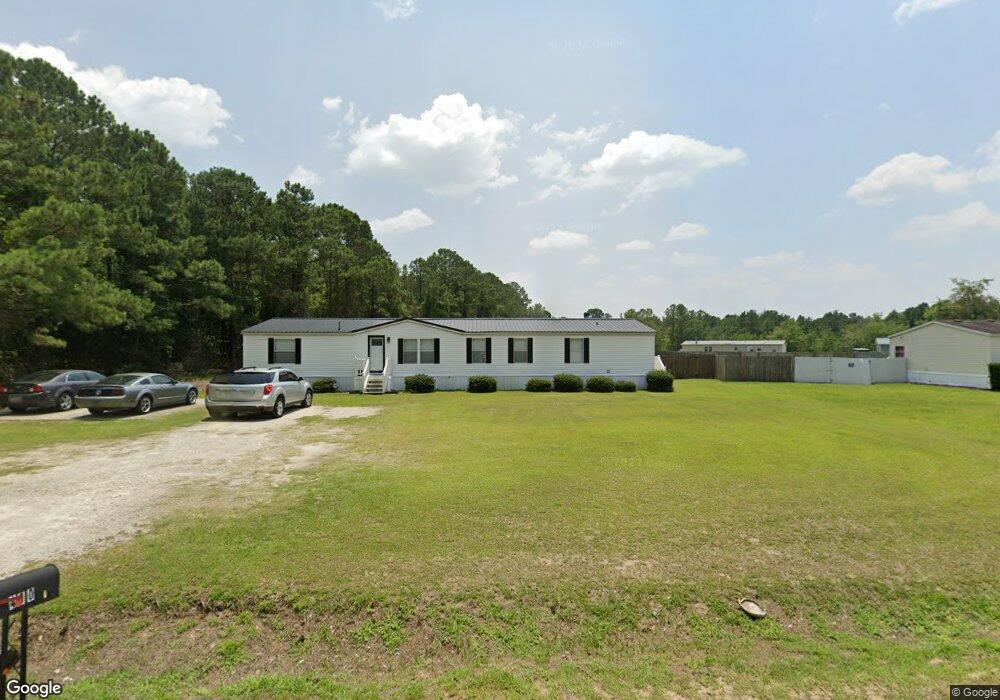
This home is located at 400 Log Cabin Rd, Loris, SC 29569 and is currently estimated at $334,940, approximately $116 per square foot. 400 Log Cabin Rd is a home located in Horry County with nearby schools including Loris Elementary School, Loris Middle School, and Loris High School.
Ownership History
Date
Name
Owned For
Owner Type
Purchase Details
Closed on
Jun 25, 2004
Sold by
Nealey Gail F
Bought by
Crosland Timothy W
Current Estimated Value
Home Financials for this Owner
Home Financials are based on the most recent Mortgage that was taken out on this home.
Original Mortgage
$80,000
Interest Rate
6.25%
Mortgage Type
Purchase Money Mortgage
Purchase Details
Closed on
Nov 13, 2003
Sold by
Indymac Bank Fsb
Bought by
Nealey Gail F
Purchase Details
Closed on
Mar 24, 2003
Sold by
Perry Caroline
Bought by
Indymac Bank Fsb
Purchase Details
Closed on
Nov 22, 2000
Sold by
Mishoe Tony Max
Bought by
Perry Caroline
Home Financials for this Owner
Home Financials are based on the most recent Mortgage that was taken out on this home.
Original Mortgage
$108,000
Interest Rate
7.71%
Mortgage Type
Purchase Money Mortgage
Create a Home Valuation Report for This Property
The Home Valuation Report is an in-depth analysis detailing your home's value as well as a comparison with similar homes in the area
Home Values in the Area
Average Home Value in this Area
Purchase History
| Date | Buyer | Sale Price | Title Company |
|---|---|---|---|
| Crosland Timothy W | $100,000 | -- | |
| Nealey Gail F | $47,500 | -- | |
| Indymac Bank Fsb | $5,000 | -- | |
| Perry Caroline | $19,900 | -- |
Source: Public Records
Mortgage History
| Date | Status | Borrower | Loan Amount |
|---|---|---|---|
| Previous Owner | Crosland Timothy W | $80,000 | |
| Previous Owner | Perry Caroline | $108,000 |
Source: Public Records
Tax History
| Year | Tax Paid | Tax Assessment Tax Assessment Total Assessment is a certain percentage of the fair market value that is determined by local assessors to be the total taxable value of land and additions on the property. | Land | Improvement |
|---|---|---|---|---|
| 2025 | $887 | $0 | $0 | $0 |
| 2024 | $887 | $14,388 | $2,584 | $11,804 |
| 2023 | $887 | $7,544 | $1,033 | $6,511 |
| 2021 | $803 | $8,845 | $1,033 | $7,812 |
| 2020 | $700 | $8,845 | $1,033 | $7,812 |
| 2019 | $700 | $8,845 | $1,033 | $7,812 |
| 2018 | $0 | $8,277 | $1,033 | $7,244 |
| 2017 | $609 | $8,277 | $1,033 | $7,244 |
| 2016 | -- | $8,277 | $1,033 | $7,244 |
| 2015 | $624 | $8,277 | $1,033 | $7,244 |
| 2014 | $570 | $8,277 | $1,033 | $7,244 |
Source: Public Records
Map
Nearby Homes
- Tbd Lot 3 Auburn Unit Auburn Drive Auburn
- Tbd Lot 3 Auburn
- TBD 2 Auburn Dr Unit Auburn Drive Lot 2
- Tbd Lot 1 Auburn
- 335 Bright Leaf Rd
- 8 Powell Ln
- Lot 10 & 9 Powell Ln
- TBD Lot 7 Powell Ln Unit TBD Powell Lane lot
- Lot 7 Powell Ln
- TBD 9 & 10 Powell Ln Unit Lots 9 & 10 Log Cabi
- TBD Lot 8 Powell Ln Unit TBD Lot 8 Powell Lan
- 463 Ribbon Rail Way
- 4177 Charleston Oaks Dr
- 600 Runaway Train Dr Unit Dover
- 590 Runaway Train Dr Unit Hartford
- 712 Locomotive Place Unit Hartford
- 127 Warner Crossing Way
- 127 Warner Crossing Way Unit Columbia
- 604 Runaway Train Dr
- 608 Runaway Train Dr Unit Columbia
- 451 Log Cabin Rd
- 449 Log Cabin Rd
- 1539 Auburn Dr
- 376 Log Cabin Rd
- TBD Auburn Dr
- 1519 Auburn Dr
- 450 Log Cabin Rd
- 364 Log Cabin Rd
- 1511 Powell Ln
- 1511 Powell Ln Unit Log Cabin
- 1511 Auburn Dr
- 407 Log Cabin Rd
- 466 Log Cabin Rd
- 401 Log Cabin Rd
- 319 Bright Leaf Rd
- 1600 Auburn Dr
- Lot 1b Auburn
- 387 Log Cabin Rd
- 321 Bright Leaf Rd
- 325 Bright Leaf Rd
Your Personal Tour Guide
Ask me questions while you tour the home.