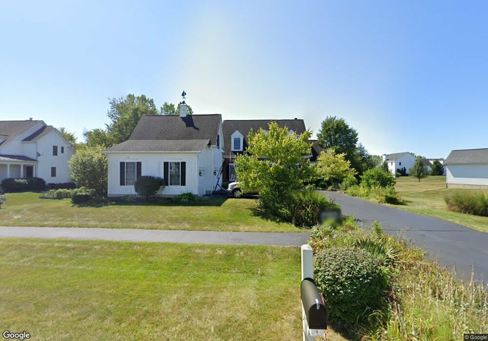
400 Long Trail Ostrander, OH 43061
Scioto NeighborhoodEstimated Value: $589,000 - $734,000
4
Beds
4
Baths
3,435
Sq Ft
$190/Sq Ft
Est. Value
About This Home
This home is located at 400 Long Trail, Ostrander, OH 43061 and is currently estimated at $651,674, approximately $189 per square foot. 400 Long Trail is a home located in Delaware County with nearby schools including Buckeye Valley High School.
Ownership History
Date
Name
Owned For
Owner Type
Purchase Details
Closed on
Sep 29, 2006
Sold by
Ahi Land Development Group Inc
Bought by
Gibbs James D and Gibbs Jodi L
Current Estimated Value
Home Financials for this Owner
Home Financials are based on the most recent Mortgage that was taken out on this home.
Original Mortgage
$61,200
Interest Rate
6.49%
Mortgage Type
Stand Alone Second
Create a Home Valuation Report for This Property
The Home Valuation Report is an in-depth analysis detailing your home's value as well as a comparison with similar homes in the area
Home Values in the Area
Average Home Value in this Area
Purchase History
| Date | Buyer | Sale Price | Title Company |
|---|---|---|---|
| Gibbs James D | $54,900 | Crown Title |
Source: Public Records
Mortgage History
| Date | Status | Borrower | Loan Amount |
|---|---|---|---|
| Closed | Gibbs James D | $61,200 | |
| Closed | Gibbs James D | $326,400 |
Source: Public Records
Tax History Compared to Growth
Tax History
| Year | Tax Paid | Tax Assessment Tax Assessment Total Assessment is a certain percentage of the fair market value that is determined by local assessors to be the total taxable value of land and additions on the property. | Land | Improvement |
|---|---|---|---|---|
| 2024 | $6,093 | $180,680 | $34,830 | $145,850 |
| 2023 | $6,093 | $180,680 | $34,830 | $145,850 |
| 2022 | $5,878 | $155,610 | $25,200 | $130,410 |
| 2021 | $5,720 | $155,610 | $25,200 | $130,410 |
| 2020 | $5,752 | $155,610 | $25,200 | $130,410 |
| 2019 | $5,648 | $139,550 | $21,000 | $118,550 |
| 2018 | $5,750 | $139,550 | $21,000 | $118,550 |
| 2017 | $4,983 | $113,960 | $17,500 | $96,460 |
| 2016 | $4,416 | $113,960 | $17,500 | $96,460 |
| 2015 | $4,658 | $113,960 | $17,500 | $96,460 |
| 2014 | $4,380 | $113,960 | $17,500 | $96,460 |
| 2013 | $4,307 | $107,660 | $17,500 | $90,160 |
Source: Public Records
Map
Nearby Homes
- 311 Blue Ridge Ct
- 3480 Ostrander Rd
- 0 E High St Unit Tract 1 225034753
- 0 E High St Unit Tract 4 225034758
- 0 E High St Unit Tract 3 225034757
- 101 S Main St
- 188 Huston St
- 0 Dean Rd Unit 225032132
- 0 Dean Rd Unit 225032131
- 0 Carr Rd Unit 225016840
- 10156 Marysville Rd
- 0 Burnt Pond Rd Unit Tract 1
- 0 Burnt Pond Rd Unit Tract 2
- 0 Burnt Pond Rd Unit Tract 4
- 0 Burnt Pond Rd Unit Tract 3
- 0 Burnt Pond Rd Unit Tract 5
- 3880 Fry Rd
- 1131 Ohio 257
- 5586 Taylor Rd
- 0 Delaware County Line Rd
- 380 Long Trail
- 414 Long Trail
- 101 Calumet Ct
- 372 Long Trail
- 113 Calumet Ct
- 180 White Barn Pkwy
- 401 Long Trail
- 364 Long Trail
- 428 Long Trail
- 100 Calumet Ct
- 356 Long Trail
- 389 Long Trail
- 125 Calumet Ct
- 181 White Barn Pkwy
- 114 Calumet Ct
- 140 White Barn Pkwy
- 425 Long Trail
- 381 Long Trail
- 442 Long Trail
- 348 Long Trail