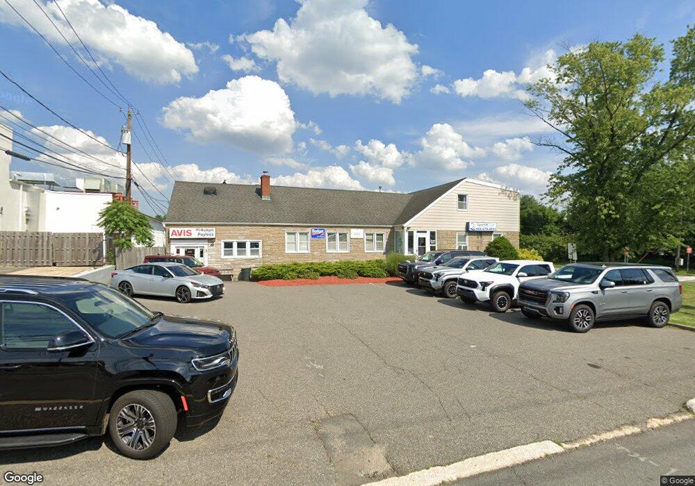
400 N Bridge St Unit 5 Bridgewater, NJ 08807
Estimated Value: $1,060,000 - $1,287,001
--
Bed
--
Bath
900
Sq Ft
$1,304/Sq Ft
Est. Value
About This Home
This home is located at 400 N Bridge St Unit 5, Bridgewater, NJ 08807 and is currently estimated at $1,173,501, approximately $1,303 per square foot. 400 N Bridge St Unit 5 is a home located in Somerset County with nearby schools including Crim Primary School, Bridgewater-Raritan Middle School, and Hillside Intermediate School.
Ownership History
Date
Name
Owned For
Owner Type
Purchase Details
Closed on
Apr 5, 2000
Sold by
400 North Bridge Asso
Bought by
Harding & Sullivan Holding Co
Current Estimated Value
Home Financials for this Owner
Home Financials are based on the most recent Mortgage that was taken out on this home.
Original Mortgage
$360,000
Outstanding Balance
$123,601
Interest Rate
8.26%
Mortgage Type
Commercial
Estimated Equity
$1,049,900
Create a Home Valuation Report for This Property
The Home Valuation Report is an in-depth analysis detailing your home's value as well as a comparison with similar homes in the area
Home Values in the Area
Average Home Value in this Area
Purchase History
| Date | Buyer | Sale Price | Title Company |
|---|---|---|---|
| Harding & Sullivan Holding Co | $450,000 | -- |
Source: Public Records
Mortgage History
| Date | Status | Borrower | Loan Amount |
|---|---|---|---|
| Open | Harding & Sullivan Holding Co | $360,000 |
Source: Public Records
Tax History Compared to Growth
Tax History
| Year | Tax Paid | Tax Assessment Tax Assessment Total Assessment is a certain percentage of the fair market value that is determined by local assessors to be the total taxable value of land and additions on the property. | Land | Improvement |
|---|---|---|---|---|
| 2025 | $18,012 | $987,800 | $161,300 | $826,500 |
| 2024 | $18,012 | $923,200 | $161,300 | $761,900 |
| 2023 | $16,660 | $839,300 | $161,300 | $678,000 |
| 2022 | $15,664 | $763,000 | $161,300 | $601,700 |
| 2021 | $12,927 | $635,800 | $161,300 | $474,500 |
| 2020 | $13,182 | $629,500 | $161,300 | $468,200 |
| 2019 | $12,927 | $611,200 | $161,300 | $449,900 |
| 2018 | $12,896 | $611,200 | $161,300 | $449,900 |
| 2017 | $12,909 | $611,200 | $161,300 | $449,900 |
| 2016 | $12,719 | $611,200 | $161,300 | $449,900 |
| 2015 | $12,463 | $599,200 | $161,300 | $437,900 |
| 2014 | $12,655 | $599,200 | $161,300 | $437,900 |
Source: Public Records
Map
Nearby Homes
- 18 Riviera Dr
- 23 W Spring St
- 25 W Spring St
- 30 Demond Place
- 20 Speer St
- 361 William St
- 21 W Cliff St
- 12 Schoolhouse Ln
- 56 Fieldstone Dr
- 81 Grove St Unit 83
- 81-83 Grove St
- 84 Grove St
- 3 Prospect St
- 35 W High St
- 32 Maple St
- 131 Eastern Ave
- 7 Monmouth Ave
- 44 Mechanic St
- 96 Eastern Ave
- 110 N Middaugh St
- 400 N Bridge St
- 400 N Bridge St
- 19 King Arthurs Ct
- 300 N Bridge St
- 23 King Arthurs Ct
- 27 King Arthurs Ct
- 11 King Arthurs Ct
- 31 King Arthurs Ct
- 286 N Bridge St
- 303 N Bridge St
- 15 King Arthurs Ct
- 301 N Bridge St
- 14 Ivanhoe Ave
- 30 King Arthurs Ct
- 295 N Bridge St
- 20 Ivanhoe Ave
- 289 N Bridge St
- 14 King Arthurs Ct
- 14 King Arthurs Ct
- 15 Ivanhoe Ave