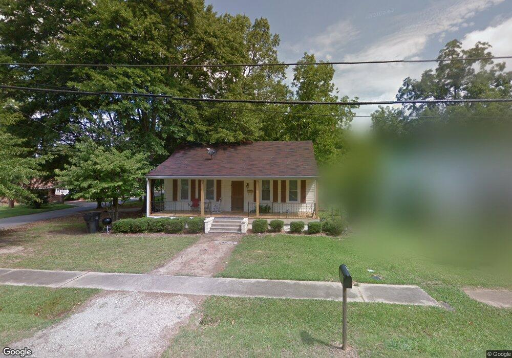
400 N Rhodes St Union Point, GA 30669
Estimated Value: $33,605 - $180,000
1
Bed
1
Bath
1,296
Sq Ft
$64/Sq Ft
Est. Value
About This Home
This home is located at 400 N Rhodes St, Union Point, GA 30669 and is currently estimated at $83,151, approximately $64 per square foot. 400 N Rhodes St is a home located in Greene County with nearby schools including Greene County High School.
Ownership History
Date
Name
Owned For
Owner Type
Purchase Details
Closed on
Sep 16, 2024
Sold by
Luna Properties Llc
Bought by
Delopez Maria Magdelena Monte
Current Estimated Value
Purchase Details
Closed on
Feb 24, 2005
Sold by
Ohalloran Kevin
Bought by
Luna Properties Llc
Purchase Details
Closed on
Aug 14, 2003
Sold by
O'Neal Walter Hill
Bought by
Stewart Family Partnership Lp
Purchase Details
Closed on
May 13, 2003
Sold by
O'Neal John Robert
Bought by
O'Neal Walter Hill
Purchase Details
Closed on
Jan 1, 1972
Sold by
Holmes Hilda
Bought by
O'Neal John Robert
Purchase Details
Closed on
Jan 1, 1955
Bought by
Holmes Hilda
Create a Home Valuation Report for This Property
The Home Valuation Report is an in-depth analysis detailing your home's value as well as a comparison with similar homes in the area
Home Values in the Area
Average Home Value in this Area
Purchase History
| Date | Buyer | Sale Price | Title Company |
|---|---|---|---|
| Delopez Maria Magdelena Monte | $33,009 | -- | |
| Luna Properties Llc | $271,000 | -- | |
| Stewart Family Partnership Lp | $35,000 | -- | |
| O'Neal Walter Hill | -- | -- | |
| O'Neal John Robert | -- | -- | |
| Holmes Hilda | -- | -- |
Source: Public Records
Tax History Compared to Growth
Tax History
| Year | Tax Paid | Tax Assessment Tax Assessment Total Assessment is a certain percentage of the fair market value that is determined by local assessors to be the total taxable value of land and additions on the property. | Land | Improvement |
|---|---|---|---|---|
| 2024 | $723 | $21,792 | $3,880 | $17,912 |
| 2023 | $592 | $17,224 | $3,337 | $13,887 |
| 2022 | $471 | $17,224 | $3,337 | $13,887 |
| 2021 | $441 | $17,544 | $3,160 | $14,384 |
| 2020 | $346 | $8,972 | $2,680 | $6,292 |
| 2019 | $354 | $8,972 | $2,680 | $6,292 |
| 2018 | $215 | $8,972 | $2,680 | $6,292 |
| 2017 | $316 | $9,033 | $2,700 | $6,333 |
| 2016 | $330 | $9,553 | $2,700 | $6,853 |
| 2015 | $300 | $9,553 | $2,700 | $6,853 |
| 2014 | $309 | $9,722 | $2,700 | $7,022 |
Source: Public Records
Map
Nearby Homes
- 324 N Rhodes St
- 606 Bryan Ave
- 504 Crawfordville Rd
- 202 Veazey St
- 0 Woodland Ct Unit 1027434
- 0 Woodland Ct Unit 10543600
- 215 Hunter St
- 1010 Orear Rd
- 0 S Rhodes St Unit 10618488
- 0 Washington Hwy Unit 7276060
- 1180 Moody St
- 1041 Hillcrest Dr
- 1241 Old Siloam Rd
- 1860 Washington Hwy
- 0 Buffalo Lick Rd Unit 10551328
- 1201 Buffalo Lick Rd
- 0 Buffalo Lick Rd Unit 10551325
- 0 Buffalo Lick Rd Unit 10551234
- 1251 Adams Rd
- 0 Old Union Point Rd Unit 1 10557753
- 402 N Rhodes St
- 0 Park Ave
- 715 Park Ave
- 404 N Rhodes St
- 804 Park Ave
- 809 Park Ave
- 405 N Rhodes St
- 713 Park Ave
- 806 Park Ave
- 804 Crawfordville Rd
- 320 N Rhodes St
- 718 Crawfordville Rd
- 416 Thornton St
- 718 Crawford Rd
- 812 Park Ave
- 302 Thornton St
- 305 Thornton St
- 405 Thornton St
- 814 Park Ave
- 300 Thornton St