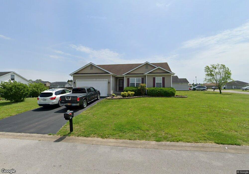
400 Saint Paul Ave Bowling Green, KY 42101
Estimated Value: $234,000 - $245,000
3
Beds
2
Baths
1,463
Sq Ft
$162/Sq Ft
Est. Value
About This Home
This home is located at 400 Saint Paul Ave, Bowling Green, KY 42101 and is currently estimated at $237,482, approximately $162 per square foot. 400 Saint Paul Ave is a home located in Warren County with nearby schools including Bristow Elementary School, Warren East Middle School, and Warren East High School.
Ownership History
Date
Name
Owned For
Owner Type
Purchase Details
Closed on
Dec 17, 2024
Sold by
Floyd Jon P
Bought by
Spalding Logan
Current Estimated Value
Home Financials for this Owner
Home Financials are based on the most recent Mortgage that was taken out on this home.
Original Mortgage
$10,000
Interest Rate
0.2%
Mortgage Type
New Conventional
Purchase Details
Closed on
Mar 26, 2020
Sold by
Murphy Rachel Brianne and Estate Of Ronald Ames Basham
Bought by
Floyd Jon P
Home Financials for this Owner
Home Financials are based on the most recent Mortgage that was taken out on this home.
Original Mortgage
$119,000
Interest Rate
3.4%
Mortgage Type
New Conventional
Create a Home Valuation Report for This Property
The Home Valuation Report is an in-depth analysis detailing your home's value as well as a comparison with similar homes in the area
Home Values in the Area
Average Home Value in this Area
Purchase History
| Date | Buyer | Sale Price | Title Company |
|---|---|---|---|
| Spalding Logan | $227,000 | Agency Title | |
| Spalding Logan | $227,000 | Agency Title | |
| Floyd Jon P | $140,000 | None Available |
Source: Public Records
Mortgage History
| Date | Status | Borrower | Loan Amount |
|---|---|---|---|
| Closed | Spalding Logan | $10,000 | |
| Open | Spalding Logan | $222,888 | |
| Closed | Spalding Logan | $222,888 | |
| Previous Owner | Floyd Jon P | $119,000 |
Source: Public Records
Tax History Compared to Growth
Tax History
| Year | Tax Paid | Tax Assessment Tax Assessment Total Assessment is a certain percentage of the fair market value that is determined by local assessors to be the total taxable value of land and additions on the property. | Land | Improvement |
|---|---|---|---|---|
| 2025 | $2,071 | $227,000 | $0 | $0 |
| 2024 | $1,349 | $140,000 | $0 | $0 |
| 2023 | $1,357 | $140,000 | $0 | $0 |
| 2022 | $1,277 | $140,000 | $0 | $0 |
| 2021 | $1,272 | $140,000 | $0 | $0 |
| 2020 | $1,197 | $130,000 | $0 | $0 |
| 2019 | $881 | $130,000 | $0 | $0 |
| 2018 | $1,189 | $130,000 | $0 | $0 |
| 2017 | $1,087 | $118,000 | $0 | $0 |
| 2015 | $1,069 | $118,000 | $0 | $0 |
| 2014 | $1,055 | $118,000 | $0 | $0 |
Source: Public Records
Map
Nearby Homes
- 1428 Quebec Way
- 332 Saint Paul Ave
- 1464 N Pointe Way
- 333 Deluth Dr
- 1631 Calgary Way
- 1311 Huron Way
- 1519 N Pointe Ct
- 1318 Salem Cir
- 423 Deluth Dr
- 498 Deluth Dr
- 2724 Cedrus Ave
- 471 Deluth Dr
- 2530 Plum Springs Rd
- 1201 Salem Cir
- 912 Alberta Dr
- 521 Labrador Dr
- 516 Deluth Dr
- 2801 Gunsmoke Trail Way
- 522 Deluth Dr
- 2837 Gunsmoke Trail Way
- 1376 Quebec Way
- 412 St Paul Ave
- 401 St Paul
- 401 Saint Paul Ave
- 1372 Quebec Way
- 407 St Paul Ave
- 372 Saint Paul Ave
- 418 St Paul Ave
- 413 St Paul Ave
- 1375 Quebec Way
- 373 Saint Paul Ave
- 359 Fairbanks Ave
- 419 St Paul Ave
- 1371 Quebec Way
- 1410 Quebec Way
- 365 Saint Paul Ave
- 365 Fairbanks Ave
- 1403 Quebec Way
- 424 St Paul Ave
- 364 Saint Paul Ave