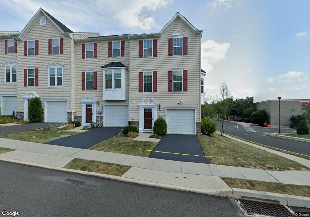
400 Susan Cir North Wales, PA 19454
Estimated Value: $448,515 - $534,000
3
Beds
3
Baths
1,680
Sq Ft
$283/Sq Ft
Est. Value
About This Home
This home is located at 400 Susan Cir, North Wales, PA 19454 and is currently estimated at $475,129, approximately $282 per square foot. 400 Susan Cir is a home with nearby schools including Montgomery Elementary School, Pennbrook Middle School, and North Penn Senior High School.
Ownership History
Date
Name
Owned For
Owner Type
Purchase Details
Closed on
Aug 1, 2016
Sold by
Lau Yukming Dennis and Lau Chuck Wing Sum
Bought by
Lau Chuck Wing Sum
Current Estimated Value
Home Financials for this Owner
Home Financials are based on the most recent Mortgage that was taken out on this home.
Original Mortgage
$178,000
Outstanding Balance
$81,434
Interest Rate
3.48%
Mortgage Type
New Conventional
Estimated Equity
$393,695
Purchase Details
Closed on
Jun 22, 2012
Sold by
Nvr Inc
Bought by
Lau Chuck Wing Sum and Lau Yukming Dennis
Home Financials for this Owner
Home Financials are based on the most recent Mortgage that was taken out on this home.
Original Mortgage
$200,000
Interest Rate
3.78%
Purchase Details
Closed on
Dec 30, 2011
Sold by
Hancock Properties Inc
Bought by
Nvr Inc and Ryan Homes
Create a Home Valuation Report for This Property
The Home Valuation Report is an in-depth analysis detailing your home's value as well as a comparison with similar homes in the area
Home Values in the Area
Average Home Value in this Area
Purchase History
| Date | Buyer | Sale Price | Title Company |
|---|---|---|---|
| Lau Chuck Wing Sum | -- | None Available | |
| Lau Chuck Wing Sum | $296,485 | None Available | |
| Nvr Inc | $700,000 | None Available |
Source: Public Records
Mortgage History
| Date | Status | Borrower | Loan Amount |
|---|---|---|---|
| Open | Lau Chuck Wing Sum | $178,000 | |
| Closed | Lau Chuck Wing Sum | $200,000 |
Source: Public Records
Tax History Compared to Growth
Tax History
| Year | Tax Paid | Tax Assessment Tax Assessment Total Assessment is a certain percentage of the fair market value that is determined by local assessors to be the total taxable value of land and additions on the property. | Land | Improvement |
|---|---|---|---|---|
| 2025 | $5,085 | $136,320 | -- | -- |
| 2024 | $5,085 | $136,320 | -- | -- |
| 2023 | $4,851 | $136,320 | $0 | $0 |
| 2022 | $4,681 | $136,320 | $0 | $0 |
| 2021 | $4,401 | $136,320 | $0 | $0 |
| 2020 | $4,285 | $136,320 | $0 | $0 |
| 2019 | $4,205 | $136,320 | $0 | $0 |
| 2018 | $728 | $136,320 | $0 | $0 |
| 2017 | $4,025 | $136,320 | $0 | $0 |
| 2016 | $3,972 | $136,320 | $0 | $0 |
| 2015 | $3,895 | $136,320 | $0 | $0 |
| 2014 | $3,793 | $136,320 | $0 | $0 |
Source: Public Records
Map
Nearby Homes
- 407 Anthony Ct
- 106 Jene Ct
- 501 Joshua Ct
- 304 Joshua Ct
- 101 Devon Ct
- 219 Red Haven Dr
- 203 Jonathan Dr
- 981 Horsham Rd
- 108 Bartlett Dr
- 228 Red Haven Dr
- 182 Filly Dr
- 203 Franklin Ct
- 302 Hancock Ct
- 107 Filly Dr
- 307 Livingston Ct
- 53 Neshaminy Falls Cir
- 2022 Longwood Place Unit 2022
- 61 Longwood Place
- 56 Neshaminy Falls Cir
- 155 Hillside Ct