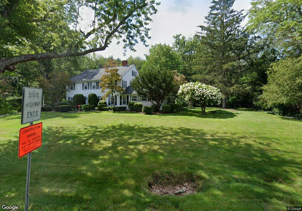
400 Thompson Rd Webster, MA 01570
Estimated Value: $228,578 - $402,000
3
Beds
3
Baths
373
Sq Ft
$802/Sq Ft
Est. Value
About This Home
This home is located at 400 Thompson Rd, Webster, MA 01570 and is currently estimated at $299,145, approximately $801 per square foot. 400 Thompson Rd is a home located in Worcester County with nearby schools including Park Avenue Elementary School, Webster Middle School, and Bartlett High School.
Ownership History
Date
Name
Owned For
Owner Type
Purchase Details
Closed on
Dec 22, 1998
Sold by
Park Sowhey
Bought by
Brochu Arthur J and Brochu Cheryl A
Current Estimated Value
Home Financials for this Owner
Home Financials are based on the most recent Mortgage that was taken out on this home.
Original Mortgage
$122,400
Outstanding Balance
$27,971
Interest Rate
6.85%
Mortgage Type
Purchase Money Mortgage
Estimated Equity
$271,174
Create a Home Valuation Report for This Property
The Home Valuation Report is an in-depth analysis detailing your home's value as well as a comparison with similar homes in the area
Home Values in the Area
Average Home Value in this Area
Purchase History
| Date | Buyer | Sale Price | Title Company |
|---|---|---|---|
| Brochu Arthur J | $8,100 | -- |
Source: Public Records
Mortgage History
| Date | Status | Borrower | Loan Amount |
|---|---|---|---|
| Open | Brochu Arthur J | $122,400 |
Source: Public Records
Tax History
| Year | Tax Paid | Tax Assessment Tax Assessment Total Assessment is a certain percentage of the fair market value that is determined by local assessors to be the total taxable value of land and additions on the property. | Land | Improvement |
|---|---|---|---|---|
| 2025 | $345 | $29,000 | $21,600 | $7,400 |
| 2024 | $341 | $28,000 | $20,700 | $7,300 |
| 2023 | $328 | $26,200 | $19,700 | $6,500 |
| 2022 | $346 | $24,800 | $19,200 | $5,600 |
| 2021 | $364 | $24,100 | $19,200 | $4,900 |
| 2020 | $360 | $23,900 | $19,200 | $4,700 |
| 2019 | $380 | $24,800 | $20,400 | $4,400 |
| 2018 | $376 | $24,400 | $20,400 | $4,000 |
| 2017 | $342 | $22,600 | $20,000 | $2,600 |
| 2016 | $342 | $22,600 | $20,000 | $2,600 |
| 2015 | $354 | $24,100 | $21,600 | $2,500 |
Source: Public Records
Map
Nearby Homes
- 13 S Point Rd
- 53-55 Point Pleasant Rd
- 0 Thompson Rd
- 26 Wakefield Ave
- 24 Cooper Rd
- 27 Ash St
- 0 Porter Plain Rd
- 10 Indian Point Rd
- 125 Birch Island Rd
- 36 Lake Pkwy
- 00 Juniper Ln
- 171 Upper Gore Rd
- 51 &52 lot Oscar Rd
- 23 Lakeview Rd
- 3 Upper Gore Rd
- 16 Hilltop Dr
- 30 Valley St
- 0 Wilsonville Rd Unit 24140220
- 1 Brook St
- 17 Mount Pleasant St
- 376 Thompson Rd
- 1379 Thompson Rd
- 1369 Thompson Rd
- 381 Thompson Rd
- 1 Happy Tree Ln
- 374 Thompson Rd
- 1403 Thompson Rd
- 373 Thompson Rd
- 370 Thompson Rd
- 371 Thompson Rd
- 1392 Thompson Rd
- 369 Thompson Rd
- 364 Thompson Rd
- 367 Thompson Rd
- 8 Bates Crossing
- 1387 Thompson Rd
- 12 Bates Crossing
- 10 Bates Crossing
- 6 Bates Crossing
- 362 Thompson Rd
Your Personal Tour Guide
Ask me questions while you tour the home.