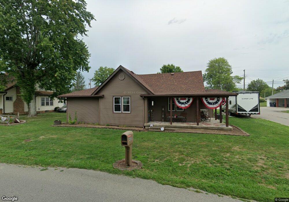
400 W Main St Westport, IN 47283
Estimated Value: $153,000 - $198,000
2
Beds
1
Bath
1,506
Sq Ft
$115/Sq Ft
Est. Value
About This Home
This home is located at 400 W Main St, Westport, IN 47283 and is currently estimated at $173,215, approximately $115 per square foot. 400 W Main St is a home located in Decatur County with nearby schools including South Decatur Elementary School and South Decatur Junior/Senior High School.
Ownership History
Date
Name
Owned For
Owner Type
Purchase Details
Closed on
Mar 10, 2020
Sold by
Hamilton Bruce W
Bought by
Deppe Roger D and Deppe Melissa D
Current Estimated Value
Purchase Details
Closed on
Aug 29, 2012
Sold by
Secretary Of Housing And Urban Developme
Bought by
Foreclosures 4 Cash Inc
Purchase Details
Closed on
Sep 26, 2011
Sold by
Pnc Bank Na
Bought by
Secretary Of Housing And Urban Developme
Purchase Details
Closed on
Sep 20, 2011
Sold by
Allen Greg
Bought by
Pnc Bank
Create a Home Valuation Report for This Property
The Home Valuation Report is an in-depth analysis detailing your home's value as well as a comparison with similar homes in the area
Home Values in the Area
Average Home Value in this Area
Purchase History
| Date | Buyer | Sale Price | Title Company |
|---|---|---|---|
| Deppe Roger D | -- | None Available | |
| Foreclosures 4 Cash Inc | -- | -- | |
| Secretary Of Housing And Urban Developme | -- | -- | |
| Pnc Bank | $75,591 | -- |
Source: Public Records
Tax History Compared to Growth
Tax History
| Year | Tax Paid | Tax Assessment Tax Assessment Total Assessment is a certain percentage of the fair market value that is determined by local assessors to be the total taxable value of land and additions on the property. | Land | Improvement |
|---|---|---|---|---|
| 2024 | $746 | $124,200 | $15,800 | $108,400 |
| 2023 | $692 | $115,400 | $15,800 | $99,600 |
| 2022 | $677 | $105,600 | $15,800 | $89,800 |
| 2021 | $649 | $91,900 | $15,800 | $76,100 |
| 2020 | $370 | $77,400 | $11,300 | $66,100 |
| 2019 | $324 | $68,900 | $11,300 | $57,600 |
| 2018 | $269 | $63,600 | $11,300 | $52,300 |
| 2017 | $241 | $60,800 | $11,300 | $49,500 |
| 2016 | $212 | $56,100 | $10,100 | $46,000 |
| 2014 | $195 | $53,300 | $10,100 | $43,200 |
| 2013 | $196 | $51,200 | $10,100 | $41,100 |
Source: Public Records
Map
Nearby Homes
- 107 W Main St
- 217 E Sycamore St
- 1017 W Main St
- 508 Deer Run
- 503 E Bennett St
- 506 E North St
- 3852 W Co Road 1100 S
- 0 W Co Rd 1100 S
- 3058 W Co Road 1100 S
- 6440 W County Road 1300 S
- 11182 S Co Road 280 W
- 7962 S State Road 3
- 4281 W County Road 800 S
- 1816 W County Road 1000 S
- 6255 E County Road 850 N
- 4944 S County Road 240 W
- 28 W Co Road 700 S
- 8950 N County Road 350 W
- 3735 W County Road 850 N
- 5766 S Co Road 20 W
- 402 W Main St
- 404 W Main St
- 107 N Elizabeth St
- 308 W Main St
- 405 W Mulberry St
- 401 W Main St
- 408 W Main St
- 405 W Main St
- 307 W Mulberry St
- 108 N Lincoln St
- 409 W Main St
- 309 W Main St
- 411 W Main St
- 304 W Main St
- 404 W Mulberry St
- 109 S Elizabeth St
- 502 W Main St
- 308 W Mulberry St
- 305 W Main St
- 506 W Main St