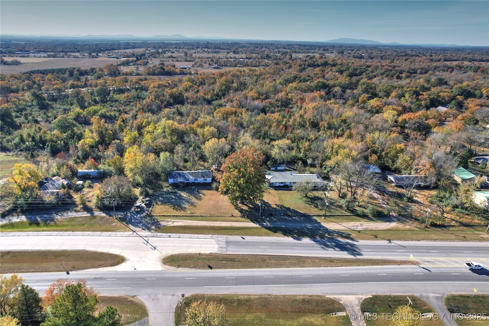
400 W Ray Fine Blvd Roland, OK 74954
Estimated payment $13,214/month
Highlights
- 23 Acre Lot
- Spring on Lot
- Additional Land
- Heavily Wooded Lot
- No HOA
- Creek or Stream
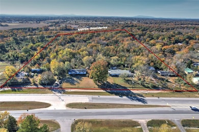
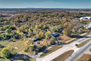
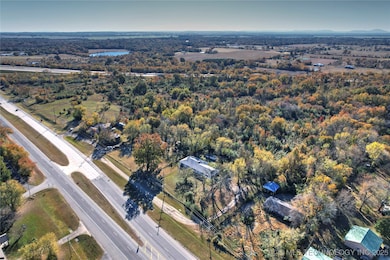
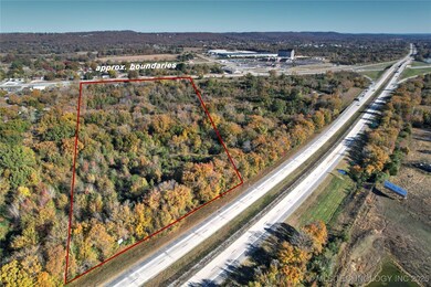
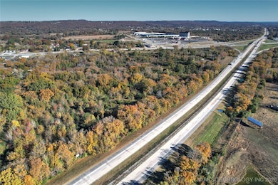
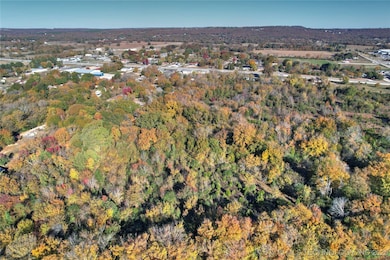
About This Lot
Prime high-visibility commercial land along I-40 and US-64 in Roland, Oklahoma — directly across from the Cherokee Casino & Hotel and just minutes from the Arkansas state line. This 23-24 acre tract offers exceptional frontage, flat topography, and easy access for development. Ideal for travel-oriented retail, lodging, or mixed-use projects, the site already has 3-phase power and access to public water and sewer through the Town of Roland. With traffic counts exceeding 30,000 vehicles per day, this location provides unbeatable exposure in one of eastern Oklahoma’s most active highway corridors. Tracts may be subdivided — bring your vision and plan
Must be sold with adjoing lot with home 1 acre mls # 2546947
Property Details
Property Type
- Land
Est. Annual Taxes
- $767
Lot Details
- 23 Acre Lot
- Lot Dimensions are 1358x856
- Property fronts an interstate
- Creek or Stream
- Partially Fenced Property
- Barbed Wire
- Heavily Wooded Lot
- Additional Land
Utilities
- Phone Available
Community Details
Overview
- No Home Owners Association
- Sequoyah Co Unplatted Subdivision
Recreation
- Spring on Lot
Map
Home Values in the Area
Average Home Value in this Area
Tax History
| Year | Tax Paid | Tax Assessment Tax Assessment Total Assessment is a certain percentage of the fair market value that is determined by local assessors to be the total taxable value of land and additions on the property. | Land | Improvement |
|---|---|---|---|---|
| 2024 | $737 | $8,281 | $1,584 | $6,697 |
| 2023 | $737 | $8,041 | $1,584 | $6,457 |
| 2022 | $688 | $7,806 | $1,584 | $6,222 |
| 2021 | $675 | $7,579 | $1,584 | $5,995 |
| 2020 | $686 | $7,535 | $1,574 | $5,961 |
| 2019 | $666 | $7,315 | $1,524 | $5,791 |
| 2018 | $594 | $7,102 | $3,740 | $3,362 |
| 2017 | $535 | $6,276 | $3,740 | $2,536 |
| 2016 | $512 | $6,094 | $3,740 | $2,354 |
| 2015 | $486 | $5,917 | $3,740 | $2,177 |
| 2014 | $484 | $5,882 | $3,809 | $2,073 |
Property History
| Date | Event | Price | List to Sale | Price per Sq Ft |
|---|---|---|---|---|
| 11/11/2025 11/11/25 | For Sale | $2,500,000 | -3.8% | -- |
| 10/04/2018 10/04/18 | For Sale | $2,600,000 | -- | -- |
Purchase History
| Date | Type | Sale Price | Title Company |
|---|---|---|---|
| Warranty Deed | -- | None Available |
Source: MLS Technology
MLS Number: 2544315
APN: 0000-27-011-026-0-018-00
Disclaimer: Certain information contained herein is derived from information provided by parties other than Homes.com. All information provided is deemed reliable, but is not guaranteed to be accurate and should be independently verified.
![]() IDX information is provided exclusively for personal, non-commercial use, and may not be used for any purpose other than to identify prospective properties consumers may be interested in purchasing.
IDX information is provided exclusively for personal, non-commercial use, and may not be used for any purpose other than to identify prospective properties consumers may be interested in purchasing.
Information is deemed reliable but not guaranteed.
- 405 W Ray Fine Blvd
- 407 W Ray Fine Blvd
- TBD W Ray Fine Blvd
- 404 W Ray Fine Blvd
- 113 Cherokee Blvd
- 320 Neal Dr
- 111587 S 4760 Rd
- TBD U S Highway 64
- 0 N Cottonwood Rd
- 2000 N Cottonwood Rd
- 110907 S 4760 Rd
- 111182 S 4760 Rd
- 511 Mayfield Dr
- 505 Mayfield Dr
- 111324 S 4780 Rd
- 110127 S 4760 Rd
- 101 Hollow Dr
- 121 Shady Ln
- Lot 1 N 4780 Rd
- 200 S Jeff Ln
