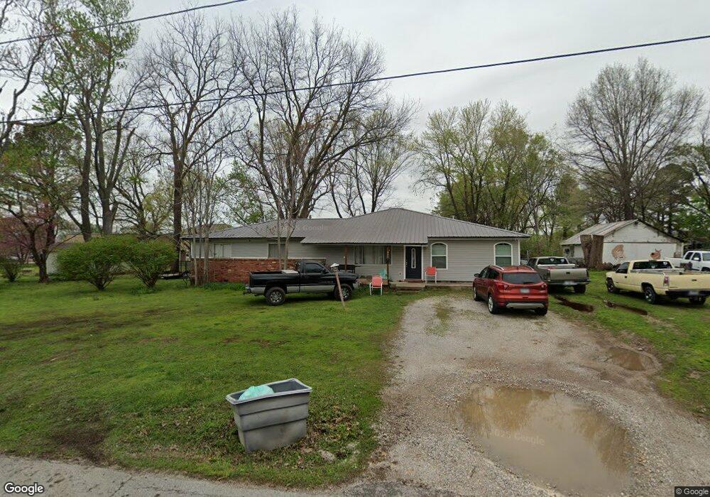
400 W Thurman St Prairie Grove, AR 72753
Estimated Value: $260,000 - $419,000
--
Bed
1
Bath
2,528
Sq Ft
$127/Sq Ft
Est. Value
About This Home
This home is located at 400 W Thurman St, Prairie Grove, AR 72753 and is currently estimated at $320,681, approximately $126 per square foot. 400 W Thurman St is a home located in Washington County with nearby schools including Prairie Grove Elementary School, Prairie Grove Middle School, and Prairie Grove Junior High School.
Ownership History
Date
Name
Owned For
Owner Type
Purchase Details
Closed on
Aug 1, 2017
Sold by
Boyd Hazel Christine
Bought by
Boyd Kenneth E and Boyd Hazel Christine
Current Estimated Value
Purchase Details
Closed on
Jul 12, 1991
Bought by
Bowling Sheridan A
Purchase Details
Closed on
Jul 1, 1986
Bought by
Bowling Sheridan Allen and Bowling Stella
Purchase Details
Closed on
May 29, 1986
Bought by
Sharp Sharp W and Sharp Georgia L
Purchase Details
Closed on
Feb 15, 1972
Bought by
Walkup, G H & Alpha M
Create a Home Valuation Report for This Property
The Home Valuation Report is an in-depth analysis detailing your home's value as well as a comparison with similar homes in the area
Home Values in the Area
Average Home Value in this Area
Purchase History
| Date | Buyer | Sale Price | Title Company |
|---|---|---|---|
| Boyd Kenneth E | -- | None Available | |
| Bowling Sheridan A | -- | -- | |
| Bowling Sheridan Allen | -- | -- | |
| Sharp Sharp W | $35,000 | -- | |
| Walkup, G H & Alpha M | -- | -- |
Source: Public Records
Tax History Compared to Growth
Tax History
| Year | Tax Paid | Tax Assessment Tax Assessment Total Assessment is a certain percentage of the fair market value that is determined by local assessors to be the total taxable value of land and additions on the property. | Land | Improvement |
|---|---|---|---|---|
| 2025 | $1,087 | $53,300 | $11,900 | $41,400 |
| 2024 | $1,139 | $53,300 | $11,900 | $41,400 |
| 2023 | $1,199 | $53,300 | $11,900 | $41,400 |
| 2022 | $1,172 | $38,300 | $4,900 | $33,400 |
| 2021 | $1,105 | $38,300 | $4,900 | $33,400 |
| 2020 | $1,032 | $38,300 | $4,900 | $33,400 |
| 2019 | $980 | $24,910 | $4,000 | $20,910 |
| 2018 | $1,005 | $24,910 | $4,000 | $20,910 |
| 2017 | $344 | $12,870 | $4,000 | $8,870 |
| 2016 | $344 | $12,870 | $4,000 | $8,870 |
| 2015 | $344 | $12,870 | $4,000 | $8,870 |
| 2014 | $316 | $12,353 | $2,640 | $9,713 |
Source: Public Records
Map
Nearby Homes
- 601 Westwood Ave
- 110 Cypress St
- 703 Grant Ave
- 4.66 +/- AC Tract 5 Hwy 62 & S Mock St
- Lot 2 Holmes St
- 806 Grant Ave
- 661 Summer Ln
- TBD Kate Smith St
- 211 Boston St
- 807 Sedgwick Dr
- 601 Pennington Ave
- 813 Grant Ave
- 311 S Mock St
- 815 Custer St
- 818 Grant Ave
- 816 Custer St
- 208 N Neal St
- 0 S Industrial Park Rd
- 301 Hindman Dr
- 106 S Ozark St
- 310 W Thurman St
- 308 W Thurman St
- 403 W Thurman St
- 313 W Thurman St
- 317 W Cleveland St
- 104 Heron Prairie Meadows
- 203 S Baggett St Unit 10
- 203 S Baggett St
- 203 S Baggett St Unit 3
- 203 S Baggett St Unit 9
- 203 S Baggett St Unit 2
- 203 S Baggett St Unit 5
- 203 S Baggett St Unit 4
- 203 S Baggett St Unit 8
- 407 W Thurman St
- 306 W Thurman St
- 311 W Thurman St
- 410 W Thurman St
- 201 S Baggett St
- 201 S Baggett St Unit 2