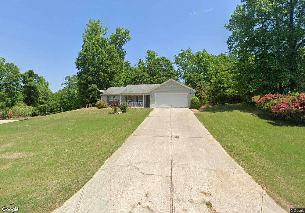
400 Warpath Rd Unit 39 Statham, GA 30666
Estimated Value: $279,000 - $304,000
3
Beds
2
Baths
1,273
Sq Ft
$232/Sq Ft
Est. Value
About This Home
This home is located at 400 Warpath Rd Unit 39, Statham, GA 30666 and is currently estimated at $294,727, approximately $231 per square foot. 400 Warpath Rd Unit 39 is a home located in Barrow County with nearby schools including Statham Elementary School, Bear Creek Middle School, and Winder-Barrow High School.
Ownership History
Date
Name
Owned For
Owner Type
Purchase Details
Closed on
Mar 27, 2013
Sold by
Mcfall Carolyn
Bought by
Schuster Daniel E and Schuster Susan K
Current Estimated Value
Purchase Details
Closed on
Jun 24, 2005
Sold by
Southfork Hms Inc
Bought by
Mcfall Carolyn
Home Financials for this Owner
Home Financials are based on the most recent Mortgage that was taken out on this home.
Original Mortgage
$140,000
Interest Rate
5.54%
Mortgage Type
New Conventional
Purchase Details
Closed on
Jul 19, 2004
Sold by
May & Short Llc
Bought by
Southfork Homes Inc
Purchase Details
Closed on
Jan 24, 2003
Bought by
May & Short Llc
Create a Home Valuation Report for This Property
The Home Valuation Report is an in-depth analysis detailing your home's value as well as a comparison with similar homes in the area
Home Values in the Area
Average Home Value in this Area
Purchase History
| Date | Buyer | Sale Price | Title Company |
|---|---|---|---|
| Schuster Daniel E | $89,000 | -- | |
| Mcfall Carolyn | $119,400 | -- | |
| Southfork Homes Inc | $31,500 | -- | |
| May & Short Llc | -- | -- |
Source: Public Records
Mortgage History
| Date | Status | Borrower | Loan Amount |
|---|---|---|---|
| Previous Owner | Mcfall Carolyn | $140,000 |
Source: Public Records
Tax History Compared to Growth
Tax History
| Year | Tax Paid | Tax Assessment Tax Assessment Total Assessment is a certain percentage of the fair market value that is determined by local assessors to be the total taxable value of land and additions on the property. | Land | Improvement |
|---|---|---|---|---|
| 2024 | $1,815 | $74,337 | $21,200 | $53,137 |
| 2023 | $1,408 | $74,737 | $21,200 | $53,537 |
| 2022 | $1,777 | $63,431 | $21,200 | $42,231 |
| 2021 | $1,439 | $49,051 | $16,000 | $33,051 |
| 2020 | $1,439 | $49,051 | $16,000 | $33,051 |
| 2019 | $1,463 | $49,051 | $16,000 | $33,051 |
| 2018 | $1,357 | $46,290 | $13,200 | $33,090 |
| 2017 | $1,168 | $40,113 | $13,200 | $26,913 |
| 2016 | $1,149 | $40,413 | $13,200 | $27,213 |
| 2015 | $1,163 | $40,718 | $13,200 | $27,518 |
| 2014 | $954 | $33,726 | $6,468 | $27,258 |
| 2013 | -- | $32,383 | $6,468 | $25,915 |
Source: Public Records
Map
Nearby Homes
- 1920 Brenda St
- 68 Charlotte Cir
- 156 Charlotte Cir
- 174 Charlotte Cir
- 190 Charlotte Dr
- 190 Charlotte Cir
- 74 Charlotte Cir
- 80 Charlotte Cir
- 210 Charlotte Cir
- 130 Abby Ln
- 107 Charlotte Place
- 29 Charlotte Place
- 139 Goldshore Way
- 126 Arnold Rd SE
- 305 Dove Field Dr Unit 80
- 287 Dove Field Dr Unit 81
- 267 Dove Field Dr Unit 82
- 247 Dove Field Dr Unit 83
- 227 Dove Field Dr Unit 84
- 265 Jefferson St
- 400 Warpath Rd
- 402 Warpath Rd
- 2240 Wagon Wheel Trail
- 2243 Wagon Wheel Trail
- 2234 Wagon Wheel Trail
- 404 Warpath Rd
- 404 Warpath Rd Unit 41
- 2233 Wagon Wheel Trail
- 2238 Wagon Wheel Trail
- 483 Canoe Ct
- 0 Warpath Rd Unit 7141478
- 0 Warpath Rd Unit 8414111
- 0 Warpath Rd Unit 7609915
- 0 Warpath Rd Unit 7036947
- 0 Warpath Rd Unit 2791773
- 0 Warpath Rd Unit 7400893
- 0 Warpath Rd Unit 8981307
- 0 Warpath Rd Unit 8762887
- 0 Warpath Rd
- 2240 Wagon Wheel Tr Lot23