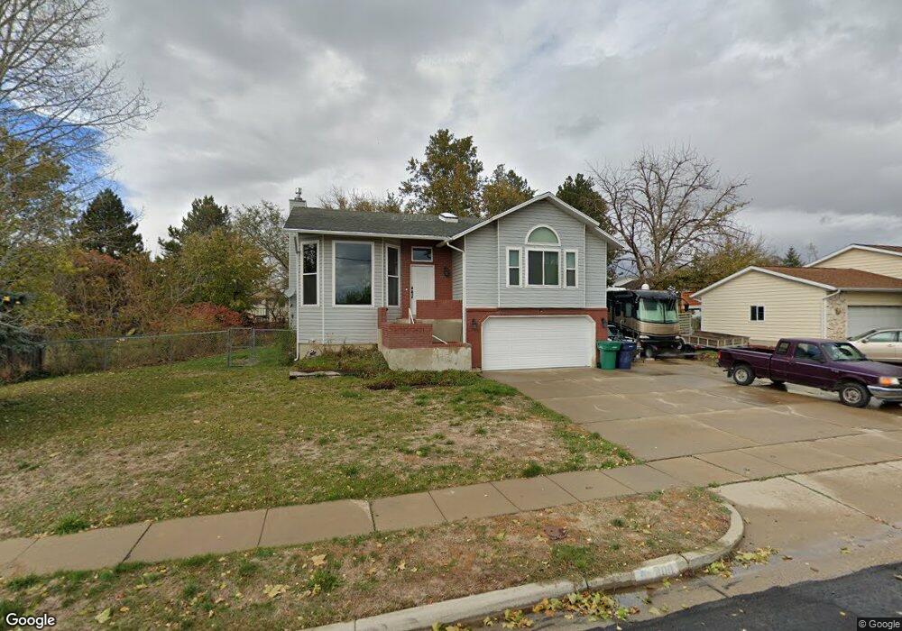
400 Weaver Ln Layton, UT 84041
Estimated Value: $533,000 - $614,000
4
Beds
3
Baths
3,336
Sq Ft
$172/Sq Ft
Est. Value
About This Home
This home is located at 400 Weaver Ln, Layton, UT 84041 and is currently estimated at $573,247, approximately $171 per square foot. 400 Weaver Ln is a home located in Davis County with nearby schools including Layton Elementary School, Fairfield Junior High School, and Layton High School.
Ownership History
Date
Name
Owned For
Owner Type
Purchase Details
Closed on
Mar 10, 2020
Sold by
Bowers Blame L and Bowers Kathleen D
Bought by
Mired Gregory S
Current Estimated Value
Home Financials for this Owner
Home Financials are based on the most recent Mortgage that was taken out on this home.
Original Mortgage
$398,860
Outstanding Balance
$353,163
Interest Rate
3.6%
Mortgage Type
VA
Estimated Equity
$220,084
Purchase Details
Closed on
Mar 31, 2016
Sold by
Bowers Blaine L and Bowers Kathleen D
Bought by
Bowers Kathleen D and Bowers Family Trust
Create a Home Valuation Report for This Property
The Home Valuation Report is an in-depth analysis detailing your home's value as well as a comparison with similar homes in the area
Home Values in the Area
Average Home Value in this Area
Purchase History
| Date | Buyer | Sale Price | Title Company |
|---|---|---|---|
| Mired Gregory S | -- | Us Title Company Of | |
| Bowers Kathleen D | -- | Richland Title |
Source: Public Records
Mortgage History
| Date | Status | Borrower | Loan Amount |
|---|---|---|---|
| Open | Mired Gregory S | $398,860 |
Source: Public Records
Tax History Compared to Growth
Tax History
| Year | Tax Paid | Tax Assessment Tax Assessment Total Assessment is a certain percentage of the fair market value that is determined by local assessors to be the total taxable value of land and additions on the property. | Land | Improvement |
|---|---|---|---|---|
| 2025 | $2,575 | $286,000 | $111,512 | $174,488 |
| 2024 | $2,575 | $272,250 | $134,239 | $138,011 |
| 2023 | $2,479 | $462,000 | $138,534 | $323,466 |
| 2022 | $2,701 | $273,350 | $82,795 | $190,555 |
| 2021 | $2,372 | $358,000 | $124,191 | $233,809 |
| 2020 | $2,141 | $310,000 | $105,497 | $204,503 |
| 2019 | $2,023 | $287,000 | $105,815 | $181,185 |
| 2018 | $1,833 | $261,000 | $93,075 | $167,925 |
| 2016 | $1,685 | $123,750 | $37,810 | $85,940 |
| 2015 | $1,621 | $113,025 | $37,810 | $75,215 |
| 2014 | $1,750 | $124,812 | $37,810 | $87,002 |
| 2013 | -- | $106,812 | $24,816 | $81,996 |
Source: Public Records
Map
Nearby Homes
- 267 S Melody St
- 562 S 850 W
- 174 W Dawson St
- 774 W Farming Way
- 362 S 950 W
- 355 W Gentile St
- 296 S 950 W
- 356 W 25 N
- 268 E 900 S
- 485 W 100 N
- 282 E 925 S
- 750 W Gentile St
- 1038 S Old Towne Rd
- 557 S Angel St
- 933 W Gentile St
- 1042 W Shoreline Dr
- 6 Grover St
- Creighton Farmhouse Plan at Angel Hill
- 142 Green Dr
- 473 E Alice Way