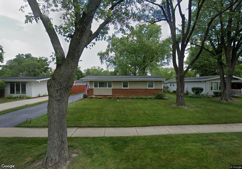
4000 Bluebird Ln Rolling Meadows, IL 60008
Estimated Value: $312,000 - $360,000
3
Beds
1
Bath
1,080
Sq Ft
$306/Sq Ft
Est. Value
About This Home
This home is located at 4000 Bluebird Ln, Rolling Meadows, IL 60008 and is currently estimated at $330,934, approximately $306 per square foot. 4000 Bluebird Ln is a home located in Cook County with nearby schools including Kimball Hill Elementary School, Carl Sandburg Junior High School, and Rolling Meadows High School.
Ownership History
Date
Name
Owned For
Owner Type
Purchase Details
Closed on
Jan 13, 2006
Sold by
Grothe Mark R and Grothe Theresa M
Bought by
Grothe Mark R
Current Estimated Value
Create a Home Valuation Report for This Property
The Home Valuation Report is an in-depth analysis detailing your home's value as well as a comparison with similar homes in the area
Home Values in the Area
Average Home Value in this Area
Purchase History
| Date | Buyer | Sale Price | Title Company |
|---|---|---|---|
| Grothe Mark R | -- | Multiple |
Source: Public Records
Tax History
| Year | Tax Paid | Tax Assessment Tax Assessment Total Assessment is a certain percentage of the fair market value that is determined by local assessors to be the total taxable value of land and additions on the property. | Land | Improvement |
|---|---|---|---|---|
| 2025 | $5,017 | $30,000 | $5,475 | $24,525 |
| 2024 | $5,017 | $23,000 | $4,633 | $18,367 |
| 2023 | $4,069 | $23,000 | $4,633 | $18,367 |
| 2022 | $4,069 | $23,000 | $4,633 | $18,367 |
| 2021 | $5,573 | $20,159 | $2,737 | $17,422 |
| 2020 | $5,516 | $20,159 | $2,737 | $17,422 |
| 2019 | $5,555 | $22,524 | $2,737 | $19,787 |
| 2018 | $5,665 | $20,925 | $2,526 | $18,399 |
| 2017 | $5,569 | $20,925 | $2,526 | $18,399 |
| 2016 | $5,447 | $20,925 | $2,526 | $18,399 |
| 2015 | $4,881 | $18,127 | $2,316 | $15,811 |
| 2014 | $4,782 | $18,127 | $2,316 | $15,811 |
| 2013 | $4,649 | $18,127 | $2,316 | $15,811 |
Source: Public Records
Map
Nearby Homes
- 2302 Fulle St
- 3712 Jay Ln
- 3605 Oriole Ln
- 1107 S Old Wilke Rd Unit 103
- 1107 S Old Wilke Rd Unit 208
- 1117 S Old Wilke Rd Unit 206
- 2201 Kingfisher Ln
- 1126 S New Wilke Rd Unit 307
- 2830 Northampton Dr Unit A1
- 2508 Algonquin Rd Unit 16
- 2709 Lily Ln
- 1227 S Old Wilke Rd Unit 306
- 3209 Trillium Cir
- 3200 Thrush Ln
- 2504 Algonquin Rd Unit 14
- 3306 Trillium Cir Unit 3001
- 837 S Dwyer Ave Unit A
- 1363 S Old Wilke Rd Unit 27
- 5000 Carriageway Dr Unit 305
- 5000 Carriageway Dr Unit 315
- 3904 Bluebird Ln
- 4002 Bluebird Ln
- 3902 Bluebird Ln
- 4004 Bluebird Ln
- 3809 Wren Ln
- 3811 Wren Ln
- 4001 Bluebird Ln
- 3807 Wren Ln
- 4006 Bluebird Ln
- 3815 Wren Ln
- 3905 Bluebird Ln
- 3806 Bluebird Ln
- 4008 Bluebird Ln
- 4003 Bluebird Ln
- 4005 Bluebird Ln
- 3817 Wren Ln
- 4007 Bluebird Ln
- 3803 Wren Ln
- 3907 Gull Ct
- 3804 Bluebird Ln
Your Personal Tour Guide
Ask me questions while you tour the home.