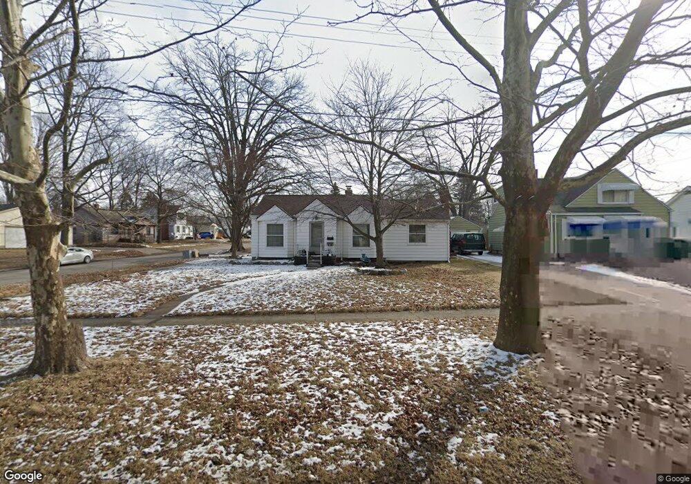
4001 Circle Dr Flint, MI 48507
Circle Drive NeighborhoodEstimated Value: $89,000 - $120,000
3
Beds
2
Baths
1,175
Sq Ft
$91/Sq Ft
Est. Value
About This Home
This home is located at 4001 Circle Dr, Flint, MI 48507 and is currently estimated at $107,384, approximately $91 per square foot. 4001 Circle Dr is a home located in Genesee County with nearby schools including Freeman Elementary School, Flint Southwestern Classical Academy, and Burton Glen Charter Academy.
Ownership History
Date
Name
Owned For
Owner Type
Purchase Details
Closed on
Jun 10, 2015
Sold by
Tagge Mark A and Citimortgage Inc
Bought by
Premier Investments Llc
Current Estimated Value
Purchase Details
Closed on
Feb 20, 2004
Sold by
Owens Kimberly and Owens John
Bought by
Tagge Mark Andrew
Purchase Details
Closed on
Jul 6, 1999
Sold by
M A Richardson Revocable Living Trust
Bought by
Huffman Kimberly
Create a Home Valuation Report for This Property
The Home Valuation Report is an in-depth analysis detailing your home's value as well as a comparison with similar homes in the area
Home Values in the Area
Average Home Value in this Area
Purchase History
| Date | Buyer | Sale Price | Title Company |
|---|---|---|---|
| Premier Investments Llc | $551 | Attorney | |
| Tagge Mark Andrew | $84,000 | Cislo Title Company | |
| Huffman Kimberly | $74,000 | Sargents Title Company Llc |
Source: Public Records
Tax History
| Year | Tax Paid | Tax Assessment Tax Assessment Total Assessment is a certain percentage of the fair market value that is determined by local assessors to be the total taxable value of land and additions on the property. | Land | Improvement |
|---|---|---|---|---|
| 2025 | $1,383 | $50,900 | $0 | $0 |
| 2024 | $1,275 | $45,100 | $0 | $0 |
| 2023 | $1,242 | $41,500 | $0 | $0 |
| 2022 | $0 | $34,000 | $0 | $0 |
| 2021 | $1,262 | $30,300 | $0 | $0 |
| 2020 | $1,155 | $24,200 | $0 | $0 |
| 2019 | $1,125 | $18,900 | $0 | $0 |
| 2018 | $1,127 | $16,600 | $0 | $0 |
| 2017 | $1,097 | $0 | $0 | $0 |
| 2016 | $1,089 | $0 | $0 | $0 |
| 2015 | -- | $0 | $0 | $0 |
| 2014 | -- | $0 | $0 | $0 |
| 2012 | -- | $17,100 | $0 | $0 |
Source: Public Records
Map
Nearby Homes
- 416 Burroughs Ave
- 4133 Custer Ave
- 4127 Custer Ave
- 621 Burroughs Ave
- 630 Buckingham Ave
- 4205 Red Arrow Rd
- 621 Lochhead Ave
- 361 Buckingham Ave
- 352 Buckingham Ave
- 326 Burroughs Ave
- 617 McKeighan Ave
- 530 McKeighan Ave
- 338 Browning Ave
- 818 Dell Ave
- 802 McKeighan Ave
- 3505 Comanche Ave
- 4526 Milton Dr
- 1111 Lochhead Ave
- 3115 Circle Dr
- 4424 Cheyenne Ave
- 4007 Circle Dr
- 514 Burroughs Ave
- 4011 Circle Dr
- 520 Burroughs Ave
- 3911 Circle Dr
- 515 Burroughs Ave
- 4017 Circle Dr
- 524 Burroughs Ave
- 4002 Circle Dr
- 4008 Circle Dr
- 511 Leta Ave
- 521 Burroughs Ave
- 4016 Circle Dr
- 4024 Circle Dr
- 3907 Circle Dr
- 515 Leta Ave
- 528 Burroughs Ave
- 3916 Circle Dr
- 525 Burroughs Ave
- 446 Burroughs Ave
Your Personal Tour Guide
Ask me questions while you tour the home.