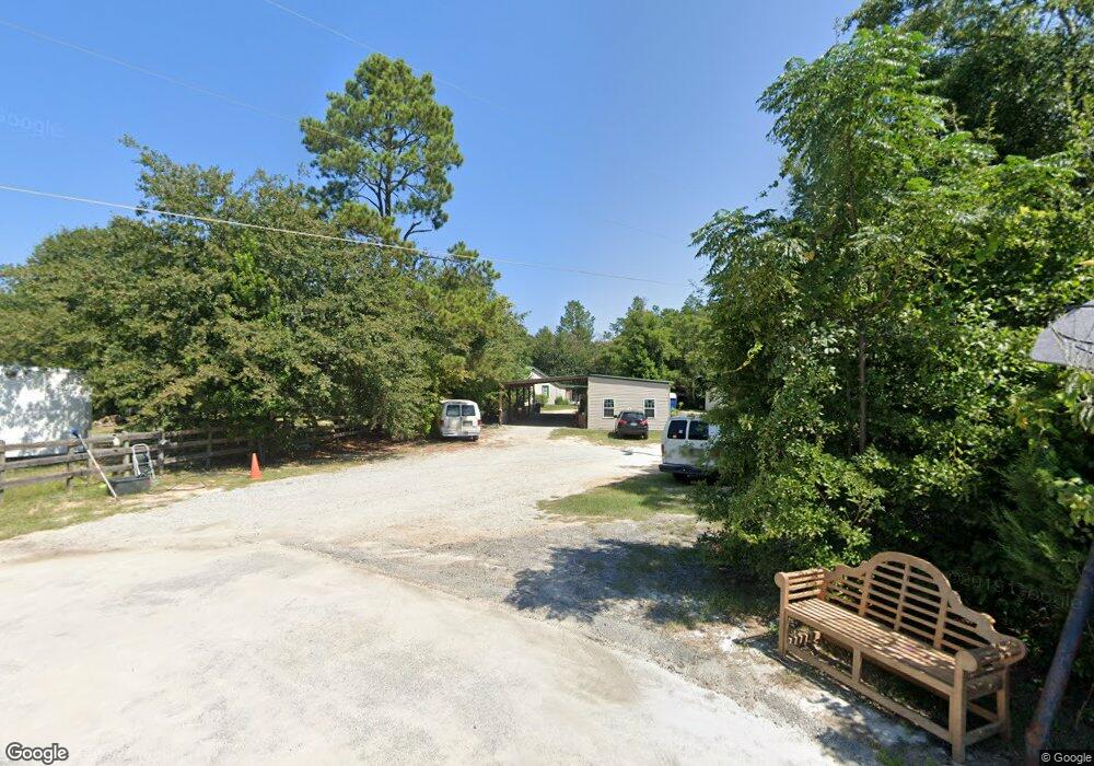
4001 Mcdaniel Rd Augusta, GA 30909
Estimated Value: $138,980 - $234,000
3
Beds
1
Bath
1,036
Sq Ft
$188/Sq Ft
Est. Value
About This Home
This home is located at 4001 Mcdaniel Rd, Augusta, GA 30909 and is currently estimated at $194,495, approximately $187 per square foot. 4001 Mcdaniel Rd is a home located in Columbia County with nearby schools including Brookwood Elementary School, Evans Middle School, and Evans High School.
Ownership History
Date
Name
Owned For
Owner Type
Purchase Details
Closed on
Apr 11, 2011
Sold by
White Charles
Bought by
Furlong James A
Current Estimated Value
Home Financials for this Owner
Home Financials are based on the most recent Mortgage that was taken out on this home.
Original Mortgage
$100,000
Interest Rate
4.85%
Mortgage Type
New Conventional
Create a Home Valuation Report for This Property
The Home Valuation Report is an in-depth analysis detailing your home's value as well as a comparison with similar homes in the area
Home Values in the Area
Average Home Value in this Area
Purchase History
| Date | Buyer | Sale Price | Title Company |
|---|---|---|---|
| Furlong James A | $145,000 | -- | |
| Furlong James A | $145,000 | -- |
Source: Public Records
Mortgage History
| Date | Status | Borrower | Loan Amount |
|---|---|---|---|
| Closed | Furlong James A | $100,000 | |
| Closed | Furlong James A | $45,000 | |
| Closed | Furlong James A | $100,000 |
Source: Public Records
Tax History
| Year | Tax Paid | Tax Assessment Tax Assessment Total Assessment is a certain percentage of the fair market value that is determined by local assessors to be the total taxable value of land and additions on the property. | Land | Improvement |
|---|---|---|---|---|
| 2025 | $897 | $37,619 | $19,022 | $18,597 |
| 2024 | $851 | $34,061 | $16,491 | $17,570 |
| 2023 | $851 | $31,408 | $12,834 | $18,574 |
| 2022 | $762 | $29,358 | $11,709 | $17,649 |
| 2021 | $716 | $26,339 | $11,147 | $15,192 |
| 2020 | $723 | $26,057 | $10,382 | $15,675 |
| 2019 | $670 | $24,141 | $10,382 | $13,759 |
| 2018 | $634 | $22,780 | $10,382 | $12,398 |
| 2017 | $628 | $22,461 | $10,107 | $12,354 |
| 2016 | $583 | $21,646 | $9,068 | $12,578 |
| 2015 | $525 | $19,448 | $9,068 | $10,380 |
| 2014 | $565 | $20,678 | $8,794 | $11,884 |
Source: Public Records
Map
Nearby Homes
- 3902 Maddox Rd
- 4413 Wrightsboro Rd
- 361 Paces Ferry Rd
- 704 Leela Ct
- 515 Scenic Dr
- 373 Forest Ct
- 591 Old Wheeler Rd
- 2924 Belwood Dr
- 4350 Quail Creek Rd
- 4367 Quail Creek Rd
- 302 Laurel Place
- 3812 Wrightsboro Rd
- 245 Kestwick Dr W
- 1447 Collins Dr
- 302 Summer Place
- 4130 Knollcrest Cir N
- 1729 Elizabeth St
- 211 Kestwick Dr W
- 2952 Bridgeport Dr
- 606 Todd Rd
- 4015 McDaniel Rd Augusta (3 of 3)
- 4011 Mcdaniel Rd
- 4008 Mcdaniel Rd
- 4010 Mcdaniel Rd
- 4015 Mcdaniel Rd
- 4332 Ridge Cliff Dr
- 4330 Ridge Cliff Dr
- 4334 Ridge Cliff Dr
- 4329 Ridge Cliff Dr
- 4336 Ridge Cliff Dr
- 4012 Mcdaniel Rd
- 4390 Ridge Valley Dr
- 4392 Ridge Valley Dr
- 504 Steepridge Ct
- 4331 Ridge Cliff Dr
- 3950 Buck Rd
- 506 Steepridge Ct
- 4338 Ridge Cliff Dr
- 1311 Community Park Rd
- 4388 Ridge Valley Dr
