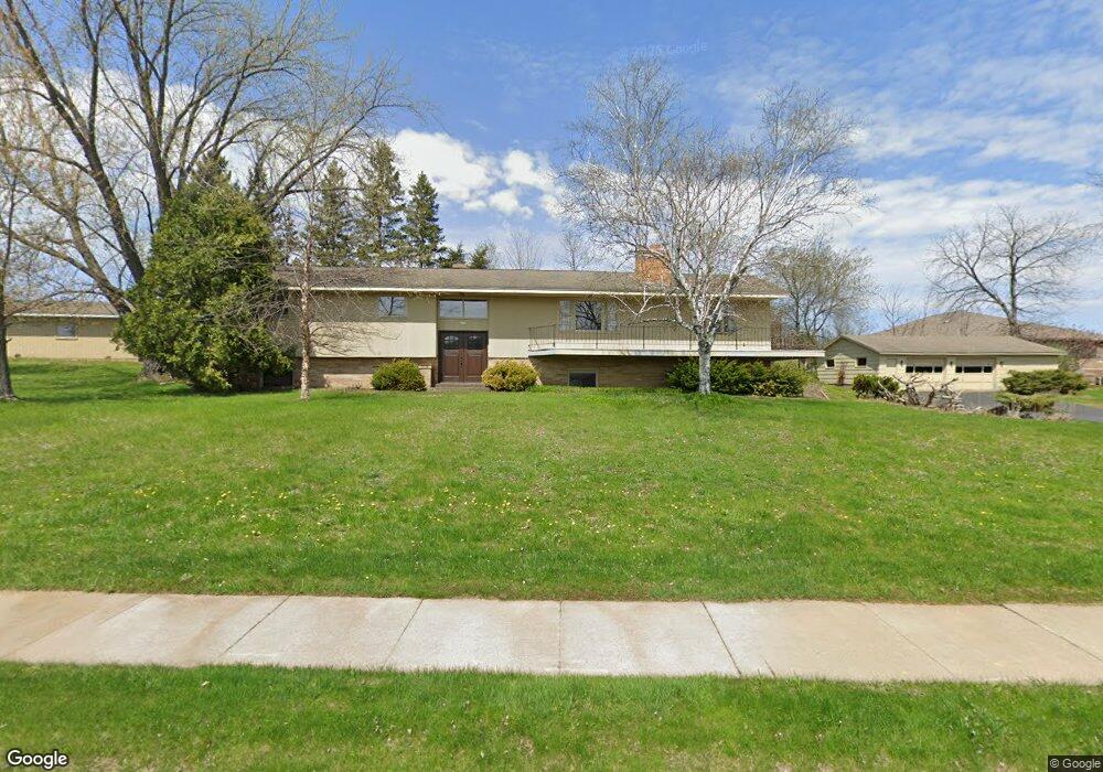
4002 Stewart Ave Wausau, WI 54401
Estimated Value: $283,000 - $400,000
4
Beds
3
Baths
1,832
Sq Ft
$187/Sq Ft
Est. Value
About This Home
This home is located at 4002 Stewart Ave, Wausau, WI 54401 and is currently estimated at $343,433, approximately $187 per square foot. 4002 Stewart Ave is a home located in Marathon County with nearby schools including Stettin Elementary School, John Muir Middle School, and West High School.
Ownership History
Date
Name
Owned For
Owner Type
Purchase Details
Closed on
Jun 7, 2013
Sold by
Marks Ronald
Bought by
Marks Roger and Glenetski Jonathon P
Current Estimated Value
Purchase Details
Closed on
Oct 18, 2011
Sold by
Marks Sherrie Mae
Bought by
Glenetski Jonathon P
Purchase Details
Closed on
Jul 9, 2007
Sold by
Marks Roger and Marks Ronald
Bought by
City Of Wausau
Purchase Details
Closed on
Feb 23, 2007
Sold by
Marks Roger
Bought by
Marks Roger and Marks Ronald
Create a Home Valuation Report for This Property
The Home Valuation Report is an in-depth analysis detailing your home's value as well as a comparison with similar homes in the area
Home Values in the Area
Average Home Value in this Area
Purchase History
| Date | Buyer | Sale Price | Title Company |
|---|---|---|---|
| Marks Roger | $60,000 | None Available | |
| Glenetski Jonathon P | $25,000 | None Available | |
| City Of Wausau | $9,700 | None Available | |
| Marks Roger | -- | None Available |
Source: Public Records
Tax History Compared to Growth
Tax History
| Year | Tax Paid | Tax Assessment Tax Assessment Total Assessment is a certain percentage of the fair market value that is determined by local assessors to be the total taxable value of land and additions on the property. | Land | Improvement |
|---|---|---|---|---|
| 2024 | $6,017 | $325,500 | $60,300 | $265,200 |
| 2023 | $4,490 | $189,800 | $54,600 | $135,200 |
| 2022 | $4,524 | $189,800 | $54,600 | $135,200 |
| 2021 | $4,357 | $189,800 | $54,600 | $135,200 |
| 2020 | $4,517 | $189,800 | $54,600 | $135,200 |
| 2019 | $4,136 | $164,200 | $43,200 | $121,000 |
| 2018 | $4,287 | $164,200 | $43,200 | $121,000 |
| 2017 | $4,003 | $164,200 | $43,200 | $121,000 |
| 2016 | $3,882 | $164,200 | $43,200 | $121,000 |
| 2015 | $4,125 | $164,200 | $43,200 | $121,000 |
| 2014 | $4,244 | $177,300 | $47,300 | $130,000 |
Source: Public Records
Map
Nearby Homes
- 310 Lisbeth Rd
- 210 S 45th Ave
- 206 N 44th Ave
- 4615 Rib River Trail
- 3401 Christian Ave
- 2812 Hubbill Ave
- 5713 Birchwood Dr
- 210 Bluestone Dr
- 2102 Wegner St
- 303 Rimrock Rd
- 2117 Sherman St
- 6007 Birchwood Dr
- 212 Windtree Dr
- 227815 Sharptail Rd
- 1708 Pardee St
- 6011 Stettin Dr
- 6603 Conner Davis Dr
- 6607 Morgan Creek Dr
- 213 N 17th Ave
- 931 S 14th Ave
- 00 Stettin Dr
- 4103 Stewart Ave
- 4108 Stewart Ave
- 600 S 39th Ave
- 4111 Stewart Ave
- 3820 Stewart Ave
- 510 S 39th Ave
- 601 S 39th Ave
- 517 S 39th Ave
- 4202 Stewart Ave
- 3808 Stewart Ave
- 502 S 39th Ave
- 4205 Stewart Ave
- 511 S 39th Ave
- 4300 Stewart Ave
- 418 S 39th Ave
- 505 S 39th Ave
- 3802 Stewart Ave
- 412 S 39th Ave
- 417 S 39th Ave