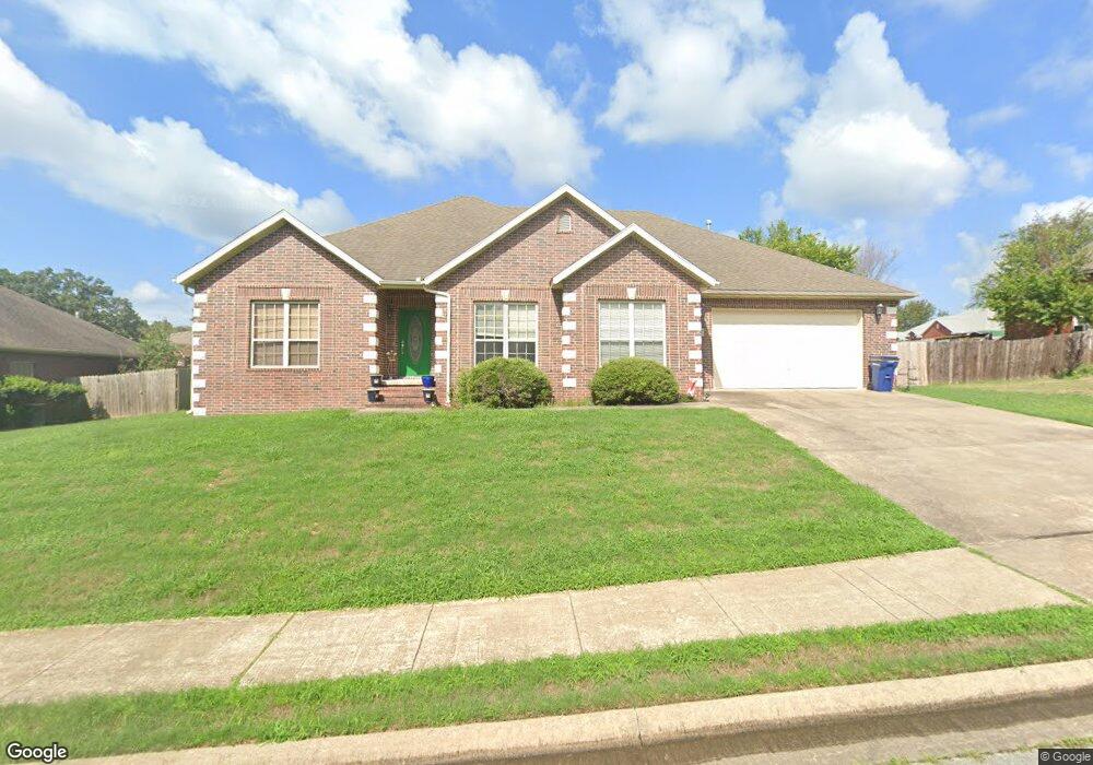
4005 Cortney Cir Siloam Springs, AR 72761
Estimated Value: $345,000 - $383,501
4
Beds
3
Baths
2,346
Sq Ft
$157/Sq Ft
Est. Value
About This Home
This home is located at 4005 Cortney Cir, Siloam Springs, AR 72761 and is currently estimated at $368,875, approximately $157 per square foot. 4005 Cortney Cir is a home located in Benton County with nearby schools including Northside Elementary School, Southside Elementary School, and Delbert Pete & Pat Allen Elementary School.
Ownership History
Date
Name
Owned For
Owner Type
Purchase Details
Closed on
Jun 14, 2024
Sold by
Atwater Weed N and Atwater Carmen
Bought by
Atwater Weed N and Atwater Carmen
Current Estimated Value
Purchase Details
Closed on
Jan 28, 2005
Sold by
Spainhower Enterprises Inc
Bought by
Weed N Dexter
Purchase Details
Closed on
Feb 19, 2004
Bought by
Spainhower
Create a Home Valuation Report for This Property
The Home Valuation Report is an in-depth analysis detailing your home's value as well as a comparison with similar homes in the area
Home Values in the Area
Average Home Value in this Area
Purchase History
| Date | Buyer | Sale Price | Title Company |
|---|---|---|---|
| Atwater Weed N | -- | None Listed On Document | |
| Weed N Dexter | $209,000 | Stewart Title Of Arkansas In | |
| Spainhower | $21,000 | -- |
Source: Public Records
Tax History Compared to Growth
Tax History
| Year | Tax Paid | Tax Assessment Tax Assessment Total Assessment is a certain percentage of the fair market value that is determined by local assessors to be the total taxable value of land and additions on the property. | Land | Improvement |
|---|---|---|---|---|
| 2025 | $2,526 | $74,767 | $8,400 | $66,367 |
| 2024 | $2,593 | $74,767 | $8,400 | $66,367 |
| 2023 | $2,593 | $48,340 | $7,200 | $41,140 |
| 2022 | $2,782 | $48,340 | $7,200 | $41,140 |
| 2021 | $2,584 | $48,340 | $7,200 | $41,140 |
| 2020 | $2,357 | $40,920 | $2,400 | $38,520 |
| 2019 | $2,357 | $40,920 | $2,400 | $38,520 |
| 2018 | $2,357 | $40,920 | $2,400 | $38,520 |
| 2017 | $2,237 | $40,920 | $2,400 | $38,520 |
| 2016 | $2,237 | $40,920 | $2,400 | $38,520 |
| 2015 | $2,033 | $35,300 | $2,600 | $32,700 |
| 2014 | $2,033 | $35,300 | $2,600 | $32,700 |
Source: Public Records
Map
Nearby Homes
- 2786 S Olive Ct
- 2711 Summitt Dr
- 2503 Chanel St
- 2210 E Fennec St
- 110 Cordes Dr
- 214 Lake Francis Dr
- 3214 S White Oak St
- 0000 Elm St S
- 3210 S Lincoln St
- 1413 E Emelyn Ln
- 3408 S Lincoln St
- 3902 Short Ln
- 0 S Mount Olive St
- 419 W Hannibal St
- 820 W Deer Lodge Ct
- 0 Tbd Hwy 412 W
- TBD W 412 Hwy
- 17900 Crestwood Dr
- 1218 E Kenwood St
- 412 W Kenwood St
- 4003 Cortney Cir
- 4007 Cortney Cir
- 0 Cortney Cir
- 2805 Cortney Cir
- 2707 Cammi Ct
- 4008 Cortney Cir
- 4009 Cortney Cir
- 4001 Cortney Cir
- 2807 Cortney Cir
- 2709 Cammi Ct
- 2705 Cammi Ct
- 4010 Cortney Cir
- 2803 Cortney Cir
- 2762 S Olive Ct
- 5003 Cortney Cir
- 5002 Cortney Cir
- Lot 46 Cammi Ct
- 3009 Cortney Cir
- 2748 S Olive Ct
- 2703 Cammi Ct