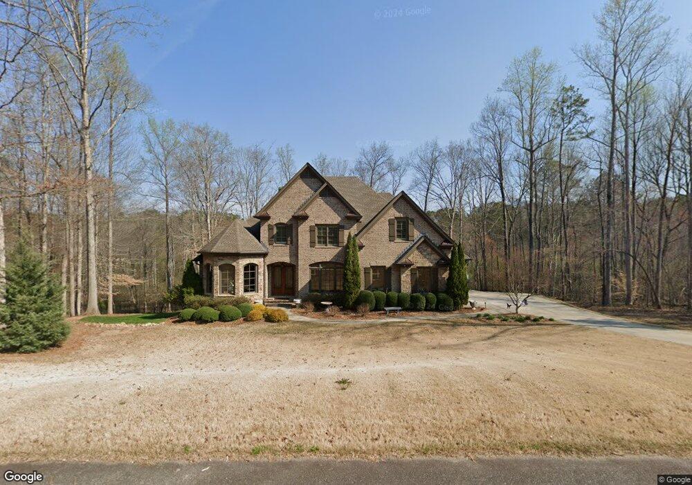
4005 Fouts Dr Unit 19 Cumming, GA 30028
Estimated Value: $1,267,000 - $1,529,000
5
Beds
6
Baths
5,035
Sq Ft
$287/Sq Ft
Est. Value
About This Home
This home is located at 4005 Fouts Dr Unit 19, Cumming, GA 30028 and is currently estimated at $1,446,994, approximately $287 per square foot. 4005 Fouts Dr Unit 19 is a home located in Forsyth County with nearby schools including Poole's Mill Elementary School, Liberty Middle School, and West Forsyth High School.
Ownership History
Date
Name
Owned For
Owner Type
Purchase Details
Closed on
Nov 26, 2018
Sold by
Bridges Timothy G
Bought by
Martin James W and Martin Dena J
Current Estimated Value
Purchase Details
Closed on
Oct 2, 2012
Sold by
Groover Family Llc
Bought by
Bridges Timothy G and Bridges Lisa W
Home Financials for this Owner
Home Financials are based on the most recent Mortgage that was taken out on this home.
Original Mortgage
$552,500
Interest Rate
3.58%
Mortgage Type
New Conventional
Create a Home Valuation Report for This Property
The Home Valuation Report is an in-depth analysis detailing your home's value as well as a comparison with similar homes in the area
Home Values in the Area
Average Home Value in this Area
Purchase History
| Date | Buyer | Sale Price | Title Company |
|---|---|---|---|
| Martin James W | $815,000 | -- | |
| Bridges Timothy G | $98,000 | -- |
Source: Public Records
Mortgage History
| Date | Status | Borrower | Loan Amount |
|---|---|---|---|
| Previous Owner | Bridges Timothy G | $552,500 |
Source: Public Records
Tax History Compared to Growth
Tax History
| Year | Tax Paid | Tax Assessment Tax Assessment Total Assessment is a certain percentage of the fair market value that is determined by local assessors to be the total taxable value of land and additions on the property. | Land | Improvement |
|---|---|---|---|---|
| 2025 | $2,819 | $566,396 | $75,980 | $490,416 |
| 2024 | $2,819 | $534,520 | $57,528 | $476,992 |
| 2023 | $2,727 | $502,360 | $59,696 | $442,664 |
| 2022 | $2,784 | $350,128 | $36,180 | $313,948 |
| 2021 | $2,709 | $350,128 | $36,180 | $313,948 |
| 2020 | $2,387 | $309,324 | $36,180 | $273,144 |
| 2019 | $2,432 | $313,440 | $58,692 | $254,748 |
| 2018 | $9,012 | $350,460 | $36,180 | $314,280 |
| 2017 | $8,467 | $323,028 | $36,180 | $286,848 |
| 2016 | $8,467 | $323,028 | $36,180 | $286,848 |
| 2015 | $8,241 | $311,600 | $38,592 | $273,008 |
| 2014 | $6,821 | $260,920 | $0 | $0 |
Source: Public Records
Map
Nearby Homes
- 4015 Fouts Dr
- 3970 Fouts Dr
- 2850 Willow Bend Dr
- 3505 Watson Rd
- 4435 Starwood Dr
- 4105 Vista Pointe Dr
- 3330 Carswell Bend
- 3220 Carswell Bend
- 4030 Bluff Creek Dr
- 3985 Starwood Dr
- 4430 Madison Hall Dr
- 3560 Daylon Dr
- 3475 Austin Michael Ln
- 3465 Austin Michael Ln
- Hedgewood Plan at Jason's Walk
- Rosalynn Plan at Jason's Walk
- Montadale Plan at Jason's Walk
- Peterson with Basement Plan at Jason's Walk
- Antoinette 3-Car Plan at Jason's Walk
- Antoinette 3-Car with Basement Plan at Jason's Walk
- 4005 Fouts Dr
- 4015 Fouts Dr Unit 18
- 3995 Fouts Dr
- 3990 Fouts Dr
- 4010 Fouts Dr Unit 16
- 4010 Fouts Dr
- 3985 Fouts Dr
- 4020 Fouts Dr
- 3975 Fouts Dr
- 3965 Fouts Dr Unit 23
- 3965 Fouts Dr
- 0 Fouts Dr Unit 3040269
- 0 Fouts Dr Unit 8405723
- 0 Fouts Dr Unit 8387186
- 0 Fouts Dr Unit 8953596
- 0 Fouts Dr Unit 8428087
- 0 Fouts Dr Unit 3256728
- 0 Fouts Dr Unit 7066509
- 0 Fouts Dr Unit 7245072
- 0 Fouts Dr Unit 7319372