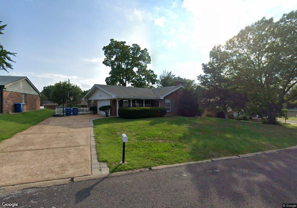
4006 High Aire Dr Saint Louis, MO 63125
Mehlville NeighborhoodEstimated Value: $266,000 - $303,000
3
Beds
2
Baths
1,482
Sq Ft
$194/Sq Ft
Est. Value
About This Home
This home is located at 4006 High Aire Dr, Saint Louis, MO 63125 and is currently estimated at $288,088, approximately $194 per square foot. 4006 High Aire Dr is a home located in St. Louis County with nearby schools including Bierbaum Elementary School, Margaret Buerkle Middle School, and Mehlville High School.
Ownership History
Date
Name
Owned For
Owner Type
Purchase Details
Closed on
Apr 15, 2025
Sold by
Rodenberg Living Trust and Rodenberg Mary Ann
Bought by
Rodenberg Marital Share One Trust and Rodenberg Family Share Two Trust
Current Estimated Value
Purchase Details
Closed on
Mar 17, 2008
Sold by
Wilson Evelyn V
Bought by
Rodenberg David and Rodenberg Mary Ann
Home Financials for this Owner
Home Financials are based on the most recent Mortgage that was taken out on this home.
Original Mortgage
$126,300
Interest Rate
5.67%
Mortgage Type
Purchase Money Mortgage
Purchase Details
Closed on
Dec 1, 1998
Sold by
Wilson Vernon J and Wilson Evelyn V
Bought by
Wilson Vernon J and Wilson Evelyn
Create a Home Valuation Report for This Property
The Home Valuation Report is an in-depth analysis detailing your home's value as well as a comparison with similar homes in the area
Home Values in the Area
Average Home Value in this Area
Purchase History
| Date | Buyer | Sale Price | Title Company |
|---|---|---|---|
| Rodenberg Marital Share One Trust | -- | None Listed On Document | |
| Rodenberg David | $157,900 | Sec | |
| Wilson Vernon J | -- | -- |
Source: Public Records
Mortgage History
| Date | Status | Borrower | Loan Amount |
|---|---|---|---|
| Previous Owner | Rodenberg David | $126,300 |
Source: Public Records
Tax History Compared to Growth
Tax History
| Year | Tax Paid | Tax Assessment Tax Assessment Total Assessment is a certain percentage of the fair market value that is determined by local assessors to be the total taxable value of land and additions on the property. | Land | Improvement |
|---|---|---|---|---|
| 2025 | $2,984 | $51,560 | $15,710 | $35,850 |
| 2024 | $2,984 | $43,960 | $9,420 | $34,540 |
| 2023 | $2,984 | $43,960 | $9,420 | $34,540 |
| 2022 | $2,901 | $40,200 | $10,220 | $29,980 |
| 2021 | $2,574 | $40,200 | $10,220 | $29,980 |
| 2020 | $2,291 | $33,990 | $9,420 | $24,570 |
| 2019 | $2,284 | $33,990 | $9,420 | $24,570 |
| 2018 | $2,086 | $27,990 | $6,820 | $21,170 |
| 2017 | $2,083 | $27,990 | $6,820 | $21,170 |
| 2016 | $2,040 | $26,300 | $5,870 | $20,430 |
| 2015 | $1,913 | $26,300 | $5,870 | $20,430 |
| 2014 | $1,947 | $26,510 | $4,450 | $22,060 |
Source: Public Records
Map
Nearby Homes
- 3655 Colonia Place Dr Unit C
- 3808 Southern Manor Dr
- 3656 Colonia Place Dr Unit C
- 3301 Avenue H
- 3707 Cordes Dr
- 4110 Lois Ln
- 4124 Lois Ln
- 2959 Annunciation Dr
- 3618 Tracey Rich Rd Unit 1B
- 1117 Hawkstone Ln
- 2511 Senator Ct Unit B
- 9201 Cedarberry Ct
- 1227 Coronation Dr
- 4318 Sunridge Dr Unit C
- 2444 Via Miralesta Dr
- 2414 Via Miralesta Dr
- 11074 Kohrs Ln
- 2337 Birch Dr
- 2325 Pecan Dr
- 4146 Crescent Dr
- 4000 High Aire Dr
- 4014 High Aire Dr
- 4011 Northern Aire Dr
- 4017 Northern Aire Dr
- 4007 High Aire Dr
- 3926 High Aire Dr
- 4001 High Aire Dr
- 4024 High Aire Dr
- 4011 High Aire Dr
- 4015 High Aire Dr
- 3927 High Aire Dr
- 3931 Northern Aire Dr
- 3918 High Aire Dr
- 4019 High Aire Dr
- 4014 Southern Aire Dr
- 4008 Southern Aire Dr
- 4016 Northern Aire Dr
- 4010 Northern Aire Dr
- 4020 Southern Aire Dr
- 4023 High Aire Dr