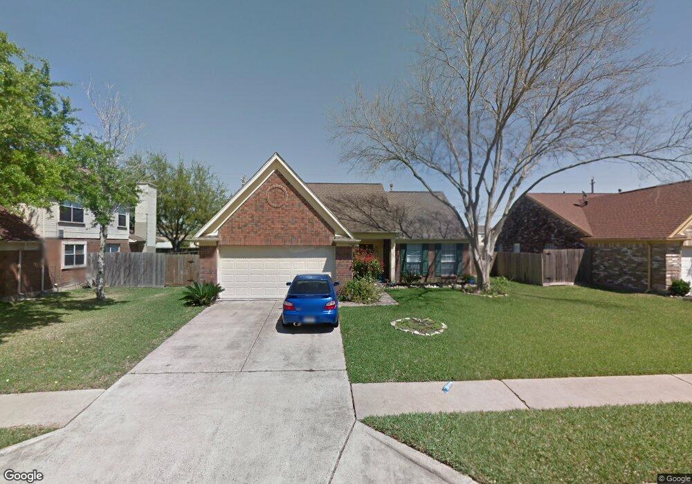
4007 Ashwood Dr Pearland, TX 77584
Estimated Value: $265,450 - $296,000
--
Bed
2
Baths
1,556
Sq Ft
$182/Sq Ft
Est. Value
About This Home
This home is located at 4007 Ashwood Dr, Pearland, TX 77584 and is currently estimated at $283,113, approximately $181 per square foot. 4007 Ashwood Dr is a home located in Brazoria County with nearby schools including Magnolia Elementary School, Pearland Junior High School South, and Sam Jamison Middle School.
Ownership History
Date
Name
Owned For
Owner Type
Purchase Details
Closed on
Apr 24, 2019
Sold by
Frenzel Douglas P and Frenzel Majorie
Bought by
Vincent Dustin and Hunter Briana
Current Estimated Value
Home Financials for this Owner
Home Financials are based on the most recent Mortgage that was taken out on this home.
Original Mortgage
$171,731
Outstanding Balance
$150,829
Interest Rate
4.25%
Mortgage Type
FHA
Estimated Equity
$132,284
Purchase Details
Closed on
Jan 3, 2013
Sold by
Frenzel Douglas P and George Sharrow
Bought by
Frenzel Douglas P and Frenzel Marjorie
Home Financials for this Owner
Home Financials are based on the most recent Mortgage that was taken out on this home.
Original Mortgage
$117,826
Interest Rate
3.25%
Mortgage Type
FHA
Purchase Details
Closed on
Jan 10, 2002
Sold by
Frenzel Dorothy P
Bought by
Frenzel Douglas P
Create a Home Valuation Report for This Property
The Home Valuation Report is an in-depth analysis detailing your home's value as well as a comparison with similar homes in the area
Home Values in the Area
Average Home Value in this Area
Purchase History
| Date | Buyer | Sale Price | Title Company |
|---|---|---|---|
| Vincent Dustin | -- | Great American Title Company | |
| Frenzel Douglas P | -- | Southland Title Llc | |
| Frenzel Douglas P | -- | -- |
Source: Public Records
Mortgage History
| Date | Status | Borrower | Loan Amount |
|---|---|---|---|
| Open | Vincent Dustin | $171,731 | |
| Previous Owner | Frenzel Douglas P | $117,826 |
Source: Public Records
Tax History Compared to Growth
Tax History
| Year | Tax Paid | Tax Assessment Tax Assessment Total Assessment is a certain percentage of the fair market value that is determined by local assessors to be the total taxable value of land and additions on the property. | Land | Improvement |
|---|---|---|---|---|
| 2025 | $4,324 | $251,110 | $28,670 | $222,440 |
| 2023 | $4,324 | $247,180 | $28,670 | $218,510 |
| 2022 | $5,358 | $222,740 | $26,460 | $196,280 |
| 2021 | $5,117 | $198,620 | $26,460 | $172,160 |
| 2020 | $5,079 | $188,240 | $22,050 | $166,190 |
| 2019 | $4,429 | $164,110 | $22,050 | $142,060 |
| 2018 | $4,235 | $157,630 | $22,050 | $135,580 |
| 2017 | $4,180 | $161,960 | $22,050 | $139,910 |
| 2016 | $3,800 | $159,220 | $22,050 | $137,170 |
| 2015 | $3,048 | $127,940 | $22,050 | $105,890 |
| 2014 | $3,048 | $124,360 | $22,050 | $102,310 |
Source: Public Records
Map
Nearby Homes
- 3804 Parry Fields Ct
- 4015 Cedarwood Dr
- 3806 Canterbury Park Dr
- 3705 Canterbury Park Dr
- 3703 Canterbury Park Dr
- 3910 Greenwood Dr
- 4013 Ivywood Dr
- 4806 Chaperel Dr
- 3911 Spring Garden Dr
- 3509 Pentland Downs St
- 16622 Mclean Rd
- 3307 Norma Ln
- 5101 Big Spring Dr
- 16719 Mclean Rd
- 5205 Spring Branch Dr
- 7206 Williams Rd
- 4967 Millican Dr
- 7223 Libby Ln
- 7225 Libby Ln
- 4004 Green Anjou Ln
- 4005 Ashwood Dr
- 4009 Ashwood Dr
- 4003 Ashwood Dr
- 4011 Ashwood Dr
- 4008 Ashwood Dr
- 4006 Ashwood Dr
- 4004 Ashwood Dr
- 4001 Ashwood Dr
- 4012 Ashwood Dr
- 4007 Beechwood Dr
- 4002 Ashwood Dr
- 4005 Beechwood Dr
- 4009 Beechwood Dr
- 4013 Ashwood Dr
- 4015 Ashwood Dr
- 4014 Ashwood Dr
- 4003 Beechwood Dr
- 4016 Ashwood Dr
- 3806 Parry Field Ct
- 3808 Parry Field Ct