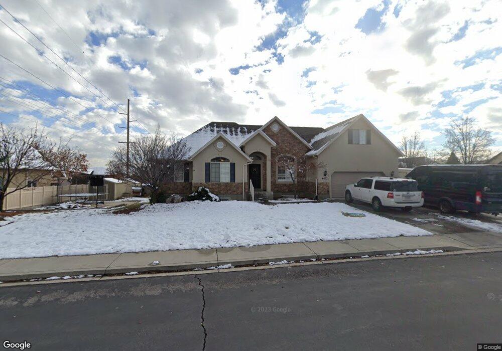
4007 W Honeylocust Ln Pleasant Grove, UT 84062
Estimated Value: $668,000 - $775,000
4
Beds
3
Baths
3,681
Sq Ft
$197/Sq Ft
Est. Value
About This Home
This home is located at 4007 W Honeylocust Ln, Pleasant Grove, UT 84062 and is currently estimated at $725,540, approximately $197 per square foot. 4007 W Honeylocust Ln is a home located in Utah County with nearby schools including Cedar Ridge Elementary School, Mountain Ridge Junior High School, and Lone Peak High School.
Ownership History
Date
Name
Owned For
Owner Type
Purchase Details
Closed on
Jun 1, 2016
Sold by
Fisher Geoffrey T and Fisher Jennifer S
Bought by
Fisher Thomas and Fisher Jennifer S
Current Estimated Value
Home Financials for this Owner
Home Financials are based on the most recent Mortgage that was taken out on this home.
Original Mortgage
$306,305
Outstanding Balance
$244,181
Interest Rate
3.62%
Mortgage Type
FHA
Estimated Equity
$481,359
Purchase Details
Closed on
Feb 16, 2005
Sold by
Patriot Homes Inc
Bought by
Fisher Geoffrey T and Fisher Jennifer S
Home Financials for this Owner
Home Financials are based on the most recent Mortgage that was taken out on this home.
Original Mortgage
$41,355
Interest Rate
5.66%
Mortgage Type
Stand Alone Second
Create a Home Valuation Report for This Property
The Home Valuation Report is an in-depth analysis detailing your home's value as well as a comparison with similar homes in the area
Home Values in the Area
Average Home Value in this Area
Purchase History
| Date | Buyer | Sale Price | Title Company |
|---|---|---|---|
| Fisher Thomas | -- | Cottonwood Title Ins Agency | |
| Fisher Geoffrey T | -- | Affiliated First Title Comp |
Source: Public Records
Mortgage History
| Date | Status | Borrower | Loan Amount |
|---|---|---|---|
| Open | Fisher Thomas | $306,305 | |
| Closed | Fisher Geoffrey T | $41,355 |
Source: Public Records
Tax History Compared to Growth
Tax History
| Year | Tax Paid | Tax Assessment Tax Assessment Total Assessment is a certain percentage of the fair market value that is determined by local assessors to be the total taxable value of land and additions on the property. | Land | Improvement |
|---|---|---|---|---|
| 2025 | $2,855 | $366,520 | $317,600 | $348,800 |
| 2024 | $2,855 | $338,140 | $0 | $0 |
| 2023 | $2,625 | $333,960 | $0 | $0 |
| 2022 | $2,999 | $372,790 | $0 | $0 |
| 2021 | $2,694 | $498,800 | $206,600 | $292,200 |
| 2020 | $2,503 | $452,200 | $191,300 | $260,900 |
| 2019 | $2,168 | $406,700 | $179,800 | $226,900 |
| 2018 | $2,133 | $377,100 | $179,800 | $197,300 |
| 2017 | $2,071 | $195,745 | $0 | $0 |
| 2016 | $2,227 | $195,745 | $0 | $0 |
| 2015 | $2,353 | $195,745 | $0 | $0 |
| 2014 | $2,063 | $170,500 | $0 | $0 |
Source: Public Records
Map
Nearby Homes
- 10412 N Bayhill Dr
- 10358 N Tamarack Way
- 4292 W Joshua Ln
- 10587 N Avalon St
- 4198 W Sage Rd N
- 10514 N Doral Dr
- 10456 N Morgan Blvd
- 4083 W Hayes Cir
- 10207 N Cottonwood Dr
- 10448 Sage Vista Ln
- 10468 N Sage Vista Ln
- 3870 Mountaintop Cir
- 4084 W Shinnecock
- 3851 W Mountaintop Cir Unit 5
- 10795 N La Costa
- 9900 N Meadow Dr
- 4616 W Carriage Ln
- 4124 N 810 W
- 9752 N Dorchester Dr
- 10052 N Marigold Ln
- 10318 N Bristlecone Way Unit 34
- 10318 N Bristlecone Way
- 10318 Bristlecone Way
- 4035 Honey Locust Ln Unit 58
- 4061 Honey Locust Ln Unit 56B
- 3957 W 10300 N
- 3957 W 10300 N Unit 13
- 4012 Honeylocust Ln
- 10329 Bristlecone Way
- 10329 N Bristlecone Way
- 3946 W 10300 N
- 3946 W 10300 N Unit 14
- 10304 N Bristlecone Way
- 10304 N Bristlecone Way
- 3957 W 10340 N
- 10315 Bristlecone Way
- 10315 Bristlecone Way Unit 59
- 4038 Honeylocust Ln
- 10316 Bristlecone Way Unit 33
- 10358 Bristlecone Way Unit 32