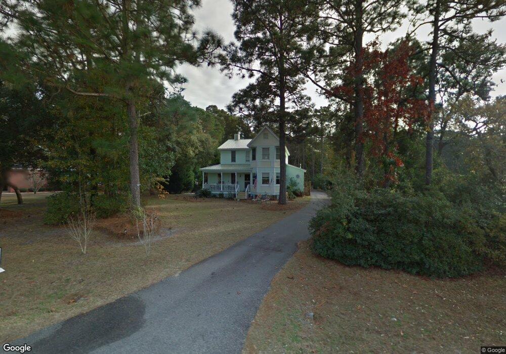
4009 Robert Ruark Dr Southport, NC 28461
Estimated Value: $464,782 - $581,000
3
Beds
3
Baths
2,028
Sq Ft
$256/Sq Ft
Est. Value
About This Home
This home is located at 4009 Robert Ruark Dr, Southport, NC 28461 and is currently estimated at $518,196, approximately $255 per square foot. 4009 Robert Ruark Dr is a home located in Brunswick County with nearby schools including Southport Elementary School, South Brunswick Middle School, and South Brunswick High School.
Ownership History
Date
Name
Owned For
Owner Type
Purchase Details
Closed on
Jun 9, 2005
Sold by
Andrews Clay and Andrews Gia
Bought by
Boyle Virginia and Boyle Kevin A
Current Estimated Value
Home Financials for this Owner
Home Financials are based on the most recent Mortgage that was taken out on this home.
Original Mortgage
$208,000
Outstanding Balance
$108,731
Interest Rate
5.88%
Mortgage Type
New Conventional
Estimated Equity
$409,465
Purchase Details
Closed on
Apr 28, 2005
Sold by
Boyle Kevin and Boyle Virginia
Bought by
Mcintyre James P and Mcintyre Jennifer L
Home Financials for this Owner
Home Financials are based on the most recent Mortgage that was taken out on this home.
Original Mortgage
$208,000
Outstanding Balance
$108,731
Interest Rate
5.88%
Mortgage Type
New Conventional
Estimated Equity
$409,465
Create a Home Valuation Report for This Property
The Home Valuation Report is an in-depth analysis detailing your home's value as well as a comparison with similar homes in the area
Home Values in the Area
Average Home Value in this Area
Purchase History
| Date | Buyer | Sale Price | Title Company |
|---|---|---|---|
| Boyle Virginia | $48,000 | None Available | |
| Mcintyre James P | $260,000 | None Available |
Source: Public Records
Mortgage History
| Date | Status | Borrower | Loan Amount |
|---|---|---|---|
| Open | Mcintyre James P | $208,000 |
Source: Public Records
Tax History Compared to Growth
Tax History
| Year | Tax Paid | Tax Assessment Tax Assessment Total Assessment is a certain percentage of the fair market value that is determined by local assessors to be the total taxable value of land and additions on the property. | Land | Improvement |
|---|---|---|---|---|
| 2025 | $1,678 | $334,550 | $84,000 | $250,550 |
| 2024 | $1,678 | $334,550 | $84,000 | $250,550 |
| 2023 | $1,652 | $334,550 | $84,000 | $250,550 |
| 2022 | $1,652 | $238,510 | $60,000 | $178,510 |
| 2021 | $1,527 | $238,510 | $60,000 | $178,510 |
| 2020 | $1,527 | $238,510 | $60,000 | $178,510 |
| 2019 | $1,527 | $72,130 | $60,000 | $12,130 |
| 2018 | $1,451 | $73,000 | $60,000 | $13,000 |
| 2017 | $1,426 | $73,000 | $60,000 | $13,000 |
| 2016 | $1,376 | $73,000 | $60,000 | $13,000 |
| 2015 | $1,376 | $223,910 | $60,000 | $163,910 |
| 2014 | $1,317 | $231,404 | $70,000 | $161,404 |
Source: Public Records
Map
Nearby Homes
- 5003 Robert Ruark Dr
- 2343 Crescent Bay Dr
- 3006 Robert Ruark Dr
- 2339 Crescent Bay Dr
- 2020 Robert Ruark Dr
- 2002 Petes Camp Dr
- 2000 Bonner Bussells Dr
- 1121 Mallard Pointe Ln
- 2293 Crescent Bay Dr
- 2308 Crescent Bay Dr
- Ellsworth Plan at Osprey Landing - Signature
- Marshall Plan at Osprey Landing - Signature
- Hadley Plan at Osprey Landing - Village
- Ashton Plan at Osprey Landing - Signature
- Ansley Plan at Osprey Landing - Signature
- Finley Plan at Osprey Landing - Signature
- Lanai Plan at Osprey Landing - Signature
- Scout Plan at Osprey Landing - Signature
- Hanover Plan at Osprey Landing - Village
- Wayside Plan at Osprey Landing - Village
- 4007 Robert Ruark Dr
- 4011 Robert Ruark Dr
- 4008 Robert Ruark Dr
- 4003 Robert Ruark Dr
- 1001 Fairley St
- 4004 Robert Ruark Dr
- 4014 Robert Ruark Dr SE
- 1003 Fairley St
- 4000 Robert Ruark Dr
- 3012 Robert Ruark Dr SE
- 1000 Bonner Bussells Dr
- 3012 Robert Ruark Dr
- 4016 Robert Ruark Dr
- 1000 Fairley St
- 1002 Fairley St
- 5007 Robert Ruark Dr
- 1000 Newton Dr
- 1004 Fairley St
- 1002 Newton Dr
- 998 Petes Camp Dr