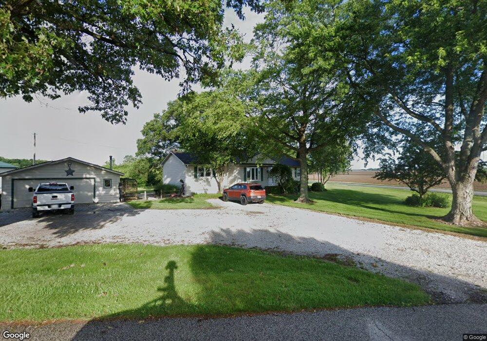
4009 S 300 E La Porte, IN 46350
Estimated Value: $270,680 - $332,000
3
Beds
2
Baths
1,360
Sq Ft
$218/Sq Ft
Est. Value
About This Home
This home is located at 4009 S 300 E, La Porte, IN 46350 and is currently estimated at $296,670, approximately $218 per square foot. 4009 S 300 E is a home located in LaPorte County with nearby schools including Kingsbury Elementary School, La Porte High School, and Dunkerton High School.
Ownership History
Date
Name
Owned For
Owner Type
Purchase Details
Closed on
Feb 11, 2010
Sold by
Hart John and Hart Georganna
Bought by
Cincoski Daniel M
Current Estimated Value
Home Financials for this Owner
Home Financials are based on the most recent Mortgage that was taken out on this home.
Original Mortgage
$137,750
Outstanding Balance
$91,531
Interest Rate
5.11%
Mortgage Type
New Conventional
Estimated Equity
$205,139
Purchase Details
Closed on
Jan 31, 2008
Sold by
The Bank Of New York Trust Co Na
Bought by
Hart John and Hart Georganna
Purchase Details
Closed on
Mar 14, 2007
Sold by
Kreighbaum Scott E and Kreighbaum Angela M
Bought by
The Bank Of New York Trust Co Na and Jpmorgan Chase Bank Na
Create a Home Valuation Report for This Property
The Home Valuation Report is an in-depth analysis detailing your home's value as well as a comparison with similar homes in the area
Home Values in the Area
Average Home Value in this Area
Purchase History
| Date | Buyer | Sale Price | Title Company |
|---|---|---|---|
| Cincoski Daniel M | -- | Meridian Title Corp | |
| Hart John | -- | Investors Titlecorp | |
| The Bank Of New York Trust Co Na | $100,725 | None Available |
Source: Public Records
Mortgage History
| Date | Status | Borrower | Loan Amount |
|---|---|---|---|
| Open | Cincoski Daniel M | $137,750 |
Source: Public Records
Tax History Compared to Growth
Tax History
| Year | Tax Paid | Tax Assessment Tax Assessment Total Assessment is a certain percentage of the fair market value that is determined by local assessors to be the total taxable value of land and additions on the property. | Land | Improvement |
|---|---|---|---|---|
| 2024 | $1,619 | $182,300 | $30,000 | $152,300 |
| 2022 | $1,874 | $174,800 | $30,000 | $144,800 |
| 2021 | $1,179 | $137,400 | $30,000 | $107,400 |
| 2020 | $1,241 | $137,400 | $30,000 | $107,400 |
| 2019 | $1,168 | $133,800 | $21,100 | $112,700 |
| 2018 | $1,213 | $135,900 | $21,100 | $114,800 |
| 2017 | $1,059 | $127,700 | $21,100 | $106,600 |
| 2016 | $1,197 | $142,800 | $30,000 | $112,800 |
| 2014 | $1,147 | $139,700 | $21,100 | $118,600 |
Source: Public Records
Map
Nearby Homes
- 2208 E 450 S
- 3466 S State Road 104
- 0 E State Road 4
- 3961 State Road 104
- 64 Green Lawn Dr
- Lot 16 S Morgan Rd
- Lot 37 S Morgan Rd
- Lot 17 S Morgan Rd
- 0 Pinoak Dr
- 307 N Main St
- 7808 S 1st Line Rd
- 0 E Aspen Ln
- 6152 E State Road 4
- 0 W 500 S
- 242 W Powell Dr
- 1168 E State Road 4
- 0 Oakwood Dr Unit NRA812783
- 577 W Nowak Dr
- 40 W Nowak Dr
- 41 W Nowak Dr