Estimated Value: $346,114 - $392,000
--
Bed
--
Bath
2,552
Sq Ft
$146/Sq Ft
Est. Value
About This Home
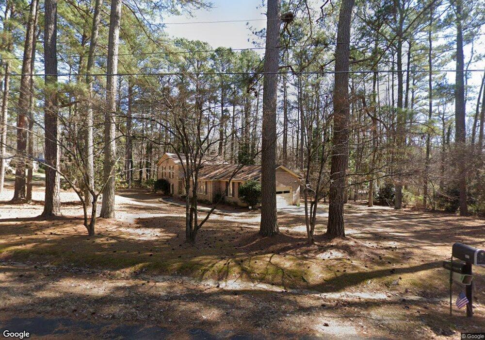
This home is located at 401 Bratton Ave, York, SC 29745 and is currently estimated at $373,029, approximately $146 per square foot. 401 Bratton Ave is a home located in York County with nearby schools including Jefferson Elementary School, York Intermediate School, and York Middle School.
Ownership History
Date
Name
Owned For
Owner Type
Purchase Details
Closed on
Jun 30, 2022
Sold by
Hamblin Stephenson Martha
Bought by
Stephenson Clinton L
Current Estimated Value
Purchase Details
Closed on
May 23, 2012
Sold by
Estate Of Franklin D Stewart
Bought by
Stewart Lorraine C
Home Financials for this Owner
Home Financials are based on the most recent Mortgage that was taken out on this home.
Original Mortgage
$162,858
Interest Rate
4.01%
Mortgage Type
New Conventional
Create a Home Valuation Report for This Property
The Home Valuation Report is an in-depth analysis detailing your home's value as well as a comparison with similar homes in the area
Home Values in the Area
Average Home Value in this Area
Purchase History
| Date | Buyer | Sale Price | Title Company |
|---|---|---|---|
| Stephenson Clinton L | -- | None Listed On Document | |
| Stewart Lorraine C | -- | -- | |
| Stewart Lorraine C | -- | -- |
Source: Public Records
Mortgage History
| Date | Status | Borrower | Loan Amount |
|---|---|---|---|
| Previous Owner | Stewart Lorraine C | $162,858 |
Source: Public Records
Tax History Compared to Growth
Tax History
| Year | Tax Paid | Tax Assessment Tax Assessment Total Assessment is a certain percentage of the fair market value that is determined by local assessors to be the total taxable value of land and additions on the property. | Land | Improvement |
|---|---|---|---|---|
| 2024 | $1,696 | $8,280 | $1,287 | $6,993 |
| 2023 | $1,719 | $8,280 | $1,287 | $6,993 |
| 2022 | $1,728 | $8,280 | $1,287 | $6,993 |
| 2021 | -- | $8,280 | $1,287 | $6,993 |
| 2020 | $1,705 | $8,280 | $0 | $0 |
| 2019 | $1,519 | $7,200 | $0 | $0 |
| 2018 | $1,486 | $7,200 | $0 | $0 |
| 2017 | $1,404 | $7,200 | $0 | $0 |
| 2016 | $1,394 | $7,200 | $0 | $0 |
| 2014 | $1,492 | $7,200 | $1,440 | $5,760 |
| 2013 | $1,492 | $7,840 | $1,440 | $6,400 |
Source: Public Records
Map
Nearby Homes
- 401 Lakeview Dr
- 27 Southbrook Dr
- 31 Southbrook Dr
- 306 Oak St Unit 18
- 121 Settlemyre Place
- 2038 Crooked Oak Ln Unit 16
- 2024 Crooked Oak Ln
- 133 Hickory Ln
- 223 Wiley Ave
- Millbrook Plan at McFarland Estates
- Bellwood Plan at McFarland Estates
- Morganton Plan at McFarland Estates
- 459 Brick House Rd
- Hamilton Plan at McFarland Estates
- 473 Brick House Rd
- 462 Brick House Rd Unit 123
- Belair II Plan at McFarland Estates
- Liberty Plan at McFarland Estates
- 177 Ella Claire Dr
- 194 Ella Claire Dr
- 118 Benfield Ave
- 403 Bratton Ave
- 406 Lakeview Dr
- 503 Lakeview Dr
- 402 Bratton Ave
- 405 Bratton Ave
- 206 Bratton Ave
- 211 Bratton Ave
- 407 Bratton Ave
- 204 Bratton Ave
- 112 Benfield Ave
- 404 Lakeview Dr
- 403 Lakeview Dr
- 403 Forest Dr
- 202 Bratton Ave
- 405 Forest Dr
- 110 Benfield Ave
- 400 Lakeview Dr
- 205 Bratton Ave
- 408 Forest Dr