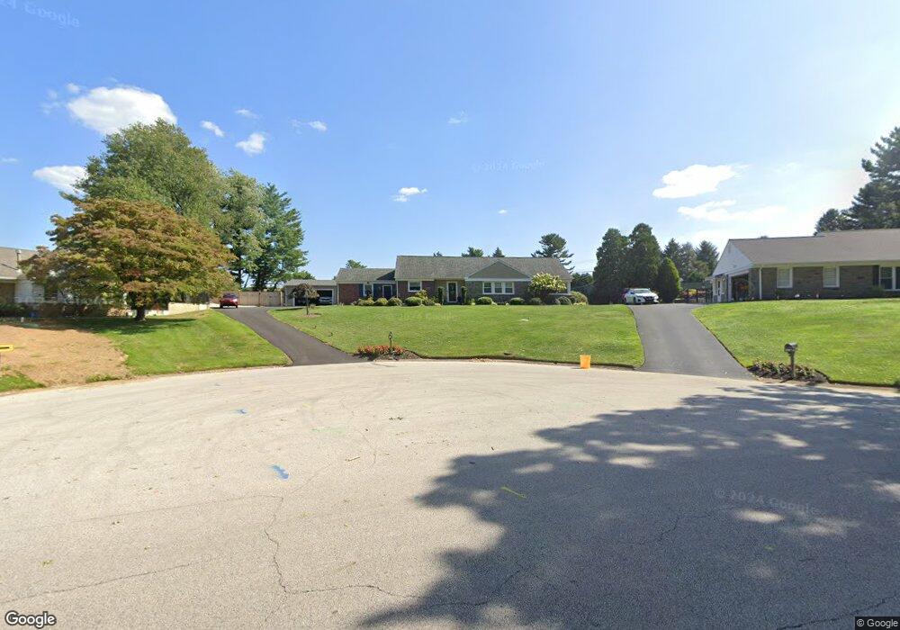
401 Collins Dr Springfield, PA 19064
Estimated Value: $611,000 - $724,000
3
Beds
2
Baths
2,462
Sq Ft
$263/Sq Ft
Est. Value
About This Home
This home is located at 401 Collins Dr, Springfield, PA 19064 and is currently estimated at $648,103, approximately $263 per square foot. 401 Collins Dr is a home located in Delaware County with nearby schools including Springfield High School, St Francis Of Assisi School, and The Walden School.
Ownership History
Date
Name
Owned For
Owner Type
Purchase Details
Closed on
Sep 15, 2009
Sold by
Caccuitti Irene and Caccuitti John G
Bought by
Ray Eugene F and Ray Stacey F
Current Estimated Value
Home Financials for this Owner
Home Financials are based on the most recent Mortgage that was taken out on this home.
Original Mortgage
$301,500
Outstanding Balance
$198,079
Interest Rate
5.28%
Mortgage Type
New Conventional
Estimated Equity
$450,024
Create a Home Valuation Report for This Property
The Home Valuation Report is an in-depth analysis detailing your home's value as well as a comparison with similar homes in the area
Home Values in the Area
Average Home Value in this Area
Purchase History
| Date | Buyer | Sale Price | Title Company |
|---|---|---|---|
| Ray Eugene F | $335,000 | None Available |
Source: Public Records
Mortgage History
| Date | Status | Borrower | Loan Amount |
|---|---|---|---|
| Open | Ray Eugene F | $301,500 |
Source: Public Records
Tax History
| Year | Tax Paid | Tax Assessment Tax Assessment Total Assessment is a certain percentage of the fair market value that is determined by local assessors to be the total taxable value of land and additions on the property. | Land | Improvement |
|---|---|---|---|---|
| 2025 | $10,450 | $379,530 | $146,980 | $232,550 |
| 2024 | $10,450 | $371,790 | $146,980 | $224,810 |
| 2023 | $10,062 | $371,790 | $146,980 | $224,810 |
| 2022 | $9,844 | $371,790 | $146,980 | $224,810 |
| 2021 | $15,246 | $371,790 | $146,980 | $224,810 |
| 2020 | $9,493 | $209,490 | $76,820 | $132,670 |
| 2019 | $9,270 | $209,490 | $76,820 | $132,670 |
| 2018 | $9,137 | $209,490 | $0 | $0 |
| 2017 | $8,926 | $209,490 | $0 | $0 |
| 2016 | $1,150 | $209,490 | $0 | $0 |
| 2015 | $1,150 | $209,490 | $0 | $0 |
| 2014 | $1,150 | $209,490 | $0 | $0 |
Source: Public Records
Map
Nearby Homes
- 464 Conard Dr
- 641 W Sproul Rd
- 516 Beatty Rd
- 147 Snyder Ln
- 606 W Springfield Rd
- 309 Corvus Cir
- 111 Forest Rd
- 31 Wayfield Rd
- 1291 Country Club Dr Unit Q137
- 364 S Rolling Rd
- 1299 Country Club Dr Unit Q141
- 501 Flora Cir
- 1433 Country Club Dr Unit T214
- 509 Beatty Rd
- 493 Wheatsheaf Rd
- 503 Beatty Rd
- 531 Gilbert St
- 901 Crum Creek Rd
- 120 W Springfield Rd
- 1588 Nicklaus Dr Unit H65
Your Personal Tour Guide
Ask me questions while you tour the home.