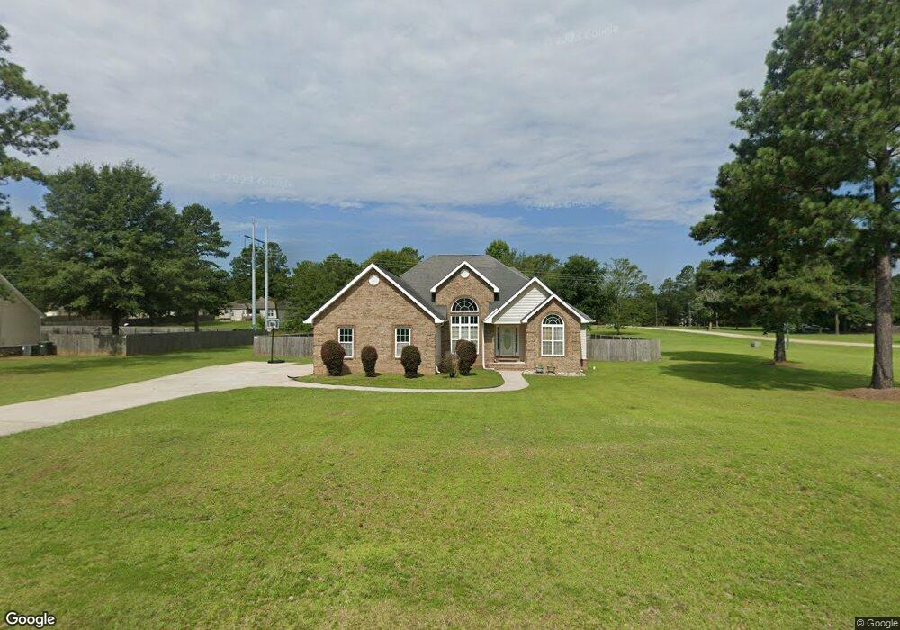
401 Dakota Trail Macon, GA 31216
Estimated Value: $246,000 - $284,465
3
Beds
2
Baths
2,067
Sq Ft
$127/Sq Ft
Est. Value
About This Home
This home is located at 401 Dakota Trail, Macon, GA 31216 and is currently estimated at $262,366, approximately $126 per square foot. 401 Dakota Trail is a home located in Bibb County with nearby schools including Heard Elementary School, Rutland Middle School, and Rutland High School.
Ownership History
Date
Name
Owned For
Owner Type
Purchase Details
Closed on
Aug 18, 2006
Sold by
Southern Homes Of Middle Georgia Llc
Bought by
Williams Cedric M and Williams Michele S
Current Estimated Value
Home Financials for this Owner
Home Financials are based on the most recent Mortgage that was taken out on this home.
Original Mortgage
$159,000
Outstanding Balance
$94,994
Interest Rate
6.67%
Mortgage Type
VA
Estimated Equity
$167,373
Purchase Details
Closed on
Mar 23, 2006
Sold by
Crisp Michael Nicholas
Bought by
Southern Homes Of Middle Ga Llc
Purchase Details
Closed on
Jan 11, 2006
Create a Home Valuation Report for This Property
The Home Valuation Report is an in-depth analysis detailing your home's value as well as a comparison with similar homes in the area
Home Values in the Area
Average Home Value in this Area
Purchase History
| Date | Buyer | Sale Price | Title Company |
|---|---|---|---|
| Williams Cedric M | $159,000 | None Available | |
| Southern Homes Of Middle Ga Llc | $27,900 | -- | |
| -- | $83,700 | -- |
Source: Public Records
Mortgage History
| Date | Status | Borrower | Loan Amount |
|---|---|---|---|
| Open | Williams Cedric M | $159,000 |
Source: Public Records
Tax History Compared to Growth
Tax History
| Year | Tax Paid | Tax Assessment Tax Assessment Total Assessment is a certain percentage of the fair market value that is determined by local assessors to be the total taxable value of land and additions on the property. | Land | Improvement |
|---|---|---|---|---|
| 2024 | $2,155 | $91,866 | $8,000 | $83,866 |
| 2023 | $2,387 | $87,582 | $6,000 | $81,582 |
| 2022 | $2,507 | $79,400 | $8,000 | $71,400 |
| 2021 | $2,249 | $66,177 | $8,000 | $58,177 |
| 2020 | $2,298 | $66,177 | $8,000 | $58,177 |
| 2019 | $2,238 | $64,176 | $8,000 | $56,176 |
| 2018 | $3,410 | $60,872 | $8,000 | $52,872 |
| 2017 | $1,708 | $52,585 | $8,000 | $44,585 |
| 2016 | $1,577 | $52,585 | $8,000 | $44,585 |
| 2015 | $2,233 | $52,585 | $8,000 | $44,585 |
| 2014 | $3,031 | $68,782 | $15,280 | $53,502 |
Source: Public Records
Map
Nearby Homes
- 312 Buckskin Dr
- 1850 Barnes Ferry Rd
- 120 Abberley Ln
- 326 Stockton Cir
- 117 Abberley Ln
- 301 Stockton Cir
- Plan 2700 at The Abberley
- Plan 2604 at The Abberley
- 7386 Hawkinsville Rd
- 317 Stockton Cir
- 7070 Sofkee Place
- 2165 Griffin Rd
- 8410 Hawkinsville Rd Unit LOT 42
- 2154 Allen Rd
- 4037 Liberty Estates Dr
- 4025 Liberty Estates Dr
- 2741 Liberty Church Rd
- 261 Amanda Dr
- 149 Lew Dr
- 344 Browning Pointe Rd
- 405 Dakota Trail
- 402 Dakota Trail
- 404 Dakota Trail
- 244 Natchez Trace
- 246 Natchez Trace
- 115 Deer Forest Trail
- 111 Deer Forest Trail
- 240 Natchez Trace
- 109 Deer Forest Trail
- 248 Natchez Trace
- 250 Natchez Trace
- 110 Deer Forest Trail
- 114 Deer Forest Trail
- 101 Deer Forest Trail
- 238 Natchez Trace
- 108 Deer Forest Trail
- 255 Natchez Trace
- 254 Natchez Trace
- 104 Deer Forest Trail
- 0 Deer Forest Trail Unit 8051998