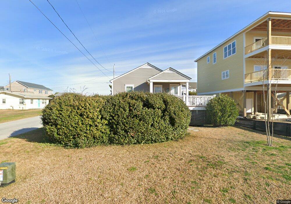
401 E Terminal Blvd Atlantic Beach, NC 28512
Estimated Value: $472,000 - $682,000
4
Beds
2
Baths
750
Sq Ft
$799/Sq Ft
Est. Value
About This Home
This home is located at 401 E Terminal Blvd, Atlantic Beach, NC 28512 and is currently estimated at $599,204, approximately $798 per square foot. 401 E Terminal Blvd is a home with nearby schools including Morehead City Primary School, Morehead Elementary School at Camp Glenn, and Morehead City Middle School.
Ownership History
Date
Name
Owned For
Owner Type
Purchase Details
Closed on
May 8, 2020
Sold by
Anderson Patrick D and Anderson Tara D
Bought by
Neese Elizabeth Kemp and Neese James Berkley
Current Estimated Value
Purchase Details
Closed on
Sep 23, 2011
Sold by
Newton Denise D and Newton Walter
Bought by
Anderson Patrick and Anderson Tara D
Home Financials for this Owner
Home Financials are based on the most recent Mortgage that was taken out on this home.
Original Mortgage
$187,720
Interest Rate
4.3%
Mortgage Type
New Conventional
Purchase Details
Closed on
Jun 28, 2001
Purchase Details
Closed on
Nov 17, 1994
Create a Home Valuation Report for This Property
The Home Valuation Report is an in-depth analysis detailing your home's value as well as a comparison with similar homes in the area
Home Values in the Area
Average Home Value in this Area
Purchase History
| Date | Buyer | Sale Price | Title Company |
|---|---|---|---|
| Neese Elizabeth Kemp | $230,000 | None Available | |
| Anderson Patrick | $235,000 | None Available | |
| -- | $130,000 | -- | |
| -- | -- | -- | |
| -- | $45,000 | -- |
Source: Public Records
Mortgage History
| Date | Status | Borrower | Loan Amount |
|---|---|---|---|
| Previous Owner | Anderson Patrick | $187,720 |
Source: Public Records
Tax History
| Year | Tax Paid | Tax Assessment Tax Assessment Total Assessment is a certain percentage of the fair market value that is determined by local assessors to be the total taxable value of land and additions on the property. | Land | Improvement |
|---|---|---|---|---|
| 2025 | $1,378 | $569,022 | $280,234 | $288,788 |
| 2024 | $888 | $232,308 | $154,687 | $77,621 |
| 2023 | $604 | $232,308 | $154,687 | $77,621 |
| 2022 | $782 | $232,308 | $154,687 | $77,621 |
| 2021 | $782 | $232,308 | $154,687 | $77,621 |
| 2020 | $782 | $232,308 | $154,687 | $77,621 |
| 2019 | $516 | $161,529 | $90,562 | $70,967 |
| 2017 | $516 | $161,529 | $90,562 | $70,967 |
| 2016 | $516 | $161,529 | $90,562 | $70,967 |
| 2015 | $500 | $161,529 | $90,562 | $70,967 |
| 2014 | $653 | $212,664 | $130,952 | $81,712 |
Source: Public Records
Map
Nearby Homes
- 310 E Terminal Blvd
- 303 E Atlantic Blvd
- 217 W Atlantic Blvd Unit 4
- 215 E Fort MacOn Rd
- 202 Glenn St
- 208 Beaufort Ave Unit 1
- 517 E Fort MacOn Rd Unit W-35
- 115 E Bogue Blvd
- 404 Dobbs St
- 104 Atlantic Beach Causeway
- 202 W Atlantic Blvd
- 108 N Kinston Ave
- 400 Atlantic Beach Causeway Unit Slip 2
- 108 W Terminal Blvd Unit B
- 308 W Bogue Blvd
- 121 Old Causeway Rd Unit 12
- 121 Sound Dr
- 203 Old Causeway Rd
- 519 Atlantic Beach Causeway
- 247 Bayview Blvd
- 403 E Terminal Blvd
- 313 E Terminal Blvd
- 206 Wilson Ave
- 405 E Terminal Blvd
- 400 E Bogue Blvd
- 311 E Terminal Blvd
- 400 E Terminal Blvd
- 402 E Bogue Blvd
- 402 E Terminal Blvd
- 404 E Terminal Blvd
- 404 E Terminal Blvd Unit 1f, 2f, 1b, 2b
- 101 Tryon St
- 310 E Bogue Blvd
- 309 E Terminal Blvd
- 406 E Terminal Blvd
- 312 E Terminal Blvd
- 101 Dobbs St
- 308 E Bogue Blvd
- 307 E Terminal Blvd
- 308 E Terminal Blvd
Your Personal Tour Guide
Ask me questions while you tour the home.