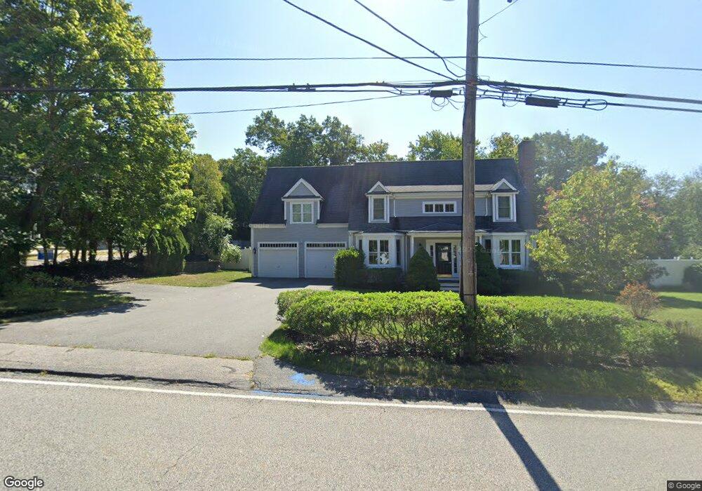
401 First Parish Rd Scituate, MA 02066
Estimated Value: $1,081,100 - $1,241,000
4
Beds
3
Baths
2,300
Sq Ft
$502/Sq Ft
Est. Value
About This Home
This home is located at 401 First Parish Rd, Scituate, MA 02066 and is currently estimated at $1,153,775, approximately $501 per square foot. 401 First Parish Rd is a home located in Plymouth County with nearby schools including Cushing Elementary School, Lester J. Gates Middle School, and Scituate High School.
Ownership History
Date
Name
Owned For
Owner Type
Purchase Details
Closed on
May 26, 2006
Sold by
Meenaghan Anthony J and Meemaghan Michaela
Bought by
Collins Robert C and Collins Tasha
Current Estimated Value
Home Financials for this Owner
Home Financials are based on the most recent Mortgage that was taken out on this home.
Original Mortgage
$488,000
Interest Rate
6.53%
Mortgage Type
Purchase Money Mortgage
Purchase Details
Closed on
Dec 19, 2003
Sold by
Sn Rt
Bought by
Meenaghan Anthony J and Meenaghan Michaela C
Home Financials for this Owner
Home Financials are based on the most recent Mortgage that was taken out on this home.
Original Mortgage
$117,300
Interest Rate
5.96%
Mortgage Type
Purchase Money Mortgage
Create a Home Valuation Report for This Property
The Home Valuation Report is an in-depth analysis detailing your home's value as well as a comparison with similar homes in the area
Home Values in the Area
Average Home Value in this Area
Purchase History
| Date | Buyer | Sale Price | Title Company |
|---|---|---|---|
| Collins Robert C | $610,000 | -- | |
| Meenaghan Anthony J | $480,000 | -- | |
| Sn Rt | -- | -- |
Source: Public Records
Mortgage History
| Date | Status | Borrower | Loan Amount |
|---|---|---|---|
| Open | Sn Rt | $430,400 | |
| Closed | Sn Rt | $488,000 | |
| Previous Owner | Sn Rt | $440,000 | |
| Previous Owner | Sn Rt | $117,300 |
Source: Public Records
Tax History Compared to Growth
Tax History
| Year | Tax Paid | Tax Assessment Tax Assessment Total Assessment is a certain percentage of the fair market value that is determined by local assessors to be the total taxable value of land and additions on the property. | Land | Improvement |
|---|---|---|---|---|
| 2025 | $8,740 | $874,900 | $374,000 | $500,900 |
| 2024 | $8,674 | $837,300 | $340,000 | $497,300 |
| 2023 | $8,544 | $775,000 | $326,300 | $448,700 |
| 2022 | $8,544 | $677,000 | $294,900 | $382,100 |
| 2021 | $8,143 | $610,900 | $280,900 | $330,000 |
| 2020 | $7,945 | $588,500 | $270,000 | $318,500 |
| 2019 | $7,825 | $569,500 | $264,700 | $304,800 |
| 2018 | $7,649 | $548,300 | $253,900 | $294,400 |
| 2017 | $7,571 | $537,300 | $242,900 | $294,400 |
| 2016 | $7,285 | $515,200 | $220,800 | $294,400 |
| 2015 | $6,749 | $515,200 | $220,800 | $294,400 |
Source: Public Records
Map
Nearby Homes
- 32 Fairview Ave
- 3 Grace Way Unit 3
- 1 Grace Way Unit 1
- 14 Aberdeen Dr
- 115 Elm St
- 111 Elm St
- 116 Old Forge Rd
- 54 Woodland Rd
- 575 First Parish Rd
- 59 Captain Peirce Rd
- 22 Kings Way
- 627 First Parish Rd
- 131 Maple St
- 27 Ann Vinal Rd
- 9 Kyle Path
- 74 Tilden Rd
- 378 Tilden Rd
- 10 Benjamin Ln Unit 10
- 112 Hollett St
- 30 Irving Rd
- 400 First Parish Rd
- 405 First Parish Rd Unit Business
- 405 First Parish Rd
- 405 First Parish Rd Unit B
- 405 First Parish Rd Unit n/a
- 396 First Parish Rd
- 406 First Parish Rd
- 6 Cornerstone Ln
- 11 Cornerstone Ln
- 10 Cornerstone Ln
- 392 First Parish Rd
- 415 First Parish Rd
- Lot 12 Deer Common
- Lot 2 Deer Common Dr
- 154 Humarock Beach
- 00 R Elm
- 15 Cornerstone Ln
- 377 First Parish Rd
- 418 First Parish Rd Unit 418A
- 418 First Parish Rd