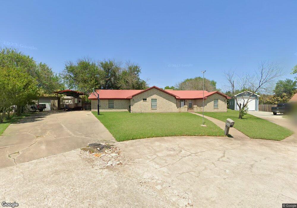
401 Jo Dr Robinson, TX 76706
Estimated Value: $294,000 - $337,000
3
Beds
2
Baths
1,872
Sq Ft
$170/Sq Ft
Est. Value
About This Home
This home is located at 401 Jo Dr, Robinson, TX 76706 and is currently estimated at $317,983, approximately $169 per square foot. 401 Jo Dr is a home located in McLennan County with nearby schools including Robinson Primary School, Robinson Elementary School, and Robinson Intermediate School.
Ownership History
Date
Name
Owned For
Owner Type
Purchase Details
Closed on
Feb 5, 2008
Sold by
Nixon Doris Maxine Howard and Nixon Dennis
Bought by
Williamson Davis Marcus Shane and Williamson Davis Kasey
Current Estimated Value
Home Financials for this Owner
Home Financials are based on the most recent Mortgage that was taken out on this home.
Original Mortgage
$128,860
Outstanding Balance
$81,663
Interest Rate
6.15%
Mortgage Type
Purchase Money Mortgage
Estimated Equity
$236,320
Create a Home Valuation Report for This Property
The Home Valuation Report is an in-depth analysis detailing your home's value as well as a comparison with similar homes in the area
Home Values in the Area
Average Home Value in this Area
Purchase History
| Date | Buyer | Sale Price | Title Company |
|---|---|---|---|
| Williamson Davis Marcus Shane | -- | None Available |
Source: Public Records
Mortgage History
| Date | Status | Borrower | Loan Amount |
|---|---|---|---|
| Open | Williamson Davis Marcus Shane | $128,860 |
Source: Public Records
Tax History
| Year | Tax Paid | Tax Assessment Tax Assessment Total Assessment is a certain percentage of the fair market value that is determined by local assessors to be the total taxable value of land and additions on the property. | Land | Improvement |
|---|---|---|---|---|
| 2025 | $4,060 | $315,280 | $39,720 | $275,560 |
| 2024 | $5,306 | $287,046 | $0 | $0 |
| 2023 | $3,567 | $260,951 | $0 | $0 |
| 2022 | $4,981 | $237,228 | $0 | $0 |
| 2021 | $5,204 | $220,380 | $31,380 | $189,000 |
| 2020 | $4,649 | $194,780 | $29,850 | $164,930 |
| 2019 | $4,418 | $184,340 | $28,600 | $155,740 |
| 2018 | $4,068 | $170,590 | $27,070 | $143,520 |
| 2017 | $3,825 | $144,670 | $22,620 | $122,050 |
| 2016 | $3,750 | $141,830 | $22,180 | $119,650 |
Source: Public Records
Map
Nearby Homes
- 631 N Robinson Dr
- 488 Hawkins Ct
- 546 Karen Dr
- 306 Baker Ln
- 511 N Robinson Dr
- 600 Apple Cross Ct
- 707 N Robinson Dr
- 517 Chado Ln
- 120 Durie
- 617 Christina Dr
- 472 Dal Paso Dr
- TBD Dison Dr
- 358 Violet Dr
- 370 Rio Bonito Dr
- 301 W Tinsley Dr
- 386 Frederick Dr
- 355 Cavitt Ct
- 304 Crye Cir
- 358 Frederick Dr
- 308 Crye Cir
Your Personal Tour Guide
Ask me questions while you tour the home.