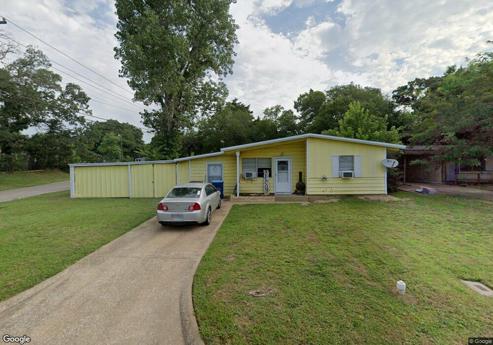
401 Knob Cir Denison, TX 75021
Estimated Value: $165,820 - $178,000
--
Bed
--
Bath
1,065
Sq Ft
$161/Sq Ft
Est. Value
About This Home
This home is located at 401 Knob Cir, Denison, TX 75021 and is currently estimated at $171,910, approximately $161 per square foot. 401 Knob Cir is a home located in Grayson County with nearby schools including Lamar Elementary School, Scott Middle School, and Denison High School.
Ownership History
Date
Name
Owned For
Owner Type
Purchase Details
Closed on
Aug 19, 2010
Sold by
Camacho Jeremiah and Camacho Connie J
Bought by
Camacho Investments Llc
Current Estimated Value
Purchase Details
Closed on
Nov 20, 2006
Sold by
Parks Jimmy L and Parks Rhonda Leann
Bought by
Camacho Connie J
Home Financials for this Owner
Home Financials are based on the most recent Mortgage that was taken out on this home.
Original Mortgage
$16,000
Interest Rate
6.37%
Mortgage Type
Purchase Money Mortgage
Purchase Details
Closed on
Jan 19, 2005
Sold by
Fontz Ronnie L
Bought by
Parks Jimmy L and Parks Rhonda Leann
Home Financials for this Owner
Home Financials are based on the most recent Mortgage that was taken out on this home.
Original Mortgage
$50,400
Interest Rate
5.71%
Mortgage Type
Stand Alone First
Create a Home Valuation Report for This Property
The Home Valuation Report is an in-depth analysis detailing your home's value as well as a comparison with similar homes in the area
Home Values in the Area
Average Home Value in this Area
Purchase History
| Date | Buyer | Sale Price | Title Company |
|---|---|---|---|
| Camacho Investments Llc | -- | None Available | |
| Camacho Connie J | -- | Chapin Title Co Inc | |
| Parks Jimmy L | -- | -- |
Source: Public Records
Mortgage History
| Date | Status | Borrower | Loan Amount |
|---|---|---|---|
| Previous Owner | Camacho Connie J | $16,000 | |
| Previous Owner | Parks Jimmy L | $50,400 |
Source: Public Records
Tax History Compared to Growth
Tax History
| Year | Tax Paid | Tax Assessment Tax Assessment Total Assessment is a certain percentage of the fair market value that is determined by local assessors to be the total taxable value of land and additions on the property. | Land | Improvement |
|---|---|---|---|---|
| 2025 | $2,460 | $107,305 | $39,075 | $68,230 |
| 2024 | $2,460 | $105,878 | $35,250 | $70,628 |
| 2023 | $2,570 | $113,438 | $48,000 | $65,438 |
| 2022 | $1,804 | $75,936 | $20,625 | $55,311 |
| 2021 | $1,582 | $62,714 | $17,250 | $45,464 |
| 2020 | $1,633 | $61,910 | $15,000 | $46,910 |
| 2019 | $1,576 | $57,270 | $9,000 | $48,270 |
| 2018 | $1,515 | $54,608 | $7,500 | $47,108 |
| 2017 | $1,289 | $46,083 | $6,150 | $39,933 |
| 2016 | $1,203 | $43,000 | $6,150 | $36,850 |
| 2015 | $1,158 | $40,999 | $6,150 | $34,849 |
| 2014 | $1,058 | $37,443 | $6,150 | $31,293 |
Source: Public Records
Map
Nearby Homes
- 1506 S Travis St
- TBD Bells Dr
- TBD E Heron St
- 1414 S Houston Ave
- 401 E Monterey St
- 415 E Monterey St
- 705 E Hanna St
- 101 E Murray St
- 1901 S Lamar Ave
- 1903 S Lamar Ave
- 1905 S Lamar Ave
- 715 E Hanna St
- 621 E Murray St
- 622 E Heron St
- 721 E Bullock St
- 111 W Murray St
- 732 E Bullock St
- 609 E Monterey St
- 1110 S Houston Ave
- 1210 S Travis Ave