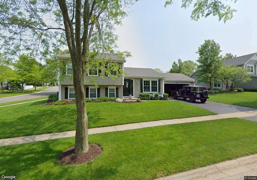
401 Lexington Ave Fox River Grove, IL 60021
Estimated Value: $356,000 - $399,000
3
Beds
2
Baths
1,144
Sq Ft
$325/Sq Ft
Est. Value
About This Home
This home is located at 401 Lexington Ave, Fox River Grove, IL 60021 and is currently estimated at $371,984, approximately $325 per square foot. 401 Lexington Ave is a home located in McHenry County with nearby schools including Algonquin Road Elementary School, Fox River Grove Middle School, and Cary Grove High School.
Ownership History
Date
Name
Owned For
Owner Type
Purchase Details
Closed on
Mar 15, 2006
Sold by
Riley Patrick O and Riley Lisa B
Bought by
Riley Patrick O and Riley Lisa B
Current Estimated Value
Purchase Details
Closed on
Jun 26, 1998
Sold by
Peters Daniel J and Peters Susan M
Bought by
Riley Patrick O and Riley Lisa B
Home Financials for this Owner
Home Financials are based on the most recent Mortgage that was taken out on this home.
Original Mortgage
$147,700
Outstanding Balance
$30,700
Interest Rate
7.18%
Estimated Equity
$341,284
Create a Home Valuation Report for This Property
The Home Valuation Report is an in-depth analysis detailing your home's value as well as a comparison with similar homes in the area
Home Values in the Area
Average Home Value in this Area
Purchase History
| Date | Buyer | Sale Price | Title Company |
|---|---|---|---|
| Riley Patrick O | -- | None Available | |
| Riley Patrick O | $155,500 | -- |
Source: Public Records
Mortgage History
| Date | Status | Borrower | Loan Amount |
|---|---|---|---|
| Open | Riley Patrick O | $147,700 |
Source: Public Records
Tax History Compared to Growth
Tax History
| Year | Tax Paid | Tax Assessment Tax Assessment Total Assessment is a certain percentage of the fair market value that is determined by local assessors to be the total taxable value of land and additions on the property. | Land | Improvement |
|---|---|---|---|---|
| 2024 | $9,297 | $103,816 | $22,570 | $81,246 |
| 2023 | $8,947 | $92,850 | $20,186 | $72,664 |
| 2022 | $8,375 | $86,378 | $19,398 | $66,980 |
| 2021 | $7,813 | $80,472 | $18,072 | $62,400 |
| 2020 | $7,618 | $77,623 | $17,432 | $60,191 |
| 2019 | $7,354 | $74,295 | $16,685 | $57,610 |
| 2018 | $7,219 | $68,632 | $15,413 | $53,219 |
| 2017 | $7,082 | $64,656 | $14,520 | $50,136 |
| 2016 | $6,962 | $60,641 | $13,618 | $47,023 |
| 2013 | -- | $56,494 | $12,703 | $43,791 |
Source: Public Records
Map
Nearby Homes
- 346 Bristol Ln Unit 6361
- 500 Tower Place
- Lot 1 Asbury Ave
- LOT 2 Asbury Ave
- 6 Jacqueline Ln
- 727 Old Hunt Rd
- 209 Gladys Ave
- 5 Jacqueline Ln
- 111 Grace Ln
- 1006 Pine St
- 3 Saville Row
- 208 S River Rd
- 422 Lincoln Ave Unit A
- 1200 Hillcrest Ave
- 300 Opatrny Dr Unit 122
- 502 Windsor Cir
- 1221 Lincoln Ave
- 806 Norge Pkwy
- 9500 Church Rd
- 215 S Northwest Hwy
- 403 Lexington Ave
- 488 Hunters Way
- 333 Lexington Ave
- 500 Hunters Way
- 484 Hunters Way
- 501 Hunters Way
- 200 Foxmoor Rd
- 503 Hunters Way Unit F3
- 198 Foxmoor Rd
- 384 Bristol Ln
- 507 Hunters Way
- 202 Foxmoor Rd Unit 4A
- 400 Lexington Ave
- 502 Hunters Way
- 329 Lexington Ave
- 480 Hunters Way
- 204 Foxmoor Rd
- 382 Bristol Ln
- 505 Hunters Way
- 402 Lexington Ave