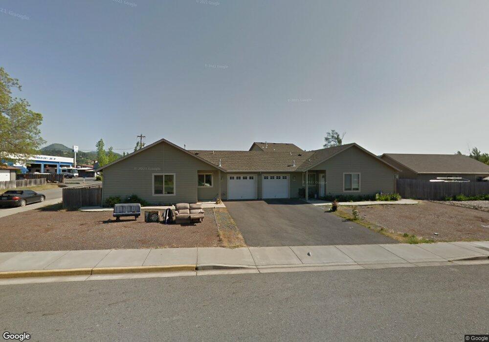
401 Marion Ln Grants Pass, OR 97527
Estimated Value: $445,086 - $493,000
6
Beds
4
Baths
2,056
Sq Ft
$228/Sq Ft
Est. Value
About This Home
This home is located at 401 Marion Ln, Grants Pass, OR 97527 and is currently estimated at $469,043, approximately $228 per square foot. 401 Marion Ln is a home located in Josephine County with nearby schools including Parkside Elementary School, South Middle School, and Grants Pass High School.
Ownership History
Date
Name
Owned For
Owner Type
Purchase Details
Closed on
Sep 6, 2011
Sold by
Kuehl Bernard A and Kuehl Mercedes J
Bought by
Kuehl Bernard A and Kuehl Mercedes Jean
Current Estimated Value
Purchase Details
Closed on
May 25, 2010
Sold by
Lubash Michael J and Lubash Karen D
Bought by
Podolski Lance T and Podolski Deanne M
Home Financials for this Owner
Home Financials are based on the most recent Mortgage that was taken out on this home.
Original Mortgage
$153,500
Outstanding Balance
$102,388
Interest Rate
5.03%
Mortgage Type
New Conventional
Estimated Equity
$366,655
Create a Home Valuation Report for This Property
The Home Valuation Report is an in-depth analysis detailing your home's value as well as a comparison with similar homes in the area
Home Values in the Area
Average Home Value in this Area
Purchase History
| Date | Buyer | Sale Price | Title Company |
|---|---|---|---|
| Kuehl Bernard A | -- | None Available | |
| Podolski Lance T | $223,500 | Ticor Title Company Oregon |
Source: Public Records
Mortgage History
| Date | Status | Borrower | Loan Amount |
|---|---|---|---|
| Open | Podolski Lance T | $153,500 |
Source: Public Records
Tax History Compared to Growth
Tax History
| Year | Tax Paid | Tax Assessment Tax Assessment Total Assessment is a certain percentage of the fair market value that is determined by local assessors to be the total taxable value of land and additions on the property. | Land | Improvement |
|---|---|---|---|---|
| 2025 | $3,314 | $255,200 | -- | -- |
| 2024 | $3,314 | $247,770 | -- | -- |
| 2023 | $3,121 | $240,560 | $0 | $0 |
| 2022 | $3,136 | $233,560 | -- | -- |
| 2021 | $2,946 | $226,760 | $0 | $0 |
| 2020 | $2,861 | $220,160 | $0 | $0 |
| 2019 | $2,778 | $213,750 | $0 | $0 |
| 2018 | $2,827 | $207,530 | $0 | $0 |
| 2017 | $2,806 | $201,490 | $0 | $0 |
| 2016 | $2,449 | $195,630 | $0 | $0 |
| 2015 | $2,386 | $189,940 | $0 | $0 |
| 2014 | $2,321 | $184,410 | $0 | $0 |
Source: Public Records
Map
Nearby Homes
- 333 W Park St
- 423 W Park St
- 444 Union Ave Unit TL 1700
- 444 Union Ave Unit TL 1600
- 1219 River Ln
- 115 Rogue River Hwy Unit 302
- 115 Rogue River Hwy Unit 307
- 0 Fruitdale Lilac Hilltop Shepha Dr Unit 220196701
- 955 SW Rogue River Ave
- 1202 SW Viola Dr
- 1626 Poplar Dr
- 1764 Harbeck Rd
- 1129 SW Ballinger Dr
- 426 SE Cadet Ct
- 0 Ramsey Southwest Ave SW Unit 220201654
- 253 SW Central Ave
- 11311133 SW Central Ave
- 185 Independence Dr
- 1331 Vista Dr
- 101 SE Liberty Dr