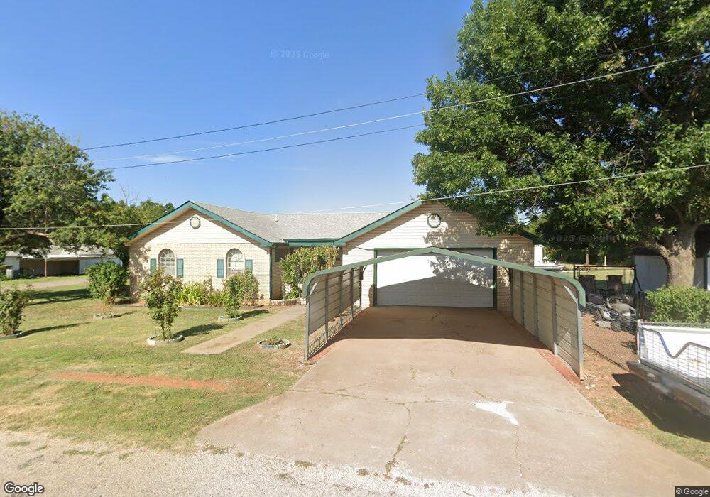
401 N 6th St Comanche, OK 73529
Estimated Value: $94,000 - $128,000
3
Beds
2
Baths
1,464
Sq Ft
$76/Sq Ft
Est. Value
About This Home
This home is located at 401 N 6th St, Comanche, OK 73529 and is currently estimated at $111,218, approximately $75 per square foot. 401 N 6th St is a home located in Stephens County with nearby schools including Comanche Elementary School, Comanche Middle School, and Comanche High School.
Ownership History
Date
Name
Owned For
Owner Type
Purchase Details
Closed on
May 12, 2017
Sold by
Singley Margaret and Singley Roer
Bought by
Burton Calvin
Current Estimated Value
Purchase Details
Closed on
Apr 6, 2017
Sold by
Boone Laura and Boone Herman
Bought by
Burton Calvin
Purchase Details
Closed on
Apr 5, 2017
Sold by
Riggs Stephens and Riggs Annie
Bought by
Burton Calvin
Purchase Details
Closed on
Oct 22, 2002
Sold by
Mayo Harlan and Mayo Opal
Bought by
Mayo Opal
Purchase Details
Closed on
Dec 19, 1995
Sold by
Shelby Billy and Shelby Betty
Purchase Details
Closed on
Dec 13, 1995
Sold by
Heartman David and Heartman Patsy
Purchase Details
Closed on
Feb 21, 1995
Sold by
Huey Mildred
Purchase Details
Closed on
Oct 7, 1991
Sold by
Cain Chris F
Create a Home Valuation Report for This Property
The Home Valuation Report is an in-depth analysis detailing your home's value as well as a comparison with similar homes in the area
Purchase History
| Date | Buyer | Sale Price | Title Company |
|---|---|---|---|
| Burton Calvin | -- | None Available | |
| Burton Calvin | -- | None Available | |
| Burton Calvin | -- | None Available | |
| Mayo Opal | -- | -- | |
| -- | $19,000 | -- | |
| -- | $18,000 | -- | |
| -- | -- | -- | |
| -- | $30,000 | -- |
Source: Public Records
Tax History
| Year | Tax Paid | Tax Assessment Tax Assessment Total Assessment is a certain percentage of the fair market value that is determined by local assessors to be the total taxable value of land and additions on the property. | Land | Improvement |
|---|---|---|---|---|
| 2025 | $602 | $7,894 | $231 | $7,663 |
| 2024 | $571 | $7,442 | $225 | $7,217 |
| 2023 | $571 | $7,441 | $225 | $7,216 |
| 2022 | $544 | $7,225 | $225 | $7,000 |
| 2021 | $555 | $7,015 | $225 | $6,790 |
| 2020 | $514 | $6,611 | $223 | $6,388 |
| 2019 | $521 | $6,419 | $223 | $6,196 |
| 2018 | $501 | $6,419 | $223 | $6,196 |
| 2017 | $507 | $6,232 | $222 | $6,010 |
| 2016 | $426 | $5,763 | $221 | $5,542 |
| 2015 | $426 | $5,595 | $220 | $5,375 |
| 2014 | $426 | $5,432 | $220 | $5,212 |
Source: Public Records
Map
Nearby Homes
- 508 Wilson Ave
- 620 Clark Ave
- 703 Wilson Ave
- 303 N 8th St
- 731 N 7th St
- 0 Oklahoma 53
- 311 S 6th St
- 281477 Doctor Pepper Rd
- 117 Seminole Dr
- Rt Rt 2
- 181259 N 2590 Rd
- 282752 E 1800 Rd
- TBD E 1840 Rd
- 180163 Larue Dr
- ? N 2800 Rd
- 282096 Andrews Dr
- 182248 N 2790 Rd
- 179712 Ledford Ln
- 181473 N 2850 Rd
- 280350 E 1780 Rd
Your Personal Tour Guide
Ask me questions while you tour the home.