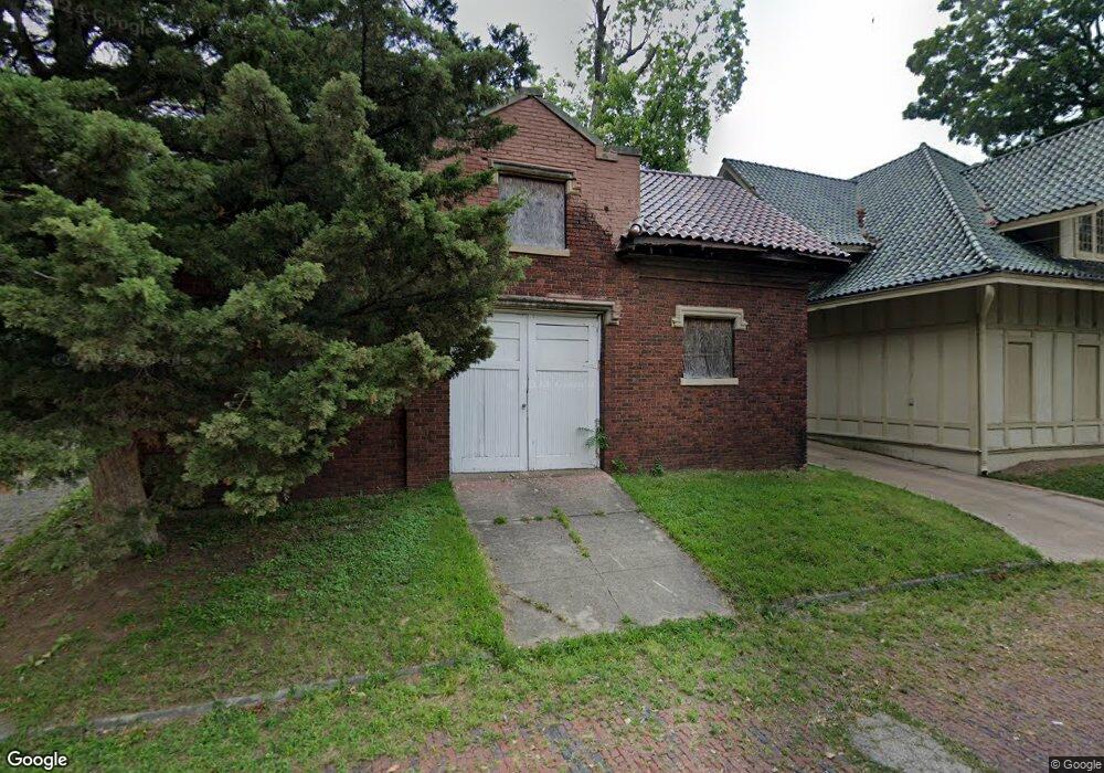
401 N College St Decatur, IL 62522
Millikin Home Neighborhood
7
Beds
8
Baths
--
Sq Ft
0.63
Acres
About This Home
This home is located at 401 N College St, Decatur, IL 62522. 401 N College St is a home located in Macon County with nearby schools including Dennis Lab School, St. Patrick School, and Teen Challenge-Home For Girls.
Ownership History
Date
Name
Owned For
Owner Type
Purchase Details
Closed on
Jan 9, 2015
Sold by
Prairie State Bank Trust
Bought by
Allen Eric Eugene
Purchase Details
Closed on
Sep 1, 2014
Purchase Details
Closed on
Mar 4, 2014
Sold by
Jones Martha G
Bought by
Federal Home Loan Mortgage Copr
Purchase Details
Closed on
Apr 25, 2006
Sold by
Kelly Wayne D and Neurostat Consultants Ltd
Bought by
Jones Martha G
Home Financials for this Owner
Home Financials are based on the most recent Mortgage that was taken out on this home.
Original Mortgage
$55,200
Interest Rate
6.39%
Create a Home Valuation Report for This Property
The Home Valuation Report is an in-depth analysis detailing your home's value as well as a comparison with similar homes in the area
Home Values in the Area
Average Home Value in this Area
Purchase History
| Date | Buyer | Sale Price | Title Company |
|---|---|---|---|
| Allen Eric Eugene | $69,000 | None Available | |
| -- | $57,500 | -- | |
| Federal Home Loan Mortgage Copr | -- | None Available | |
| Jones Martha G | $276,500 | Decatur Title Co Llc |
Source: Public Records
Mortgage History
| Date | Status | Borrower | Loan Amount |
|---|---|---|---|
| Previous Owner | Jones Martha G | $55,200 | |
| Previous Owner | Jones Martha G | $220,950 |
Source: Public Records
Tax History Compared to Growth
Tax History
| Year | Tax Paid | Tax Assessment Tax Assessment Total Assessment is a certain percentage of the fair market value that is determined by local assessors to be the total taxable value of land and additions on the property. | Land | Improvement |
|---|---|---|---|---|
| 2024 | $3,785 | $45,097 | $7,458 | $37,639 |
| 2023 | $3,732 | $43,501 | $7,194 | $36,307 |
| 2022 | $3,789 | $43,046 | $13,314 | $29,732 |
| 2021 | $3,519 | $40,200 | $12,434 | $27,766 |
| 2020 | $3,438 | $38,333 | $11,856 | $26,477 |
| 2019 | $3,438 | $38,333 | $11,856 | $26,477 |
| 2018 | $1,453 | $19,825 | $11,895 | $7,930 |
| 2017 | $1,504 | $20,355 | $12,213 | $8,142 |
| 2016 | $1,539 | $20,563 | $12,338 | $8,225 |
| 2015 | $2,065 | $20,200 | $12,120 | $8,080 |
| 2014 | $1,917 | $20,000 | $12,000 | $8,000 |
| 2013 | $5,900 | $61,807 | $18,888 | $42,919 |
Source: Public Records
Map
Nearby Homes
- 422 W William St
- 875 N Monroe St
- 609 W William St
- 330 W William St
- 452 W Prairie Ave
- 442 W Prairie Ave
- 233 N Edward St
- 415 W Green St
- 366 W Prairie Ave
- 254 N Pine St
- 717 W Prairie Ave Unit 2
- 844 N Edward St
- 281 W Prairie Ave
- 320 W Main St
- 958 W William St
- 657 W Wood St
- 450 W Macon St
- 612 W Macon St
- 440 W Macon St
- 899 W Main St
- 361 N College St
- 444 W North St
- 355 N College St
- 550 W North St
- 421 N College St
- 437 W North St
- 515 W Eldorado St
- 540 W North St
- 328 N College St
- 455 W Eldorado St
- 425 W North St
- 340 N College St
- 560 W North St
- 549 W North St
- 447 W North St
- 320 N College St
- 510 W William St
- 349 N Edward St
- 425 N Edward St
- 462 W William St