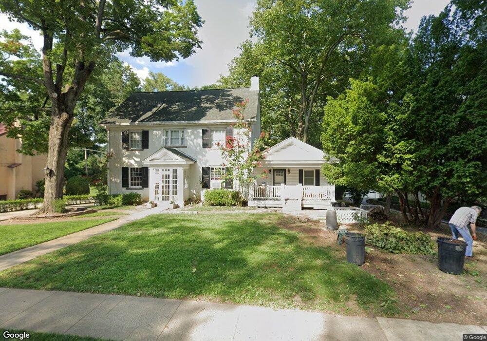
401 N Rolling Rd Springfield, PA 19064
Estimated Value: $591,000 - $725,000
4
Beds
2
Baths
3,185
Sq Ft
$213/Sq Ft
Est. Value
About This Home
This home is located at 401 N Rolling Rd, Springfield, PA 19064 and is currently estimated at $679,098, approximately $213 per square foot. 401 N Rolling Rd is a home located in Delaware County with nearby schools including Springfield High School, St Francis Of Assisi School, and St. Andrew School.
Ownership History
Date
Name
Owned For
Owner Type
Purchase Details
Closed on
Mar 1, 2005
Sold by
Mooney James P and Mooney Christine G
Bought by
Sokoloff Jonathan D and Sokoloff Mary Ellen
Current Estimated Value
Purchase Details
Closed on
May 30, 1997
Sold by
Braun Anne E and Molloy Lillian
Bought by
Mooney James P and Mooney Christine G
Home Financials for this Owner
Home Financials are based on the most recent Mortgage that was taken out on this home.
Original Mortgage
$162,000
Interest Rate
7.25%
Create a Home Valuation Report for This Property
The Home Valuation Report is an in-depth analysis detailing your home's value as well as a comparison with similar homes in the area
Home Values in the Area
Average Home Value in this Area
Purchase History
| Date | Buyer | Sale Price | Title Company |
|---|---|---|---|
| Sokoloff Jonathan D | $550,000 | -- | |
| Mooney James P | $180,000 | -- |
Source: Public Records
Mortgage History
| Date | Status | Borrower | Loan Amount |
|---|---|---|---|
| Previous Owner | Mooney James P | $162,000 |
Source: Public Records
Tax History
| Year | Tax Paid | Tax Assessment Tax Assessment Total Assessment is a certain percentage of the fair market value that is determined by local assessors to be the total taxable value of land and additions on the property. | Land | Improvement |
|---|---|---|---|---|
| 2025 | $12,442 | $442,670 | $186,550 | $256,120 |
| 2024 | $12,442 | $442,670 | $186,550 | $256,120 |
| 2023 | $11,980 | $442,670 | $186,550 | $256,120 |
| 2022 | $11,721 | $442,670 | $186,550 | $256,120 |
| 2021 | $18,152 | $442,670 | $186,550 | $256,120 |
| 2020 | $8,749 | $193,080 | $89,000 | $104,080 |
| 2019 | $8,544 | $193,080 | $89,000 | $104,080 |
| 2018 | $8,422 | $193,080 | $0 | $0 |
| 2017 | $8,227 | $193,080 | $0 | $0 |
| 2016 | $1,081 | $193,080 | $0 | $0 |
| 2015 | $1,081 | $193,080 | $0 | $0 |
| 2014 | $1,081 | $193,080 | $0 | $0 |
Source: Public Records
Map
Nearby Homes
- 8 Pilgrim Ln
- 4928 State Rd
- 5239 Arrowhead Ln
- 4913 Woodland Ave
- 658 W Rolling Rd
- 712 Clarendon Rd
- 42 Greenhill Rd
- 501 Flora Cir
- 831 Stanbridge Rd
- 29 School Ln
- 463 Foulke Ln
- 800 Collenbrook Ave
- 905 Addingham Ave
- 824 Collenbrook Ave
- 120 W Springfield Rd
- 908 Roberts Ave
- 465 Hawarden Rd
- 474 Ridge Ln
- 842 Alexander Ave
- 637 N Bishop Ave
- 369 N Rolling Rd
- 411 N Rolling Rd
- 363 N Rolling Rd
- 400 N Rolling Rd
- 417 N Rolling Rd
- 358 N Rolling Rd
- 357 N Rolling Rd
- 423 N Rolling Rd
- 106 Broadview Rd
- 429 N Rolling Rd
- 430 N Rolling Rd
- 107 Broadview Rd
- 351 N Rolling Rd
- 346 N Rolling Rd
- 112 Broadview Rd
- 345 N Rolling Rd
- 115 Broadview Rd
- 511 N State Rd
- 340 N Rolling Rd
- 118 Broadview Rd
Your Personal Tour Guide
Ask me questions while you tour the home.