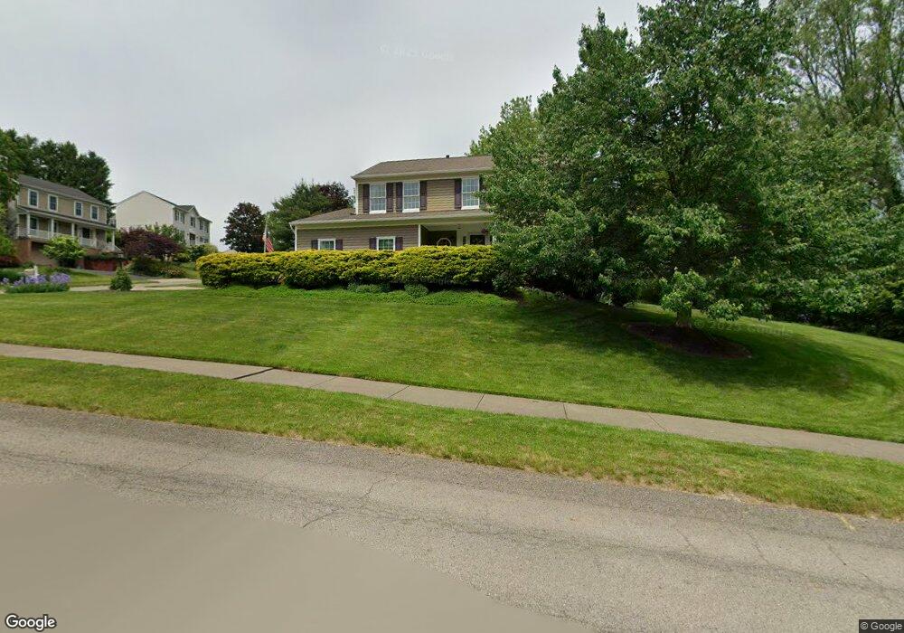
401 Poplar Ct Coraopolis, PA 15108
Estimated Value: $409,264 - $428,000
4
Beds
3
Baths
1,992
Sq Ft
$212/Sq Ft
Est. Value
About This Home
This home is located at 401 Poplar Ct, Coraopolis, PA 15108 and is currently estimated at $421,816, approximately $211 per square foot. 401 Poplar Ct is a home located in Allegheny County with nearby schools including Moon Area High School.
Ownership History
Date
Name
Owned For
Owner Type
Purchase Details
Closed on
Apr 17, 2024
Sold by
Cercone Lynnette A and Cercone Nicholas J
Bought by
Cercone Lynnette A Trust and Cercone Nicholas J Trust
Current Estimated Value
Purchase Details
Closed on
Mar 8, 2024
Sold by
Cercone Nicholas J and Cercone Lynnette A
Bought by
Nicholas J Cercone & Lynnette A Cerconerevoca
Purchase Details
Closed on
Mar 23, 1997
Sold by
Luchini Donald S and Luchini Judith A
Bought by
Cercone Nicholas J and Cercone Lynnette A
Create a Home Valuation Report for This Property
The Home Valuation Report is an in-depth analysis detailing your home's value as well as a comparison with similar homes in the area
Home Values in the Area
Average Home Value in this Area
Purchase History
| Date | Buyer | Sale Price | Title Company |
|---|---|---|---|
| Cercone Lynnette A Trust | -- | -- | |
| Nicholas J Cercone & Lynnette A Cerconerevoca | -- | -- | |
| Cercone Nicholas J | $161,000 | -- |
Source: Public Records
Tax History Compared to Growth
Tax History
| Year | Tax Paid | Tax Assessment Tax Assessment Total Assessment is a certain percentage of the fair market value that is determined by local assessors to be the total taxable value of land and additions on the property. | Land | Improvement |
|---|---|---|---|---|
| 2025 | $5,814 | $186,000 | $45,200 | $140,800 |
| 2024 | $5,814 | $186,000 | $45,200 | $140,800 |
| 2023 | $5,607 | $186,000 | $45,200 | $140,800 |
| 2022 | $5,607 | $186,000 | $45,200 | $140,800 |
| 2021 | $5,606 | $186,000 | $45,200 | $140,800 |
| 2020 | $5,467 | $186,000 | $45,200 | $140,800 |
| 2019 | $5,317 | $186,000 | $45,200 | $140,800 |
| 2018 | $880 | $186,000 | $45,200 | $140,800 |
| 2017 | $5,027 | $186,000 | $45,200 | $140,800 |
| 2016 | $880 | $186,000 | $45,200 | $140,800 |
| 2015 | $880 | $186,000 | $45,200 | $140,800 |
| 2014 | $4,896 | $186,000 | $45,200 | $140,800 |
Source: Public Records
Map
Nearby Homes
- 001 Spring Run Road Extension
- 105 Springwater Ct
- 116 Mesa Dr
- 121 Shelbourne Dr
- 0 Spring Run Road Extension Unit 1684623
- Somerset Plan at Victoria Ridge
- Rockford Plan at Victoria Ridge
- Birmingham Plan at Victoria Ridge
- Eisenhower Plan at Victoria Ridge
- Carlisle Plan at Victoria Ridge
- Truman Plan at Victoria Ridge
- Chattanooga Plan at Victoria Ridge
- Cleveland Plan at Victoria Ridge
- 121 Victoria Dr
- 108 Economy Grade Rd
- 110 Victoria Dr
- Bristol Plan at Victoria Ridge
- Galen Plan at Victoria Ridge
- Hanover Plan at Victoria Ridge
- Hadley Plan at Victoria Ridge
- 302 Shady Glen Dr
- 403 Poplar Ct
- 400 Poplar Ct
- 303 Shady Glen Dr
- 300 Shady Glen Dr
- 305 Shady Glen Dr
- 402 Poplar Ct
- 407 Poplar Ct
- 307 Shady Glen Dr
- 404 Poplar Ct
- 301 Shady Glen Dr
- 308 Shady Glen Dr
- 298 Shady Glen Dr
- 309 Shady Glen Dr
- 411 Poplar Ct
- 138 Elmhurst Dr
- 406 Poplar Ct
- 136 Elmhurst Dr
- 310 Shady Glen Dr
- 296 Shady Glen Dr