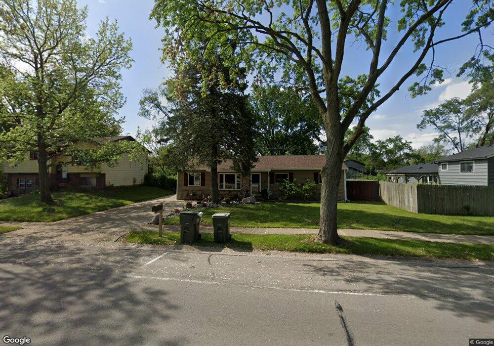
401 Rockhurst Rd Bolingbrook, IL 60440
East Bolingbrook NeighborhoodEstimated Value: $296,000 - $335,000
4
Beds
2
Baths
1,322
Sq Ft
$233/Sq Ft
Est. Value
About This Home
This home is located at 401 Rockhurst Rd, Bolingbrook, IL 60440 and is currently estimated at $308,144, approximately $233 per square foot. 401 Rockhurst Rd is a home located in Will County with nearby schools including Jonas E Salk Elementary School, Hubert H Humphrey Middle School, and Brooks Middle School.
Ownership History
Date
Name
Owned For
Owner Type
Purchase Details
Closed on
Sep 20, 2010
Sold by
Lafromboise Simon S
Bought by
Lafromboise Simon S and Lafromboise Christine A
Current Estimated Value
Purchase Details
Closed on
Jun 29, 1995
Sold by
Zajac Theodore R and Zajac Joan
Bought by
Hickey Shawn S and Hickey Heather J
Home Financials for this Owner
Home Financials are based on the most recent Mortgage that was taken out on this home.
Original Mortgage
$73,400
Interest Rate
7.75%
Create a Home Valuation Report for This Property
The Home Valuation Report is an in-depth analysis detailing your home's value as well as a comparison with similar homes in the area
Home Values in the Area
Average Home Value in this Area
Purchase History
| Date | Buyer | Sale Price | Title Company |
|---|---|---|---|
| Lafromboise Simon S | -- | First American Title | |
| Hickey Shawn S | $92,000 | -- |
Source: Public Records
Mortgage History
| Date | Status | Borrower | Loan Amount |
|---|---|---|---|
| Closed | Hickey Shawn S | $73,400 |
Source: Public Records
Tax History
| Year | Tax Paid | Tax Assessment Tax Assessment Total Assessment is a certain percentage of the fair market value that is determined by local assessors to be the total taxable value of land and additions on the property. | Land | Improvement |
|---|---|---|---|---|
| 2024 | $6,864 | $82,318 | $15,183 | $67,135 |
| 2023 | $6,864 | $74,067 | $13,661 | $60,406 |
| 2022 | $6,007 | $66,775 | $12,316 | $54,459 |
| 2021 | $5,682 | $62,436 | $11,516 | $50,920 |
| 2020 | $5,501 | $60,383 | $11,137 | $49,246 |
| 2019 | $5,198 | $56,380 | $10,399 | $45,981 |
| 2018 | $4,764 | $51,867 | $9,567 | $42,300 |
| 2017 | $4,524 | $49,163 | $9,068 | $40,095 |
| 2016 | $4,188 | $45,000 | $8,300 | $36,700 |
| 2015 | $3,696 | $43,200 | $8,000 | $35,200 |
| 2014 | $3,696 | $39,300 | $7,300 | $32,000 |
| 2013 | $3,696 | $43,700 | $8,100 | $35,600 |
Source: Public Records
Map
Nearby Homes
- 404 Galahad Rd
- 220 N Ashbury Ave
- 207 Seabury Rd
- 325 Rockhurst Rd
- 473 Rockhurst Rd
- 409 N Ashbury Ave
- 428 N Ashbury Ave
- 124 Seabury Rd
- 234 Malibu Dr
- 505 Goodwin Dr
- 417 Monet Cir
- 153 Camelot Way
- 526 King Arthur Way
- 492 Ridge Ln
- 490 Ridge Ln
- 547 Goodwin Dr
- 424 Van Gogh Cir Unit 1
- 462 Ridge Ln
- 458 Ridge Ln
- 118 Camelot Way
- 405 Rockhurst Rd
- 260 N Ashbury Ave
- 252 Oakridge Ct
- 409 Rockhurst Rd
- 256 Oakridge Ct
- 248 Oakridge Ct
- 400 Rockhurst Rd
- 404 Rockhurst Rd Unit 4
- 300 N Ashbury Ave
- 413 Rockhurst Rd
- 259 N Ashbury Ave
- 255 N Ashbury Ave
- 408 Rockhurst Rd
- 244 Oakridge Ct
- 417 Rockhurst Rd
- 109 Staunton Ct Unit 6
- 412 Rockhurst Rd
- 251 Meadowbrook Dr
- 350 Rockhurst Rd
- 359 Galahad Rd
Your Personal Tour Guide
Ask me questions while you tour the home.