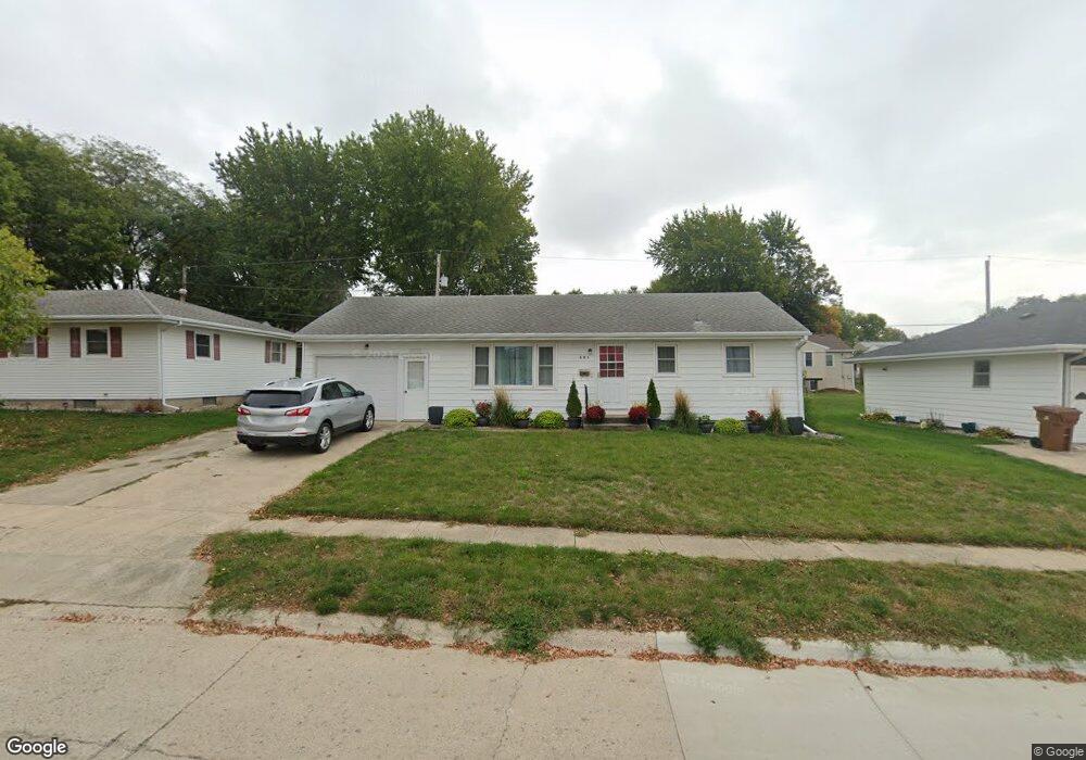
401 S Maple St Carroll, IA 51401
Estimated Value: $124,000 - $169,000
2
Beds
2
Baths
988
Sq Ft
$153/Sq Ft
Est. Value
About This Home
This home is located at 401 S Maple St, Carroll, IA 51401 and is currently estimated at $151,652, approximately $153 per square foot. 401 S Maple St is a home located in Carroll County with nearby schools including Fairview Elementary School, Adams Elementary School, and Carroll Middle School.
Ownership History
Date
Name
Owned For
Owner Type
Purchase Details
Closed on
Dec 16, 2019
Sold by
Cmm Rentals Llc
Bought by
Murrell Heather M
Current Estimated Value
Home Financials for this Owner
Home Financials are based on the most recent Mortgage that was taken out on this home.
Original Mortgage
$103,700
Outstanding Balance
$81,257
Interest Rate
3.7%
Mortgage Type
Stand Alone Refi Refinance Of Original Loan
Estimated Equity
$70,395
Purchase Details
Closed on
Oct 27, 2010
Sold by
Ocken Wilfred J and Ocken Rose M
Bought by
Ocken Rose M
Create a Home Valuation Report for This Property
The Home Valuation Report is an in-depth analysis detailing your home's value as well as a comparison with similar homes in the area
Home Values in the Area
Average Home Value in this Area
Purchase History
| Date | Buyer | Sale Price | Title Company |
|---|---|---|---|
| Murrell Heather M | $110,500 | None Available | |
| Murrell Heather M | $110,500 | None Available | |
| Ocken Rose M | -- | None Available |
Source: Public Records
Mortgage History
| Date | Status | Borrower | Loan Amount |
|---|---|---|---|
| Open | Murrell Heather M | $103,700 | |
| Closed | Murrell Heather M | $103,700 |
Source: Public Records
Tax History
| Year | Tax Paid | Tax Assessment Tax Assessment Total Assessment is a certain percentage of the fair market value that is determined by local assessors to be the total taxable value of land and additions on the property. | Land | Improvement |
|---|---|---|---|---|
| 2025 | $1,614 | $138,770 | $21,290 | $117,480 |
| 2024 | $16 | $123,120 | $21,290 | $101,830 |
| 2023 | $1,533 | $123,120 | $21,290 | $101,830 |
| 2022 | $1,452 | $100,200 | $19,870 | $80,330 |
| 2021 | $1,452 | $100,200 | $19,870 | $80,330 |
| 2020 | $1,367 | $100,200 | $19,870 | $80,330 |
| 2019 | $1,220 | $92,170 | $19,870 | $72,300 |
| 2018 | $1,146 | $92,170 | $19,870 | $72,300 |
| 2017 | $1,140 | $88,692 | $13,664 | $75,028 |
| 2016 | $1,062 | $82,890 | $0 | $0 |
| 2015 | $1,062 | $80,970 | $0 | $0 |
| 2014 | $1,022 | $80,970 | $0 | $0 |
Source: Public Records
Map
Nearby Homes
- 409 E Valley Dr
- 317 Arthur Neu Dr
- Deer Creek Ln Lot 36
- 222 W 2nd St
- 479 Deer Creek Ln
- 326 N West St
- 629 Meadow Ln
- 804 N Clark St
- 19383 U S 30
- 332 N Crawford St
- 827 N Clark St
- 451 Deer Creek Ln
- 827 N Main St
- 415 W Pleasant Ridge Rd
- 110 E 10th St
- 0 Deer Creek Ln Unit 6302348
- 0 Monterey Dr Unit 6307161
- 0 Monterey Dr Unit 6137563
- 505 Parkview Dr
- 1015 N Adams St
- 333 S Maple St
- 407 S Maple St
- 327 S Maple St
- 415 S Maple St
- 400 S Walnut St
- 332 S Walnut St
- 406 S Walnut St
- 321 S Maple St
- 412 S Walnut St
- 421 S Maple St
- 326 S Walnut St
- 320 S Walnut St
- 313 S Maple St
- 405 S Walnut St
- 418 S Walnut St
- 312 S Walnut St
- Lot 7 S Walnut St
- 429 S Maple St
- Lot 7 and 8 S Walnut St
- 424 S Walnut St
Your Personal Tour Guide
Ask me questions while you tour the home.