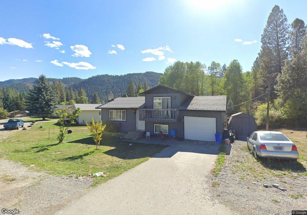
401 Shoshone Blvd Osburn, ID 83849
Estimated Value: $258,410 - $328,000
3
Beds
1
Bath
1,056
Sq Ft
$284/Sq Ft
Est. Value
About This Home
This home is located at 401 Shoshone Blvd, Osburn, ID 83849 and is currently estimated at $299,470, approximately $283 per square foot. 401 Shoshone Blvd is a home with nearby schools including Silver Hills Elementary School and Wallace Junior/Senior High School.
Ownership History
Date
Name
Owned For
Owner Type
Purchase Details
Closed on
Dec 17, 2024
Sold by
Woods Lori Ann
Bought by
Woods Lori Ann and Merrifield Kevin James
Current Estimated Value
Purchase Details
Closed on
Dec 6, 2023
Sold by
Rellos Jake Andrew
Bought by
Daum Construction Llc
Create a Home Valuation Report for This Property
The Home Valuation Report is an in-depth analysis detailing your home's value as well as a comparison with similar homes in the area
Purchase History
| Date | Buyer | Sale Price | Title Company |
|---|---|---|---|
| Woods Lori Ann | -- | None Listed On Document | |
| Daum Construction Llc | -- | Kootenai County Title |
Source: Public Records
Tax History
| Year | Tax Paid | Tax Assessment Tax Assessment Total Assessment is a certain percentage of the fair market value that is determined by local assessors to be the total taxable value of land and additions on the property. | Land | Improvement |
|---|---|---|---|---|
| 2025 | $42 | $265,085 | $66,895 | $198,190 |
| 2024 | $268 | $265,085 | $66,895 | $198,190 |
| 2023 | $268 | $267,321 | $66,895 | $200,426 |
| 2022 | $340 | $206,844 | $51,865 | $154,979 |
| 2021 | $546 | $150,325 | $36,765 | $113,560 |
| 2020 | $938 | $129,893 | $34,403 | $95,490 |
| 2019 | $703 | $133,673 | $34,403 | $99,270 |
| 2018 | $308 | $103,933 | $29,403 | $74,530 |
| 2017 | $756 | $96,123 | $29,403 | $66,720 |
| 2016 | $547 | $95,933 | $29,403 | $66,530 |
| 2015 | $857 | $95,933 | $29,403 | $66,530 |
| 2014 | $607 | $95,932 | $29,402 | $66,530 |
Source: Public Records
Map
Nearby Homes
- 208 Rio Vista St
- 235 Rio Vista St
- 905 Terror Gulch Rd
- 406 E Larch Ave
- 1600 W Yellowstone Ave Unit 45
- 1600 W Yellowstone Ave Unit 31
- 603 E Larch Ave
- 807 E Garden Ave
- 3 Polaris Peak Rd
- 2 Polaris Peak Rd
- 1 Polaris Peak Rd
- 1151 E Fir
- NKA Country Club Rd
- 86 E Circle Dr
- 930 Moon Gulch Rd
- 1068 Moon Gulch Rd
- NNA Italian Gulch
- 1247 Montgomery Gulch Rd
- 51833 Silver Valley Road Id
- 52 Park Cir
- 403 Shoshone Blvd
- 309 Rio Vista
- 413 Shoshone Boulevar
- 432 Shoshone Blvd
- 405 Shoshone Blvd
- 204 Rio Vista St
- NKA Rio Vista St Lot 26
- 245 Rio Vista
- 307 Rio Vista
- 209 Rio Vista St
- 501 Lower Rio Vista St
- 404 Shoshone Blvd
- NKA Rio Vista St Lot 25
- 211 Rio Vista St
- 503 Lower Rio Vista St
- 21 Shoshone Blvd
- 13 Shoshone Blvd
- 206 Rio Vista
- 303 Cameron Dr
- 0 Sunny Slopes Rd
Your Personal Tour Guide
Ask me questions while you tour the home.