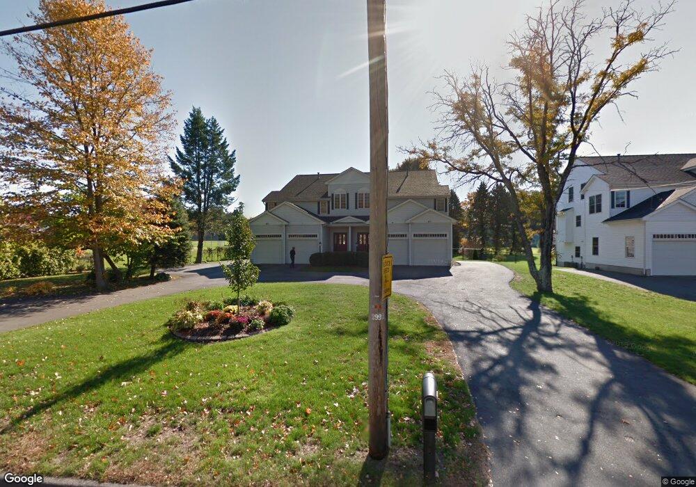
401 Sutton St North Andover, MA 01845
Estimated Value: $752,000 - $900,000
4
Beds
3
Baths
2,627
Sq Ft
$306/Sq Ft
Est. Value
About This Home
This home is located at 401 Sutton St, North Andover, MA 01845 and is currently estimated at $803,195, approximately $305 per square foot. 401 Sutton St is a home located in Essex County with nearby schools including Thomson Elementary School, North Andover Middle School, and North Andover High School.
Ownership History
Date
Name
Owned For
Owner Type
Purchase Details
Closed on
Jan 14, 2011
Sold by
Jones Richard and Jones Susan
Bought by
R&S Rosecliff Rt
Current Estimated Value
Purchase Details
Closed on
Nov 20, 2001
Sold by
Karolisyn Antoinette R
Bought by
Scribner Blaine A and Scribner Cheryl A
Home Financials for this Owner
Home Financials are based on the most recent Mortgage that was taken out on this home.
Original Mortgage
$204,000
Interest Rate
6.7%
Mortgage Type
Purchase Money Mortgage
Create a Home Valuation Report for This Property
The Home Valuation Report is an in-depth analysis detailing your home's value as well as a comparison with similar homes in the area
Home Values in the Area
Average Home Value in this Area
Purchase History
| Date | Buyer | Sale Price | Title Company |
|---|---|---|---|
| R&S Rosecliff Rt | -- | -- | |
| Scribner Blaine A | $255,000 | -- |
Source: Public Records
Mortgage History
| Date | Status | Borrower | Loan Amount |
|---|---|---|---|
| Previous Owner | Scribner Blaine A | $204,000 |
Source: Public Records
Tax History Compared to Growth
Tax History
| Year | Tax Paid | Tax Assessment Tax Assessment Total Assessment is a certain percentage of the fair market value that is determined by local assessors to be the total taxable value of land and additions on the property. | Land | Improvement |
|---|---|---|---|---|
| 2025 | $6,772 | $601,400 | $0 | $601,400 |
| 2024 | $6,432 | $580,000 | $0 | $580,000 |
| 2023 | $6,119 | $499,900 | $0 | $499,900 |
| 2022 | $6,270 | $463,400 | $0 | $463,400 |
| 2021 | $6,308 | $445,200 | $0 | $445,200 |
| 2020 | $5,866 | $426,900 | $0 | $426,900 |
| 2019 | $5,505 | $410,500 | $0 | $410,500 |
| 2018 | $5,965 | $410,500 | $0 | $410,500 |
| 2017 | $4,965 | $347,700 | $0 | $347,700 |
| 2016 | $4,962 | $347,700 | $0 | $347,700 |
| 2015 | $5,003 | $347,700 | $0 | $347,700 |
Source: Public Records
Map
Nearby Homes
- 385 Sutton St
- 62 Brightwood Ave
- 29 Brightwood Ave
- 826 Osgood St
- 148 Main St Unit A508
- 148 Main St Unit C538
- 148 Main St Unit A307
- 12 Walker Rd Unit 6
- 0 Great Pond Rd
- 64 2nd St
- 87 French Farm Rd
- 13 Woodland St
- 68 Union St
- 11 W Bradstreet Rd
- 52 Howard St
- 127 Marblehead St Unit A
- 7 Stevens Ct
- 75 Beverly St Unit 75
- 1 Riverview Blvd Unit 3-8
- 1 Riverview Blvd Unit 2-203
- 403 Sutton St
- 391 Sutton St
- 393 Sutton St
- 110 Wentworth Ave
- 387 Sutton St
- 387 Sutton St Unit 387
- 387 Sutton St
- 394 Sutton St
- 386 Sutton St
- 410 Sutton St
- 66 Chadwick St
- 76 Chadwick St
- 379 Sutton St
- 15 Wood Ave
- 15 Wood Ave
- 17 Wood Ave
- 15 Wood Ave Unit 17
- 15 Wood Ave Unit 15
- 20 Methuen Ave
- 445 Sutton St