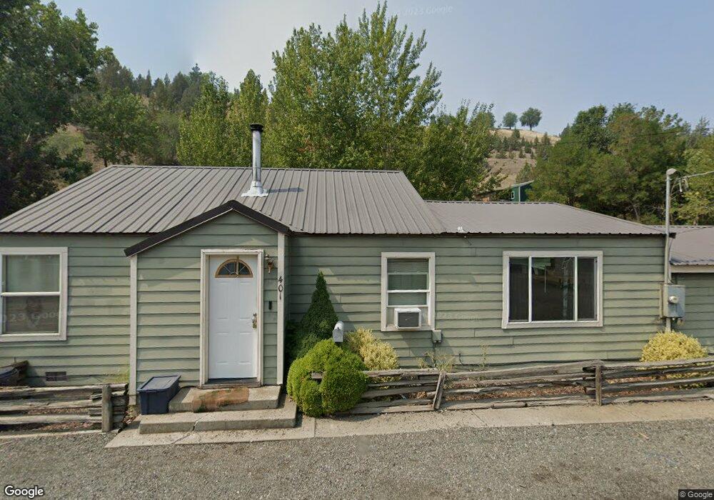
401 SW Brent Dr John Day, OR 97845
Estimated Value: $241,000 - $288,278
4
Beds
2
Baths
1,804
Sq Ft
$146/Sq Ft
Est. Value
About This Home
This home is located at 401 SW Brent Dr, John Day, OR 97845 and is currently estimated at $263,070, approximately $145 per square foot. 401 SW Brent Dr is a home located in Grant County with nearby schools including Grant Union Junior/Senior High School.
Ownership History
Date
Name
Owned For
Owner Type
Purchase Details
Closed on
Nov 30, 2015
Sold by
Blake Dana J
Bought by
Randleas Katrina and Randleas Lucas
Current Estimated Value
Home Financials for this Owner
Home Financials are based on the most recent Mortgage that was taken out on this home.
Original Mortgage
$119,795
Outstanding Balance
$94,228
Interest Rate
3.71%
Mortgage Type
New Conventional
Estimated Equity
$168,842
Purchase Details
Closed on
Aug 26, 2011
Sold by
Young Russell J
Bought by
Blake Dana J
Create a Home Valuation Report for This Property
The Home Valuation Report is an in-depth analysis detailing your home's value as well as a comparison with similar homes in the area
Home Values in the Area
Average Home Value in this Area
Purchase History
| Date | Buyer | Sale Price | Title Company |
|---|---|---|---|
| Randleas Katrina | -- | None Available | |
| Blake Dana J | $120,000 | None Available |
Source: Public Records
Mortgage History
| Date | Status | Borrower | Loan Amount |
|---|---|---|---|
| Open | Randleas Katrina | $119,795 |
Source: Public Records
Tax History Compared to Growth
Tax History
| Year | Tax Paid | Tax Assessment Tax Assessment Total Assessment is a certain percentage of the fair market value that is determined by local assessors to be the total taxable value of land and additions on the property. | Land | Improvement |
|---|---|---|---|---|
| 2024 | $1,648 | $109,069 | $28,698 | $80,371 |
| 2023 | $1,601 | $105,893 | $27,860 | $78,033 |
| 2022 | $1,556 | $102,809 | $27,048 | $75,761 |
| 2021 | $1,523 | $99,815 | $26,264 | $73,551 |
| 2020 | $1,596 | $96,908 | $25,493 | $71,415 |
| 2019 | $1,546 | $94,086 | $23,518 | $70,568 |
| 2018 | $1,506 | $91,346 | $22,835 | $68,511 |
| 2017 | $1,469 | $88,686 | $22,166 | $66,520 |
| 2016 | $1,428 | $86,103 | $21,522 | $64,581 |
| 2015 | $1,342 | $81,162 | $20,287 | $60,875 |
| 2014 | $1,342 | $81,162 | $20,287 | $60,875 |
| 2013 | $1,256 | $78,799 | $23,596 | $55,203 |
Source: Public Records
Map
Nearby Homes
- 318 SW Brent Dr
- 0 SW 4th Ave Unit 24562517
- 128 SW Canton St
- 304 SE Hillcrest Dr
- 801 Ferguson Rd
- 250 E Main St
- 100 SE Hillcrest Rd
- 173 N Canyon Blvd
- 212 NW Bridge St
- 250 NE Dayton St
- 0 Blue Gulch Rd
- 227 NW 2nd Ave
- 310 N Canyon Blvd
- 312 N Canyon Blvd
- 314 NW 3rd Ave
- 520 SE Hillcrest Rd
- 600 SE 2nd Ave
- 410 NW Bridge St
- 213 NW 4th Ave
- 212 NW 5th Ave
- 329 SW Brent Dr
- 195 SW 3rd Ave
- 325 SW Brent Dr
- 336 SW Brent Dr
- 404 SW Brent Dr
- 407 SW Brent Dr
- 275 SW 4th Ave
- 275 SW 4th Ave Unit DR
- 406 SW Brent Dr
- 317 S Canyon Blvd
- 315 SW Brent Dr
- 316 SW Brent Dr
- 408 SW Brent Dr
- 411 SW Brent Dr
- 315 S Canyon Blvd
- 403 S Canyon Blvd
- 314 SW Brent Dr
- 313 S Canyon Blvd
- 280 SW 4th Ave
- 405 S Canyon Blvd