401 Tolhurst Rd Cleveland, GA 30528
Estimated Value: $751,000 - $1,601,413
4
Beds
4
Baths
3,887
Sq Ft
$295/Sq Ft
Est. Value
About This Home
This home is located at 401 Tolhurst Rd, Cleveland, GA 30528 and is currently estimated at $1,147,804, approximately $295 per square foot. 401 Tolhurst Rd is a home located in White County with nearby schools including Tesnatee Gap Elementary (Old White County Intermediate), White County 9th Grade Academy, and Jack P. Nix Elementary School.
Ownership History
Date
Name
Owned For
Owner Type
Purchase Details
Closed on
Dec 20, 2024
Sold by
Horserange Properties Llc
Bought by
Adams Larry D and Adams Norma D
Current Estimated Value
Purchase Details
Closed on
Sep 1, 2008
Sold by
Not Provided
Bought by
Horserange Properties Llc
Purchase Details
Closed on
Mar 13, 2008
Sold by
Adams Brothers Partnership
Bought by
Horserange Properties Llc
Purchase Details
Closed on
Aug 1, 2006
Sold by
Not Provided
Bought by
Horserange Properties Llc
Create a Home Valuation Report for This Property
The Home Valuation Report is an in-depth analysis detailing your home's value as well as a comparison with similar homes in the area
Home Values in the Area
Average Home Value in this Area
Purchase History
| Date | Buyer | Sale Price | Title Company |
|---|---|---|---|
| Adams Larry D | $10,000 | -- | |
| Horserange Properties Llc | -- | -- | |
| Horserange Properties Llc | -- | -- | |
| Horserange Properties Llc | $2,000,000 | -- |
Source: Public Records
Tax History Compared to Growth
Tax History
| Year | Tax Paid | Tax Assessment Tax Assessment Total Assessment is a certain percentage of the fair market value that is determined by local assessors to be the total taxable value of land and additions on the property. | Land | Improvement |
|---|---|---|---|---|
| 2025 | $7,718 | $642,600 | $151,228 | $491,372 |
| 2024 | $7,718 | $463,952 | $113,420 | $350,532 |
| 2023 | $5,596 | $328,184 | $100,820 | $227,364 |
| 2022 | $4,953 | $290,760 | $100,820 | $189,940 |
| 2021 | $3,795 | $222,956 | $99,688 | $123,268 |
| 2020 | $860 | $106,256 | $93,456 | $12,800 |
| 2019 | $487 | $93,456 | $93,456 | $0 |
| 2018 | $613 | $97,140 | $93,456 | $3,684 |
| 2017 | $696 | $99,548 | $92,180 | $7,368 |
| 2016 | $1,049 | $112,684 | $92,180 | $20,504 |
| 2015 | $1,038 | $97,170 | $94,800 | $22,360 |
| 2014 | $973 | $90,930 | $0 | $0 |
Source: Public Records
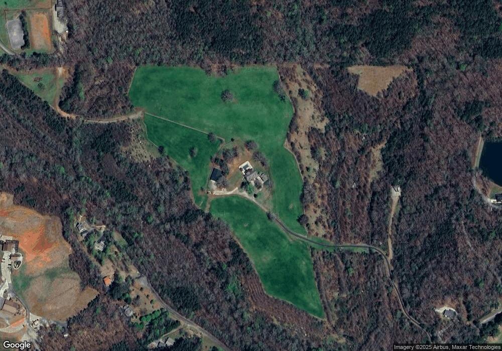
Map
Nearby Homes
- 47 Sage Brush Dr
- 166 High Meadow Trail
- 4179 Highway 129 N
- 94 Big Jim Rd
- 86 Back Trail
- 138 Back Trail
- 431 Paradise Valley Rd
- 366 Barker Trail Rd
- 773 Paradise Valley Rd
- 266 Slayton Gap Trail
- 1031 Mountain Shadows Dr Unit 90A
- 76 Periwinkle Ln
- 941 Mountain Shadows Dr
- 961 Mountain Shadows Dr
- 175 Yogi Bear Blvd
- 32 Yogi Bear Blvd
- 38 Yogi Bear Blvd
- 19 Yogi Bear Blvd Unit B29
- 57 Beehive Trail
- 146 Canyon Pass
- 370 Thornblade Trail
- 349 Prairie Flower Dr
- 354 Prairie Flower Dr
- 255 Prairie Flower Dr
- 201 Prairie Flower Dr
- 171 Prairie Flower Dr
- 97 Prairie Flower Dr
- 49 Prairie Flower Dr
- 90 Sage Brush Dr Unit 4
- 90 Sage Brush Dr
- 171 Thornblade Trail
- 141 Thornblade Trail
- 43 Thornblade Trail
- 49 Thornblade Trail
- 5050 Highway 129 N
- 25 Sage Brush Dr
- 131 Thornblade Trail
- 99 Thornblade Trail
- 0 Prairie Flower Dr Unit 8694974
- 0 Prairie Flower Dr Unit 7319838